Category:Gwyddelwern
Jump to navigation
Jump to search
village and community in Denbighshire, Wales, UK   | |||||
| Upload media | |||||
| Instance of | |||||
|---|---|---|---|---|---|
| Location | Denbighshire, Wales | ||||
| Population |
| ||||
| Area |
| ||||
 | |||||
Cymraeg: Pentref a phlwyf yn Sir Ddinbych yw Gwyddelwern; arferai fod yn Edeyrnion ac yn Sir Feirionnydd. Saif y pentref ar y briffordd A494 rhwng Corwen a Bryn Saith Marchog, rhyw ddwy filltir i'r gogledd o Gorwen. Cysegrwyd yr eglwys i Sant Beuno, a fu'n byw yma am gyfnod, ac mae'r fynwent gron yn awgrymu ei bod yn sefydliad hynafol.
English: Gwyddelwern is a small village of about 400 residents, situated approximately two miles north of Corwen in Denbighshire, Wales. Historically the village was part of the Edeirnion district of the ancient county of Merioneth. Edeirnion (more recently Edeyrnion) was part of the Glyndwr district of Clwyd from 1974 to 1996, when the area came under the administration of the principal area of Denbighshire. The village straddles the A494 road (trunk road).
Nederlands: Gwyddelwern is een plaats in Wales, in het bestuurlijke graafschap Denbighshire en in het ceremoniële behouden graafschap Clwyd.
Svenska: Gwyddelwern är en liten ort med omkring 400 invånare, belägen omkring 2 miles norr om Corwen i norra Wales. Historiskt sett har orten varit en del av distriktet Edeirnion i det traditionella grevskapet Merionethshire. Edeirnion (idag känt som Edeyrnion) var en del av distriktet Glyndŵr i Clwyd från 1974 till 1996, då området gick in under administration av Denbighshire. Orten ligger vid vägen A494.
Subcategories
This category has the following 5 subcategories, out of 5 total.
G
- Graig Lelo quarry (10 F)
- Gwyddelwern railway station (2 F)
S
T
- Ty Mawr, Gwyddelwern (7 F)
W
- Wern Ddu quarry (1 F)
Media in category "Gwyddelwern"
The following 130 files are in this category, out of 130 total.
-
 1940's Vauxhall saloon - geograph.org.uk - 5349060.jpg 640 × 480; 64 KB
-
 A dairy churn stand - geograph.org.uk - 2936241.jpg 1,600 × 1,200; 762 KB
-
 A load of tyres at Caenog - geograph.org.uk - 1808939.jpg 480 × 640; 72 KB
-
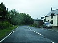
 A494 at Gwyddelwern village boundary - geograph.org.uk - 3004906.jpg 640 × 479; 61 KB
-
 A494 at Pandy'r Capel - geograph.org.uk - 3004919.jpg 640 × 481; 58 KB
-
 A494 looking north - geograph.org.uk - 3004917.jpg 640 × 480; 42 KB
-
 Barns at Maesgwyn Felin - geograph.org.uk - 1808997.jpg 640 × 480; 84 KB
-
 Benchmark at Felin Meiarth, Derwen - geograph.org.uk - 5557735.jpg 1,200 × 1,600; 756 KB
-

-
 Bon-yr-On - geograph.org.uk - 1817865.jpg 640 × 480; 65 KB
-
 Bryn Domwy, Gwyddelwern - geograph.org.uk - 898349.jpg 640 × 480; 45 KB
-
 Canolfan Gwyddelwern - geograph.org.uk - 1307111.jpg 640 × 455; 87 KB
-
 Capal wesla Gwyddel.JPG 3,648 × 2,736; 2.33 MB
-
 Cart lodge and farm house at Highgate - geograph.org.uk - 2936258.jpg 1,600 × 1,200; 490 KB
-
 Cefn Maen Llwyd - geograph.org.uk - 1802395.jpg 640 × 480; 103 KB
-
 Churn stand at Highgate farm - geograph.org.uk - 1808930.jpg 640 × 480; 88 KB
-
 Corwen Sawmill, Gwyddelwern - geograph.org.uk - 791557.jpg 640 × 480; 74 KB
-
 Crossroads near Bron-yr-on - geograph.org.uk - 1926648.jpg 1,600 × 1,071; 518 KB
-
 Dee Valley Way signpost - geograph.org.uk - 128155.jpg 479 × 640; 133 KB
-
 DV 27 No.10.Gwyddelwern.png 1,371 × 912; 3.58 MB
-
 Early 18th century tomb, Gwyddelwern - geograph.org.uk - 791555.jpg 640 × 480; 107 KB
-
 Entrance to Caenog Farm - geograph.org.uk - 6401391.jpg 2,880 × 2,160; 2.79 MB
-
 Ewes and lambs busy grazing - geograph.org.uk - 2936300.jpg 1,600 × 1,200; 380 KB
-
 Farm buildings at Caenog - geograph.org.uk - 2933586.jpg 1,600 × 1,200; 345 KB
-
 Farm buildings at Cefnmaenllwyd - geograph.org.uk - 1802398.jpg 640 × 480; 75 KB
-
 Farm lane leading to Cefnmaenllwyd - geograph.org.uk - 1802406.jpg 640 × 480; 121 KB
-
 Farm road east of Wern-ddu - geograph.org.uk - 2586864.jpg 1,500 × 983; 1.2 MB
-
 Farm road to Maes Gamedd Plas - geograph.org.uk - 1802319.jpg 640 × 480; 92 KB
-
 Farm track to Ty'n y Rhos - geograph.org.uk - 1809003.jpg 510 × 640; 105 KB
-
 Farmland at Gwyddelwern - geograph.org.uk - 798523.jpg 640 × 480; 81 KB
-
 Farmland near Bryn Saith Marchog - geograph.org.uk - 6398975.jpg 1,600 × 1,200; 483 KB
-
 Field "shut up" for conservation - geograph.org.uk - 1926662.jpg 1,600 × 1,071; 612 KB
-
 Field near Tyddyn Angharad - geograph.org.uk - 243778.jpg 640 × 480; 63 KB
-
 Find the birdie^ - geograph.org.uk - 560829.jpg 640 × 480; 125 KB
-
 Flower-filled roadside bank - geograph.org.uk - 1307489.jpg 640 × 480; 153 KB
-

-
 Gwyddelwern - geograph.org.uk - 1802325.jpg 640 × 480; 75 KB
-
 Gwyddelwern - geograph.org.uk - 1809102.jpg 518 × 640; 65 KB
-
 Gwyddelwern primary school - geograph.org.uk - 1809099.jpg 640 × 480; 59 KB
-
 Gwyddelwern Sawmills - geograph.org.uk - 1307127.jpg 640 × 480; 64 KB
-
 Hafotty, Gwyddelwern - geograph.org.uk - 1802359.jpg 640 × 480; 77 KB
-
 Hendre Bryn Cyffo - geograph.org.uk - 1307136.jpg 640 × 456; 52 KB
-
 Hendre Isa - geograph.org.uk - 1309652.jpg 640 × 480; 46 KB
-
 HGV entrance to Maes Gamedd Plas - geograph.org.uk - 1802331.jpg 640 × 480; 76 KB
-
 Highgate Farm - geograph.org.uk - 1584925.jpg 640 × 480; 114 KB
-
 Lane heading towards Bryn-deicws - geograph.org.uk - 1926672.jpg 1,600 × 1,071; 655 KB
-

-
 Last seasons haylage bales at Bron-yr-on - geograph.org.uk - 1926613.jpg 1,600 × 1,071; 504 KB
-
 Livestock handling pens at Bron-yr-on - geograph.org.uk - 1926628.jpg 1,600 × 1,071; 393 KB
-
 Lodge on Rhug Estate - geograph.org.uk - 242722.jpg 640 × 478; 67 KB
-
 Looking down on Sychnant - geograph.org.uk - 2933530.jpg 1,600 × 1,200; 401 KB
-
 Looking down towards Nant Fawr - geograph.org.uk - 2936222.jpg 1,600 × 1,200; 625 KB
-
 Looking towards an important rural crossroad - geograph.org.uk - 2936357.jpg 1,600 × 1,200; 444 KB
-
 Maerdy - geograph.org.uk - 1802423.jpg 640 × 480; 82 KB
-
 Maerdy Bach - geograph.org.uk - 798527.jpg 640 × 480; 78 KB
-
 Maerdy sheep - geograph.org.uk - 798530.jpg 640 × 480; 103 KB
-
 Maes Gamedd - geograph.org.uk - 798525.jpg 640 × 480; 76 KB
-
 Maesgamedd - geograph.org.uk - 1802342.jpg 640 × 480; 70 KB
-
 Mixed grazing and woodland - geograph.org.uk - 3500712.jpg 1,024 × 768; 282 KB
-
 Moriah Chapel, Gwyddelwern - geograph.org.uk - 791561.jpg 640 × 480; 71 KB
-
 Mynydd Rhyd Ddu - geograph.org.uk - 1307573.jpg 640 × 480; 49 KB
-
 Nant Fawr heads towards Afon Dyfrdwy - geograph.org.uk - 2936204.jpg 1,600 × 1,200; 480 KB
-
 New houses at Gwyddelwern - geograph.org.uk - 1809088.jpg 640 × 480; 77 KB
-
 Old and new roads on east side of Mynydd Rhyd ddu - geograph.org.uk - 2586915.jpg 1,500 × 1,125; 1.43 MB
-

-
 Out of sight, out of mind - geograph.org.uk - 1802374.jpg 640 × 480; 93 KB
-
 Overview of Gwyddelwern. - geograph.org.uk - 561041.jpg 640 × 480; 63 KB
-
 Pandy'r Capel.JPG 3,648 × 2,736; 2.52 MB
-
 Pen-y-Platt - geograph.org.uk - 1802433.jpg 640 × 480; 76 KB
-
 Pole barn at Highgate - geograph.org.uk - 2936282.jpg 1,600 × 1,200; 440 KB
-

-

-
 Quarry track at Graig Lelo - geograph.org.uk - 1308441.jpg 640 × 480; 84 KB
-
 Road junction in the hills - geograph.org.uk - 1802438.jpg 640 × 480; 94 KB
-
 Rural lane junction - geograph.org.uk - 2933547.jpg 1,600 × 1,200; 464 KB
-
 Sheep on Mynydd Rhyd Ddu - geograph.org.uk - 1307545.jpg 640 × 480; 62 KB
-
 Small quarry near Maerdy Bach - geograph.org.uk - 1802430.jpg 640 × 480; 135 KB
-
 St Beuno's Well, Gwyddelwern - geograph.org.uk - 791563.jpg 640 × 480; 112 KB
-
 Sychnant - geograph.org.uk - 1808957.jpg 640 × 480; 80 KB
-
 The A494 near Meiarth Bach - geograph.org.uk - 5341878.jpg 5,184 × 3,888; 5.14 MB
-
 The A494 Ruthin to Corwen Road - geograph.org.uk - 1308455.jpg 640 × 480; 56 KB
-
 The garden of Graig Lelo Villa - geograph.org.uk - 1309638.jpg 640 × 480; 80 KB
-

-
 The Tal y Bidwel to Nant road - geograph.org.uk - 1808925.jpg 640 × 480; 71 KB
-
 Ty Nant, Gwyddelwern - geograph.org.uk - 1809011.jpg 640 × 480; 81 KB
-
 Ty Nant, Gwyddelwern - geograph.org.uk - 1809091.jpg 640 × 480; 81 KB
-
 Ty'n Llechwedd, Gwyddelwern - geograph.org.uk - 1307131.jpg 640 × 456; 40 KB
-
 Ty'n y Rhos - geograph.org.uk - 1809005.jpg 640 × 480; 86 KB
-
 Tyddyn Angharad - geograph.org.uk - 1808973.jpg 640 × 480; 72 KB
-
 Tyddyn y Cae Hir - geograph.org.uk - 1802348.jpg 640 × 480; 79 KB
-
 Upland sheep ^ cattle grazings - geograph.org.uk - 2936216.jpg 1,600 × 1,200; 325 KB
-
 View above Gwyddelwern - geograph.org.uk - 739195.jpg 640 × 480; 87 KB
-
 View north-west of Gwyddelwern - geograph.org.uk - 1802385.jpg 640 × 480; 92 KB
-
 View of Gwyddelwern - geograph.org.uk - 739183.jpg 640 × 480; 81 KB
-

-
 View through the trees - geograph.org.uk - 4979735.jpg 1,200 × 800; 459 KB
-

-

-
 Wales Denbighshire Community Gwyddelwern map.svg 512 × 773; 560 KB
-

-
 Wooded hilltop near Meyarth Hall - geograph.org.uk - 1309640.jpg 640 × 480; 91 KB
-
 At the crossroads - geograph.org.uk - 559280.jpg 640 × 480; 147 KB
-
 Autumn fruits - geograph.org.uk - 560853.jpg 480 × 640; 122 KB
-
 Bon yr On - geograph.org.uk - 559283.jpg 640 × 480; 125 KB
-
 Bryn Du - geograph.org.uk - 559236.jpg 640 × 480; 108 KB
-
 Caenog - geograph.org.uk - 170350.jpg 640 × 480; 126 KB
-
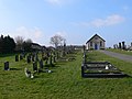 Corwen Cemetery - geograph.org.uk - 375994.jpg 640 × 480; 94 KB
-
 Farm track to Sychnant - geograph.org.uk - 243781.jpg 640 × 480; 134 KB
-
 Foel Fodig - geograph.org.uk - 559224.jpg 640 × 480; 62 KB
-
 Foel Fodig from Caer Drewyn - geograph.org.uk - 558620.jpg 640 × 480; 89 KB
-
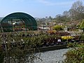 Glyndwr Plant Centre - geograph.org.uk - 402230.jpg 640 × 480; 139 KB
-
 Highgate Farm - geograph.org.uk - 170347.jpg 640 × 480; 71 KB
-
 Industrial Estate, Corwen - geograph.org.uk - 170551.jpg 640 × 480; 80 KB
-
 Maerdy Mawr Caravan Park - geograph.org.uk - 560845.jpg 640 × 480; 112 KB
-
 Maesgwyn Felyn. - geograph.org.uk - 571334.jpg 640 × 480; 62 KB
-
 Mown Field. - geograph.org.uk - 571320.jpg 640 × 480; 99 KB
-
 Near Cefn Maen Llwyd - geograph.org.uk - 559231.jpg 640 × 480; 77 KB
-
 Old railway bridge - geograph.org.uk - 125544.jpg 640 × 480; 115 KB
-
 Part of the Rhug Estate- Stad y Rug - geograph.org.uk - 298084.jpg 640 × 480; 94 KB
-
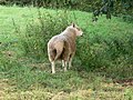 Ram - geograph.org.uk - 560867.jpg 640 × 480; 173 KB
-
 Rhug Parkland - geograph.org.uk - 242720.jpg 640 × 480; 86 KB
-
 River Dee - geograph.org.uk - 128158.jpg 479 × 640; 62 KB
-
 Road Junction. - geograph.org.uk - 563193.jpg 640 × 480; 118 KB
-
 Road to Berth-ddu - geograph.org.uk - 298081.jpg 640 × 480; 79 KB
-
 Rock outcrop - geograph.org.uk - 243775.jpg 640 × 528; 88 KB
-
 Ruin - geograph.org.uk - 129128.jpg 640 × 480; 109 KB
-
 Sheep country - geograph.org.uk - 440964.jpg 640 × 480; 68 KB
-
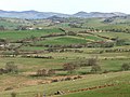
 The upper Clwyd valley - geograph.org.uk - 440962.jpg 640 × 480; 90 KB
-
 Ty-cerig - geograph.org.uk - 242574.jpg 640 × 480; 68 KB
-
 Wooden steps - geograph.org.uk - 129141.jpg 480 × 640; 150 KB


