Category:Gwernymynydd
Jump to navigation
Jump to search
village in Flintshire, United Kingdom   | |||||
| Upload media | |||||
| Instance of | |||||
|---|---|---|---|---|---|
| Location | Flintshire, Wales | ||||
 | |||||
Media in category "Gwernymynydd"
The following 56 files are in this category, out of 56 total.
-
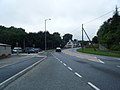
 A494 at Gwernymynydd - geograph.org.uk - 6149985.jpg 1,280 × 853; 278 KB
-
-
 A494 looking west - geograph.org.uk - 1987686.jpg 640 × 480; 52 KB
-
 A494 road, Gwernymynydd 2.JPG 3,648 × 2,736; 3.64 MB
-
 Access road, Cambrian Quarry - geograph.org.uk - 2458873.jpg 640 × 480; 99 KB
-
 Cambrian Quarry - geograph.org.uk - 2458926.jpg 640 × 480; 97 KB
-
 Disused quarry plant - geograph.org.uk - 2458936.jpg 640 × 480; 89 KB
-
 Eagles and Crawford Coaches, Gwernymynydd - geograph.org.uk - 6149981.jpg 1,280 × 853; 268 KB
-
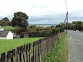
 Farm between Cadole and Gweraffield - geograph.org.uk - 4857705.jpg 640 × 480; 52 KB
-
 Ffordd Las - geograph.org.uk - 2555115.jpg 640 × 480; 71 KB
-
 Ffordd Maeshafn, Gwernymynydd.JPG 3,648 × 2,736; 3.55 MB
-
 Flintshire quarries - geograph.org.uk - 2115864.jpg 2,592 × 1,944; 3.74 MB
-
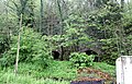
 Footpath along track beside woodland - geograph.org.uk - 3737878.jpg 3,264 × 2,448; 3.8 MB
-
 Footpath through beech trees - geograph.org.uk - 3737873.jpg 3,264 × 2,448; 6.47 MB
-
 From a footpath across fields by Hafod Road - geograph.org.uk - 3737886.jpg 3,264 × 2,448; 3.37 MB
-
 Grazing field beside woodland - geograph.org.uk - 3737870.jpg 3,264 × 2,448; 4.84 MB
-
 Grazing fields north of Tros-y-wern Farm - geograph.org.uk - 3737891.jpg 3,264 × 2,448; 3.65 MB
-
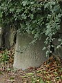
 Gwernymynydd roadside stone.JPG 2,736 × 3,648; 3.65 MB
-
 Gwernymynydd sign 1.JPG 3,648 × 2,736; 3.68 MB
-
 Gwernymynydd sign, A494 - DSC05507.JPG 3,648 × 2,736; 3.55 MB
-
 Gwernymynydd.jpg 4,000 × 3,000; 6.02 MB
-
 Hafod Drive, Gwernymynydd - geograph.org.uk - 5366096.jpg 2,592 × 3,888; 5.83 MB
-

-
 Lime kilns, Gwernymynydd - geograph.org.uk - 6149977.jpg 1,280 × 826; 644 KB
-
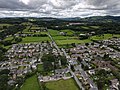
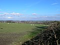
 Looking down on Gwernymynydd - geograph.org.uk - 224823.jpg 640 × 480; 97 KB
-
-
 Milestone on the A494 at Cadole - east face - geograph.org.uk - 5912707.jpg 1,053 × 1,408; 380 KB
-
 Milestone on the A494 at Cadole - geograph.org.uk - 5912697.jpg 1,600 × 1,203; 689 KB
-
 Milestone on the A494 at Cadole - west face - geograph.org.uk - 5912703.jpg 1,196 × 1,600; 560 KB
-

-
 Old Milestone by the A5104, Cadole - geograph.org.uk - 6035924.jpg 782 × 1,143; 262 KB
-

-
 Owain Glyndwr Inn - geograph.org.uk - 6034641.jpg 4,288 × 3,216; 3.7 MB
-
 Panorama of Mold from Gwernymynydd.JPG 3,648 × 2,736; 3.57 MB
-
 Plaque, Gwernymynydd - DSCF0560.JPG 4,000 × 3,000; 2.81 MB
-
 Plas Hafod Hotel in the snow - geograph.org.uk - 5621765.jpg 1,024 × 769; 231 KB
-
 Public footpath, Gwernymynydd 1.JPG 2,736 × 3,648; 3.57 MB
-
 Public footpath, Gwernymynydd 2.JPG 3,648 × 2,736; 3.6 MB
-
 Public footpath, Gwernymynydd 3.JPG 2,736 × 3,648; 3.57 MB
-
 Public footpath, Gwernymynydd 4.JPG 2,736 × 3,648; 3.58 MB
-
 Public footpath, Gwernymynydd 5.JPG 3,648 × 2,736; 3.51 MB
-
 Row of cottages - geograph.org.uk - 6034411.jpg 4,288 × 3,216; 3.5 MB
-
 Somewhere over the Rainbow - geograph.org.uk - 52139.jpg 640 × 480; 101 KB
-
 Stile and signpost at a junction of paths in fields - geograph.org.uk - 3737848.jpg 3,264 × 2,448; 5.56 MB
-

-

-
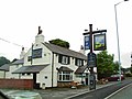
 The Rainbow Inn - geograph.org.uk - 2838477.jpg 640 × 471; 68 KB
-
 The Rainbow Inn, Gwernymynydd.JPG 3,648 × 2,736; 3.54 MB
-

-
 The Swan pub, Gwernymynydd.JPG 3,648 × 2,736; 3.64 MB
-
 The Swan, Gwernymynydd - geograph.org.uk - 140858.jpg 640 × 433; 77 KB
-
 View to the Alyn Valley from the Owain Glyndwr Inn - geograph.org.uk - 6034646.jpg 4,288 × 3,216; 3.59 MB
-
 Ysgol Gwernymynydd.jpg 640 × 423; 75 KB
-
 Gwernymynydd - geograph.org.uk - 35452.jpg 640 × 480; 89 KB
-

-
 The A494 at Gwernymynydd - geograph.org.uk - 657314.jpg 640 × 480; 75 KB


