Category:Gustavsbergs vattentorn
Jump to navigation
Jump to search
| Object location | | View all coordinates using: OpenStreetMap |
|---|
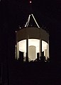
Svenska: Gustavsbergs vattentorn.
water tower in Gustavsberg, Värmdö kommun, Sweden  | |||||
| Upload media | |||||
| Instance of | |||||
|---|---|---|---|---|---|
| Location | Gustavsberg, Uppland, Stockholm County, Sweden | ||||
| Inception |
| ||||
| Height |
| ||||
 | |||||
Media in category "Gustavsbergs vattentorn"
The following 4 files are in this category, out of 4 total.
-
 Gustavsbergs hamn, maj 2018.jpg 4,896 × 3,497; 4.24 MB
-
 Gustavsbergs vattentorn maj 2018.jpg 4,520 × 3,425; 3.49 MB
-
 Gustavsbergs vattentorn vinternatt.jpg 1,503 × 2,091; 560 KB
-
 Gustavsbergs vattentorn.jpg 4,896 × 3,537; 4.44 MB


