Category:Gulf Islands National Seashore
Jump to navigation
Jump to search
96,000 underwater acres in Mississippi and Florida (US) managed by the National Park Service  | |||||
| Upload media | |||||
| Instance of | |||||
|---|---|---|---|---|---|
| Location |
| ||||
| Operator | |||||
| IUCN protected areas category | |||||
| Inception |
| ||||
| Visitors per year |
| ||||
| official website | |||||
 | |||||
Subcategories
This category has the following 6 subcategories, out of 6 total.
Media in category "Gulf Islands National Seashore"
The following 102 files are in this category, out of 102 total.
-
 1HornIS.JPG 3,072 × 2,304; 952 KB
-

-
 Bald Eagle on sign (e1c1387d-1dd8-b71c-07b2-cfb80a0e8ec8).jpg 2,272 × 1,704; 613 KB
-
 Cannon at Fort Barrancas (3b9aa306-bb72-453d-868e-8ac283c6fe5b).jpg 5,184 × 3,456; 8.32 MB
-
 Chasefield Plantation Gravestones (e8d7d2b6-6380-42d4-84e6-76dc46962dd5).JPG 5,472 × 3,648; 2.19 MB
-
 Colonial Power Struggle Interpretive Panel (a5566370-515d-48ca-9bf3-49750a884260).jpg 4,032 × 3,024; 1.95 MB
-
 Conradina (01) (a60b996b-8095-4094-81a7-c37e16450d5a).JPG 6,000 × 4,000; 1.47 MB
-
 Conradina (02) (a05c1dc1-81a8-416f-ba15-96740c5b24a8).JPG 6,000 × 4,000; 1.09 MB
-
 Double Arch Wayside (2b468cc2-86c8-496c-8c75-5f92951551e8).JPG 5,472 × 3,648; 1.59 MB
-
 Early morning fog at the Davis Bayou National Park.jpg 6,048 × 4,032; 1.11 MB
-
 Easy does it (4823810733).jpg 1,280 × 720; 432 KB
-
 Egg pickin at Fort Pickens (4824110523).jpg 3,072 × 2,304; 2.8 MB
-
 Federal Fire Power at Fort Pickens (7393770960).jpg 413 × 563; 46 KB
-
 Federal Fire Power at Fort Pickens (7393771042).jpg 597 × 814; 80 KB
-
 FEMA - 13308 - Photograph by Andrea Booher taken on 06-13-2005 in Florida.jpg 2,700 × 1,796; 1.76 MB
-
 Fort Barrancas and the Spanish Water Battery (e633e795-4156-42d6-aa13-7bde3b95a5ee).jpg 5,184 × 2,512; 3.45 MB
-
 Fort Barrancas Sally Port (d14e2567-c92a-404d-9162-cb91881c0199).jpg 5,472 × 3,648; 4.18 MB
-
 Fort Barrancas Tour Stop 8 (2c6f1d09-c208-44e1-bc93-96180e1989c7).jpg 4,032 × 3,024; 1.15 MB
-
 Fort Barrancas Trench (3161c0e1-043d-49b1-9088-c4f69bfe59ce).jpg 4,032 × 3,024; 3.02 MB
-
 Fort Barrancas Trench Trail (1340f399-f8cc-4cae-8d32-2c8badd05042).jpg 4,032 × 3,024; 2.85 MB
-
 Fort Barrancas Trench Trailhead- Advanced Redoubt (c674bd5f-3a8c-4ed0-a26d-6fae9638dcfb).jpg 4,032 × 3,024; 3.57 MB
-

-
 Fort Pickens Water Filling Station (01) (cb228c9a-b91a-41c8-8fca-52cc6e1eaad0).JPG 5,472 × 3,648; 1.82 MB
-
 Fort Pickens Water Filling Station (02) (aa7bdda8-6683-4f25-a3c5-0c632f94080f).JPG 5,472 × 3,648; 2.31 MB
-
 Frank Bowers, Retired USFWS, Oil Spill Responder (5015392918).jpg 5,616 × 3,744; 2.61 MB
-
 FrenchWarehouseSite.jpg 227 × 323; 42 KB
-
 Ghost Crab (84e7d3fe-53e2-4640-aaa1-50dc389d0312).JPG 6,000 × 4,000; 1,010 KB
-
 Group Camping Gate (9d0affe5-c9c7-4a6c-99b5-008e2bc1987c).JPG 5,472 × 3,648; 1.87 MB
-
 Gulf Islands LOC 97688517.jpg 10,084 × 4,726; 6.72 MB
-
 Gulf Islands LOC 97688517.tif 10,084 × 4,726; 136.35 MB
-
 Gulf Islands National Seashore (0055a6cb-541e-48f8-af3e-660531e891c5).jpg 8,379 × 5,586; 27.32 MB
-
 Gulf Islands National Seashore FL at sunset.jpg 4,188 × 2,792; 2.64 MB
-
 Gulf Islands National Seashore geologic cross section.jpg 804 × 466; 60 KB
-
 Gulf Islands National Seashore GUIS1785.jpg 3,072 × 2,048; 3.49 MB
-
 Gulf Islands National Seashore GUIS1787.jpg 3,072 × 2,048; 4.09 MB
-
 Gulf Islands National Seashore GUIS1791.jpg 3,072 × 2,048; 3.75 MB
-
 Gulf Islands National Seashore GUIS1793.jpg 2,048 × 3,072; 3.14 MB
-
 Gulf Islands National Seashore GUIS1796.jpg 3,072 × 2,048; 4 MB
-
 Gulf Islands National Seashore GUIS1800.jpg 3,072 × 2,048; 2.84 MB
-
 Gulf Islands National Seashore map.jpg 1,346 × 674; 92 KB
-
 Gulf Islands National Seashore-Visitor Center.jpg 1,200 × 900; 322 KB
-
 Gulf Islands NS.jpg 600 × 490; 28 KB
-

-

-
 Johnson's Beach Access "A" (01) (ed894c08-f720-4080-a7a1-5a2d8e270aa0).JPG 5,472 × 3,648; 1.92 MB
-
 Johnson's Beach Access "A" (02) (1cae8800-1f76-43e0-bdfc-8dd08f35ce93).JPG 5,472 × 3,648; 1.76 MB
-
 Johnson's Beach Access "A" (03) (4d3704d3-1d37-4d28-a4b2-e7848078c19b).JPG 4,197 × 3,426; 1.24 MB
-
 Johnson's Beach Access "C" (01) (dc988169-d79a-4c5e-b3a4-e65bfb3ba76d).JPG 5,472 × 3,648; 1.13 MB
-
 Johnson's Beach Access "C" (02) (69ed9fb5-8533-43a7-9f2e-ca518361fa6b).JPG 5,472 × 3,648; 1.14 MB
-
 Johnson's Beach Access "D" (01) (501456c1-ff7b-40b2-ad5d-6fe53a7a80c9).JPG 5,472 × 3,648; 1.73 MB
-
 Johnson's Beach Access "D" (02) (2da17def-3963-4507-8aed-fe092874e123).JPG 5,472 × 3,648; 2.14 MB
-
 Johnson's Beach Access "D" (03) (efde062c-9310-4d28-b36b-3c0234696738).JPG 4,775 × 3,500; 1.23 MB
-
 Johnson's Beach Access "E" (01) (1d5fae9d-004d-442f-8379-33baab4d9bb7).JPG 5,472 × 3,648; 1.41 MB
-
 Johnson's Beach Access "E" (02) (4aa9a856-c425-4ad5-900f-22d7a77fc1dd).JPG 5,472 × 3,648; 1.28 MB
-
 Johnson's Beach Access "E" (03) (81b73fda-0d06-403f-a63d-b0070c6b6eb5).JPG 5,472 × 3,648; 1.56 MB
-
 Johnson's Beach Access "E" (04) (512884ef-8f91-4a5a-98ae-178439f60532).JPG 5,472 × 3,648; 1.4 MB
-
 Johnson's Beach Access "G" (01) (7f7a2547-f73e-449c-a8d6-5dd2fcff65cc).JPG 5,472 × 3,648; 1.16 MB
-
 Johnson's Beach Access "H" (01) (07ee630f-9f39-42a0-b82e-0cebf1944e42).JPG 5,472 × 3,648; 1.47 MB
-
 Johnson's Beach Access "H" (02) (2df10803-5e16-4509-b3ab-e6b045576cf0).JPG 5,245 × 3,497; 1.46 MB
-
 Johnson's Beach Access "H" (03) (34608687-9a1b-4c3d-a01c-c4429aca41e5).JPG 4,459 × 3,648; 1.21 MB
-
 Johnson's Beach Access "I" (01) (3347f8f4-5781-4617-9e5f-2713f5b5f833).JPG 5,472 × 3,648; 1.66 MB
-
 Johnson's Beach Access "I" (02) (34a75f3d-f31b-4317-b39b-26b2b756f830).JPG 5,472 × 3,648; 1.34 MB
-
 Johnson's Beach Access "I" (02) (bcbf75ed-dce4-496a-b3d5-03ddcd751b52).JPG 5,273 × 3,162; 1.47 MB
-
 Johnson's Beach Access "I" (03) (56781fe5-0f41-4e94-9977-c765385c5c25).JPG 5,472 × 3,648; 1.72 MB
-
 Johnson's Beach Facilities (166d59c9-15e3-4b0f-b19b-3996f79f8a3c).JPG 5,472 × 3,648; 1.53 MB
-
 Johnson's Beach Picnic Pavilions (79b3ac2a-bc47-46a4-9026-47b032293a76).JPG 5,472 × 3,648; 1,023 KB
-
 Johnson's Beach Showers (0cceafc2-e40b-401e-adb1-383240364de2).JPG 5,374 × 3,583; 1.09 MB
-
 Johnson's Beach Water Filling Station (5f26d77f-85e3-4893-8087-b746a69debb9).JPG 3,527 × 3,465; 560 KB
-

-
 Location map of Davis Bayou area. (d1e5e54b-e2d9-4590-86d3-c4da3ffe1439).jpg 1,546 × 1,940; 1.86 MB
-
 Location map of Gulf Islands National Seashore. (1d04e25f-5503-4b8e-81eb-6201559cce7d).jpg 2,402 × 1,051; 1.98 MB
-
 Location map of Gulf Islands National Seashore. (b0ea7415-657a-4e6c-8553-69f48694d637).jpg 2,400 × 1,051; 1.95 MB
-
 Nature's Way Trail (3ef62924-8942-462f-a343-54e834099585).jpg 4,032 × 3,024; 2.32 MB
-
 Nature's Way Trail Overlook (b610df1c-8049-4698-a729-8249b9f99698).jpg 4,032 × 3,024; 2.6 MB
-
 Pensacola Beach - White Sands, Florida Coast (27268946483).jpg 5,760 × 3,840; 18.04 MB
-
 Pensacola Lighthouse P9190068.jpg 3,072 × 2,304; 1.2 MB
-
 Perdido Key Beach Access J (43164bc6-a89d-423a-b970-2f3316e37675).jpg 4,032 × 3,024; 1.15 MB
-
 Perdido Key Beach Access K (2ec01f39-0b55-48dd-8353-e8f7facb1c46).jpg 4,032 × 3,024; 1.2 MB
-
 Perdido Key Discovery Trail East Trailhead (184990d0-646e-44ee-af9f-00f43b6ea097).jpg 4,032 × 3,024; 2.68 MB
-

-

-
 Prickly Pear Flower (01) (2de410ec-8b5a-425c-ade5-c73e4cd6a506).JPG 6,000 × 4,000; 853 KB
-
 Prickly Pear Flower (02) (d46120de-f761-4ba9-a6d4-3dc6ca3b402f).JPG 6,000 × 4,000; 960 KB
-
 Prickly Pear Flower (03) (00768094-783f-4495-aae3-4c2c10d204dd).JPG 6,000 × 4,000; 1.39 MB
-
 Red Winged Black Bird (4bb08401-072d-4447-bb0c-d99625bbb666).JPG 6,000 × 4,000; 892 KB
-
 Rosamond Johnson Wayside and Plaque (02) (7020a639-734a-4b1f-b0a6-d2eb18f1435e).JPG 5,472 × 3,648; 1.45 MB
-
 Rosamond Johnson Wayside and Plaque (1bc86f66-95a6-4561-bdc3-77d6cd39db40).JPG 5,472 × 3,648; 1.33 MB
-
 Santa Rosa Beach Access "15A" (01) (668f1bf3-900e-485c-b840-1169f2b3855a).JPG 5,472 × 3,648; 1.57 MB
-
 Santa Rosa Beach Access "15B" (01) (b754f6e8-d645-49d1-9b69-169443f56fa3).JPG 5,472 × 3,648; 1.38 MB
-
 Santa Rosa Beach Access "15B" (02) (a7581192-3e69-40d0-8d4e-09ad454de642).JPG 5,472 × 3,648; 1.6 MB
-
 Santa Rosa Beach Access "15B" (03) (7f66e001-a4aa-4203-873c-310f00c6c3c1).JPG 5,177 × 3,648; 1.26 MB
-
 Ship Island Excursions Biloxi Pier (27718303-05dd-4266-b0ba-a3def9b8ca10).jpg 4,032 × 3,024; 1.16 MB
-
 Ship Island Excursions Gulfport Pier (0e71b957-576d-4297-aac9-6ff8df872163).jpg 4,032 × 3,024; 1.19 MB
-
 ShipCatIslands ASTER 08sep05.jpg 540 × 704; 94 KB
-
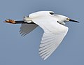 Snowy Egret (47544779051).jpg 2,085 × 1,609; 503 KB
-
 The First to Fight (7222899374).jpg 750 × 1,050; 170 KB
-
 The First to Fight (7222899454).jpg 750 × 1,050; 210 KB
-
 The Pensacola Forts Avenue to Freedom (7222899222).jpg 750 × 1,050; 270 KB
-
 Tour Boat Pier Pensacola Beach (25ab1fbe-af34-4087-acd6-b842bca68d37).jpg 4,032 × 3,024; 1.63 MB
-
 Turtle Runner (fd5e1855-960a-405f-b638-158a7ab11513).JPG 6,000 × 4,000; 1.18 MB
-
 Two agencies, one nest (4824110783).jpg 2,304 × 3,072; 2.94 MB
-
 West Ship Island.jpg 1,920 × 1,280; 1.33 MB


.jpg)
.jpg)
.JPG)
.jpg)
_(a60b996b-8095-4094-81a7-c37e16450d5a).JPG)
_(a05c1dc1-81a8-416f-ba15-96740c5b24a8).JPG)
.JPG)

.jpg)
.jpg)
.jpg)
.jpg)

.jpg)
.jpg)
.jpg)
.jpg)
.jpg)
.jpg)
.jpg)
_(cb228c9a-b91a-41c8-8fca-52cc6e1eaad0).JPG)
_(aa7bdda8-6683-4f25-a3c5-0c632f94080f).JPG)
.jpg)

.JPG)
.JPG)

.jpg)


.jpg)
.jpg)
_(ed894c08-f720-4080-a7a1-5a2d8e270aa0).JPG)
_(1cae8800-1f76-43e0-bdfc-8dd08f35ce93).JPG)
_(4d3704d3-1d37-4d28-a4b2-e7848078c19b).JPG)
_(dc988169-d79a-4c5e-b3a4-e65bfb3ba76d).JPG)
_(69ed9fb5-8533-43a7-9f2e-ca518361fa6b).JPG)
_(501456c1-ff7b-40b2-ad5d-6fe53a7a80c9).JPG)
_(2da17def-3963-4507-8aed-fe092874e123).JPG)
_(efde062c-9310-4d28-b36b-3c0234696738).JPG)
_(1d5fae9d-004d-442f-8379-33baab4d9bb7).JPG)
_(4aa9a856-c425-4ad5-900f-22d7a77fc1dd).JPG)
_(81b73fda-0d06-403f-a63d-b0070c6b6eb5).JPG)
_(512884ef-8f91-4a5a-98ae-178439f60532).JPG)
_(7f7a2547-f73e-449c-a8d6-5dd2fcff65cc).JPG)
_(07ee630f-9f39-42a0-b82e-0cebf1944e42).JPG)
_(2df10803-5e16-4509-b3ab-e6b045576cf0).JPG)
_(34608687-9a1b-4c3d-a01c-c4429aca41e5).JPG)
_(3347f8f4-5781-4617-9e5f-2713f5b5f833).JPG)
_(34a75f3d-f31b-4317-b39b-26b2b756f830).JPG)
_(bcbf75ed-dce4-496a-b3d5-03ddcd751b52).JPG)
_(56781fe5-0f41-4e94-9977-c765385c5c25).JPG)
.JPG)
.JPG)
.JPG)
.JPG)
.jpg)
.jpg)
.jpg)
.jpg)
.jpg)
.jpg)
.jpg)

.jpg)
.jpg)
.jpg)
.jpg)
.jpg)
_(2de410ec-8b5a-425c-ade5-c73e4cd6a506).JPG)
_(d46120de-f761-4ba9-a6d4-3dc6ca3b402f).JPG)
_(00768094-783f-4495-aae3-4c2c10d204dd).JPG)
.JPG)
_(7020a639-734a-4b1f-b0a6-d2eb18f1435e).JPG)
.JPG)
_(668f1bf3-900e-485c-b840-1169f2b3855a).JPG)
_(b754f6e8-d645-49d1-9b69-169443f56fa3).JPG)
_(a7581192-3e69-40d0-8d4e-09ad454de642).JPG)
_(7f66e001-a4aa-4203-873c-310f00c6c3c1).JPG)
.jpg)
.jpg)

.jpg)
.jpg)
.jpg)
.jpg)
.jpg)
.JPG)
.jpg)
