Category:Guggihütte
Jump to navigation
Jump to search
| Object location | | View all coordinates using: OpenStreetMap |
|---|
 | |||||
| Upload media | |||||
| Instance of | |||||
|---|---|---|---|---|---|
| Location | Matten bei Interlaken, Interlaken-Oberhasli administrative district, Oberland administrative region, Bern, Switzerland | ||||
| Owned by | |||||
| Mountain range | |||||
| Elevation above sea level |
| ||||
| official website | |||||
 | |||||
Media in category "Guggihütte"
The following 11 files are in this category, out of 11 total.
-
 Alte Guggihütte 1.jpg 5,152 × 3,864; 7.36 MB
-
 Alte Guggihütte 2.jpg 5,152 × 3,864; 7.4 MB
-
 Alte Guggihütte Blick ins Innere.jpg 3,864 × 5,152; 6.14 MB
-
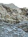 Auf dem Hüttenweg zur Guggi-Hütte.jpg 3,864 × 5,152; 6.98 MB
-
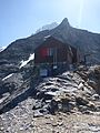 Guggihütte aussen.jpg 1,728 × 2,304; 1.63 MB
-
 Guggihütte innen1.jpg 1,728 × 2,304; 921 KB
-
 Guggihütte innen2.jpg 1,728 × 2,304; 849 KB
-
 Guggihütte.jpg 1,312 × 843; 781 KB
-
 Jungfraujoch 2016-09-02 n21.jpg 7,360 × 4,912; 23.44 MB
-
 Jungfraujoch 2016-09-02 n23.jpg 7,360 × 4,912; 18.88 MB
-
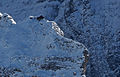
 Sphinx und Guggihütte.jpg 4,912 × 3,264; 5.95 MB


