Category:Gruttersdijk 24, Utrecht
Jump to navigation
Jump to search
| Object location | | View all coordinates using: OpenStreetMap |
|---|
| Upload media | |||||
| Instance of | |||||
|---|---|---|---|---|---|
| Location | Utrecht, Netherlands | ||||
| Has part(s) | |||||
| Heritage designation |
| ||||
 | |||||
Hoofdadres
|
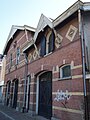
This is a category about rijksmonument number 514208
|
Garage
|
This is a category about rijksmonument number 514209
|
Handelskantoor
|
This is a category about rijksmonument number 514210
|
| Address |
|
| Address |
|
Media in category "Gruttersdijk 24, Utrecht"
This category contains only the following file.
-
 Utrecht - Gruttersdijk 24 - Rijksmonument514209.jpg 1,920 × 2,560; 940 KB
