Category:Groynes in the East Riding of Yorkshire
Jump to navigation
Jump to search
Subcategories
This category has the following 2 subcategories, out of 2 total.
B
- Barmston Main Drain (Outfall) (11 F)
Media in category "Groynes in the East Riding of Yorkshire"
The following 200 files are in this category, out of 257 total.
(previous page) (next page)-
-
 A Family Day on Withernsea's Beach - geograph.org.uk - 1412921.jpg 640 × 480; 73 KB
-

-
 A groyne on Withernsea beach - geograph.org.uk - 1050927.jpg 427 × 640; 403 KB
-
 A Groyne on Withernsea Beach at Dusk (geograph 3517098).jpg 3,565 × 2,630; 1.51 MB
-
 A Groyne on Withernsea Beach at Dusk (geograph 3517155).jpg 3,538 × 2,460; 1.43 MB
-
 A Groyne on Withernsea Beach at Dusk (geograph 3517159).jpg 3,553 × 2,520; 1.64 MB
-

-
 A Withernsea Beach Groyne - geograph.org.uk - 1195802.jpg 640 × 451; 75 KB
-
 A Withernsea Beach Groyne - geograph.org.uk - 932205.jpg 640 × 370; 49 KB
-
 Along The River Humber - geograph.org.uk - 400548.jpg 640 × 480; 132 KB
-
 Beach (geograph 4101977).jpg 1,024 × 683; 142 KB
-
 Beach - panoramio - Immanuel Giel.jpg 1,685 × 1,715; 324 KB
-
 Beach and groynes, Withernsea (geograph 6375107).jpg 800 × 600; 72 KB
-
 Beach and groynes, Withernsea (geograph 6375108).jpg 640 × 480; 53 KB
-
 Beach and lifeboat station, Withernsea (geograph 5295987).jpg 640 × 480; 395 KB
-
 Beach at Bridlington and coastline - geograph.org.uk - 685414.jpg 640 × 480; 48 KB
-
 Beach at Withernsea (geograph 6382363).jpg 800 × 600; 61 KB
-
 Beach at Withernsea (geograph 6382364).jpg 800 × 600; 41 KB
-
 Beach at Withernsea (geograph 6382369).jpg 800 × 600; 54 KB
-
 Beach at Withernsea (geograph 6382378).jpg 800 × 600; 77 KB
-
 Beach casting, Withernsea (geograph 5513279).jpg 640 × 536; 123 KB
-
 Beach fishing, Withernsea (geograph 6382374).jpg 800 × 561; 56 KB
-
 Beach Groyne - geograph.org.uk - 932192.jpg 640 × 480; 77 KB
-
 Beach groyne Spurn Head - geograph.org.uk - 819719.jpg 640 × 480; 72 KB
-
 Beach groyne Spurn Head - geograph.org.uk - 819721.jpg 640 × 451; 64 KB
-
 Beach groynes, Withernsea - geograph.org.uk - 1515593.jpg 640 × 480; 50 KB
-
 Beach landing, Withernsea (geograph 5513296).jpg 529 × 640; 138 KB
-
 Beach of Hornsea 01.jpg 1,789 × 1,697; 463 KB
-
 Beach of Hornsea 02.jpg 2,143 × 1,426; 431 KB
-
 Beach Reflection (geograph 5230616).jpg 2,696 × 3,456; 712 KB
-
 Boulder clay mounds on the beach (geograph 6054965).jpg 1,600 × 1,262; 434 KB
-
 Breaking waves - geograph.org.uk - 752287.jpg 589 × 640; 100 KB
-
 Breakwater North beach - geograph.org.uk - 1208036.jpg 640 × 427; 99 KB
-
 Bridlington 3.jpg 3,072 × 2,304; 3.58 MB
-
 Bridlington beach 2.jpg 427 × 640; 35 KB
-
 Bridlington North Beach - geograph.org.uk - 1348651.jpg 640 × 391; 65 KB
-
 Bridlington North Sands - geograph.org.uk - 294956.jpg 640 × 479; 64 KB
-
 Bridlington South Sands - geograph.org.uk - 357040.jpg 640 × 512; 50 KB
-
 British Isles rural and coastal Lincolnshire (4452298172).jpg 2,048 × 1,371; 763 KB
-
 Cliff at Owthorne (geograph 4330390).jpg 1,024 × 768; 134 KB
-

-
 Coast defences, Withernsea (geograph 5295990).jpg 640 × 452; 307 KB
-
 Coastal Defences, Mappleton Sands - geograph.org.uk - 1442097.jpg 640 × 480; 65 KB
-
 Concrete and Groyne - geograph.org.uk - 530218.jpg 640 × 480; 97 KB
-
 Concrete sea defences in Withernsea (geograph 4583985).jpg 640 × 427; 35 KB
-
 Defence Against the Sea - geograph.org.uk - 537978.jpg 640 × 444; 62 KB
-
 Descending the dunes at Spurn Point - geograph.org.uk - 1096122.jpg 640 × 480; 61 KB
-
 Deserted beach at Withernsea - geograph.org.uk - 190827.jpg 640 × 480; 61 KB
-
 Dunes, Spurn Head - geograph.org.uk - 944705.jpg 640 × 480; 76 KB
-
 Early Morning at Hornsea - geograph.org.uk - 1801397.jpg 4,000 × 3,000; 2.86 MB
-
 Eliza forever- the seafront at Withernsea (geograph 4583995).jpg 640 × 427; 60 KB
-
 End of the northern groyne, Mappleton - geograph.org.uk - 269656.jpg 640 × 480; 62 KB
-
 Erosion on Spurn Peninsula. - geograph.org.uk - 530217.jpg 640 × 480; 64 KB
-
 First groyne, Mappleton - geograph.org.uk - 1201892.jpg 640 × 427; 285 KB
-
 Fisherman In Repose (geograph 4267035).jpg 5,184 × 3,888; 6.36 MB
-
 Fishing on Withernsea Beach - geograph.org.uk - 762167.jpg 640 × 480; 239 KB
-
 Fishing on Withernsea Beach - geograph.org.uk - 762172.jpg 640 × 480; 213 KB
-
 Footpath, Owthorne - geograph.org.uk - 1743391.jpg 800 × 600; 72 KB
-
 Groyne - geograph.org.uk - 323285.jpg 640 × 480; 133 KB
-
 Groyne - geograph.org.uk - 514955.jpg 640 × 427; 85 KB
-
 Groyne and off-shore wind farm (geograph 4330379).jpg 1,024 × 768; 175 KB
-
 Groyne at Dusk (geograph 4321012).jpg 4,316 × 3,135; 1.37 MB
-
 Groyne at Spurn - geograph.org.uk - 80771.jpg 640 × 418; 79 KB
-
 Groyne at Withernsea - geograph.org.uk - 537948.jpg 640 × 387; 38 KB
-
 Groyne into the sea - geograph.org.uk - 1202635.jpg 640 × 480; 68 KB
-
 Groyne on beach Spurn - geograph.org.uk - 484383.jpg 640 × 565; 153 KB
-
 Groyne on Spurn Beach. - geograph.org.uk - 530223.jpg 640 × 480; 53 KB
-
 Groyne on Spurn Head - geograph.org.uk - 952040.jpg 475 × 640; 195 KB
-
 Groyne on Spurn Head 2 - geograph.org.uk - 952044.jpg 427 × 640; 197 KB
-
 Groyne Posts on Withernsea Beach - geograph.org.uk - 932229.jpg 640 × 439; 72 KB
-
 Groyne Posts on Withernsea's Beach - geograph.org.uk - 932233.jpg 473 × 640; 58 KB
-
 Groyne replacement, Withernsea (geograph 5513285).jpg 640 × 480; 185 KB
-
 Groyne, Hornsea Beach - geograph.org.uk - 1326206.jpg 640 × 480; 54 KB
-
 Groyne, West Spurn - geograph.org.uk - 952050.jpg 640 × 425; 211 KB
-
 Groyne, Withernsea Beach - geograph.org.uk - 1743276.jpg 800 × 570; 74 KB
-
 Groyne, Withernsea South Beach - geograph.org.uk - 1743424.jpg 800 × 600; 92 KB
-
 Groynes and Leisure World, Bridlington - geograph.org.uk - 804868.jpg 640 × 390; 151 KB
-
 Groynes and Lighthouse at Spurn - geograph.org.uk - 238276.jpg 480 × 640; 75 KB
-
 Groynes and Nets, Spurn Beach - geograph.org.uk - 944591.jpg 640 × 480; 96 KB
-

-
 Groynes at Spurn (2) - geograph.org.uk - 1515275.jpg 480 × 640; 79 KB
-
 Groynes at Spurn - geograph.org.uk - 1515269.jpg 481 × 640; 83 KB
-
 Groynes at Spurn Point - geograph.org.uk - 995909.jpg 640 × 427; 45 KB
-
 Groynes at Wyke Bight - geograph.org.uk - 1472502.jpg 640 × 480; 55 KB
-
 Groynes on Hornsea Beach - geograph.org.uk - 1248351.jpg 640 × 427; 277 KB
-
 Groynes on Hornsea Beach - geograph.org.uk - 271423.jpg 640 × 402; 59 KB
-
 Groynes on Hornsea Sands - geograph.org.uk - 1059681.jpg 640 × 300; 255 KB
-
 Groynes on Hornsea Sands - geograph.org.uk - 1059682.jpg 640 × 281; 247 KB
-
 Groynes on Spurn Eastern Coastline - geograph.org.uk - 1469362.jpg 640 × 480; 71 KB
-
 Groynes on Spurn Head - geograph.org.uk - 952037.jpg 640 × 339; 111 KB
-
 Groynes on the beach looking north - geograph.org.uk - 1220864.jpg 640 × 427; 56 KB
-
 Groynes south of Withernsea - geograph.org.uk - 1050919.jpg 640 × 427; 224 KB
-
 Groynes, Spurn Beach - geograph.org.uk - 944558.jpg 640 × 468; 93 KB
-
 Groynes, Spurn Beach - geograph.org.uk - 944571.jpg 640 × 480; 76 KB
-
 Groynes, Spurn Beach - geograph.org.uk - 944772.jpg 640 × 480; 101 KB
-
 Groynes, Spurn Beach - geograph.org.uk - 947767.jpg 640 × 476; 103 KB
-
-
 Hessle Foreshore - panoramio (5).jpg 793 × 1,200; 383 KB
-
 Hessle Haven IMG 9276.jpg - panoramio.jpg 1,600 × 1,067; 529 KB
-
 High tide at Withernsea (geograph 4349152).jpg 1,600 × 1,062; 549 KB
-
 High tide at Withernsea (geograph 4349154).jpg 1,600 × 1,062; 544 KB
-
 Hilderthorpe Beach - geograph.org.uk - 845200.jpg 640 × 459; 43 KB
-
 Hilderthorpe Beach - geograph.org.uk - 845203.jpg 459 × 640; 56 KB
-
 Hornsea - geograph.org.uk - 40853.jpg 640 × 479; 97 KB
-
 Hornsea - The Beach in January - geograph.org.uk - 322192.jpg 640 × 393; 92 KB
-
 Hornsea 1.jpg 3,072 × 2,304; 2.66 MB
-
 Hornsea 2.jpg 3,072 × 2,304; 2.72 MB
-
 Hornsea 3.jpg 3,072 × 2,304; 2.89 MB
-
 Hornsea 4.jpg 3,072 × 2,304; 2.67 MB
-
 Hornsea banner seafront.jpg 2,450 × 350; 284 KB
-
 Hornsea beach - geograph.org.uk - 1059683.jpg 640 × 331; 266 KB
-
 Hornsea Beach - geograph.org.uk - 1326203.jpg 640 × 469; 60 KB
-
 Hornsea beach - geograph.org.uk - 259150.jpg 640 × 480; 52 KB
-
 Hornsea Beach - geograph.org.uk - 668792.jpg 640 × 460; 52 KB
-
 Hornsea Beach - geograph.org.uk - 937532.jpg 640 × 480; 65 KB
-
 Hornsea beach IMG 4192 - panoramio.jpg 1,134 × 674; 136 KB
-
 Hornsea Beach IMG 5782 - panoramio.jpg 1,400 × 933; 340 KB
-
 Hornsea Beach in February - geograph.org.uk - 332481.jpg 640 × 480; 100 KB
-
 Hornsea Beach in January - geograph.org.uk - 334306.jpg 640 × 417; 94 KB
-
 Hornsea Beach on a March day - geograph.org.uk - 1220762.jpg 640 × 427; 58 KB
-
 Hornsea groyne - geograph.org.uk - 1483884.jpg 432 × 640; 226 KB
-
 Hornsea Groyne - geograph.org.uk - 548935.jpg 480 × 640; 109 KB
-

-
-
 Hornsea Sands - geograph.org.uk - 856032.jpg 640 × 452; 50 KB
-
 Hornsea Sands - geograph.org.uk - 856036.jpg 640 × 453; 102 KB
-
 Humber Riverbank near to Paull - geograph.org.uk - 275164.jpg 640 × 480; 117 KB
-
 Looking out to sea. - geograph.org.uk - 511908.jpg 640 × 480; 70 KB
-
 Mappleton Beach - geograph.org.uk - 255425.jpg 640 × 480; 67 KB
-
 Mappleton beach scene - geograph.org.uk - 1370541.jpg 640 × 480; 67 KB
-
 Mappleton Sands - geograph.org.uk - 456507.jpg 463 × 640; 74 KB
-
 Mappleton sands and groynes - geograph.org.uk - 269698.jpg 640 × 480; 58 KB
-
 North Cliff Beach, Hornsea - geograph.org.uk - 1326199.jpg 640 × 480; 52 KB
-
 North Cliff beach, Hornsea - geograph.org.uk - 1334440.jpg 640 × 480; 53 KB
-
 North Groyne, Mappleton - geograph.org.uk - 1353866.jpg 434 × 640; 219 KB
-
 North Pier, Bridlington - geograph.org.uk - 1067892.jpg 640 × 471; 308 KB
-
 North Promenade, Withernsea (geograph 3609244).jpg 1,024 × 768; 120 KB
-
 North Promenade, Withernsea (geograph 3609378).jpg 1,024 × 768; 129 KB
-
 North Promenade, Withernsea (geograph 3609406).jpg 1,024 × 768; 114 KB
-
 North Promenade, Withernsea (geograph 3609754).jpg 1,024 × 768; 131 KB
-
 North Promenade, Withernsea (geograph 6365690).jpg 1,024 × 768; 103 KB
-
 North Sands at Bridlington (geograph 5785149).jpg 800 × 579; 121 KB
-
 North Sands toward Flamborough - geograph.org.uk - 1126905.jpg 640 × 480; 67 KB
-
 Northern groyne, Mappleton Sands - geograph.org.uk - 269655.jpg 640 × 480; 62 KB
-
 Old Rope (geograph 5230609).jpg 4,608 × 3,456; 4.37 MB
-
 Old Ropes and Nets (geograph 5230611).jpg 3,548 × 3,235; 3.52 MB
-
 On the Beach at Spurn Point - geograph.org.uk - 1271083.jpg 640 × 493; 90 KB
-
 On Withernsea beach (geograph 4988011).jpg 4,476 × 3,585; 2.68 MB
-
 On Withernsea's Beach - geograph.org.uk - 932211.jpg 640 × 370; 56 KB
-
 On Withernsea's Beach - geograph.org.uk - 932216.jpg 640 × 480; 79 KB
-
 Once upon a time I was a Groyne - geograph.org.uk - 768745.jpg 640 × 350; 100 KB
-

-
 Oyster Ness - geograph.org.uk - 714616.jpg 459 × 640; 192 KB
-
 Path above the beach, Withernsea (geograph 6382366).jpg 800 × 600; 70 KB
-
 Promenaders at Withernsea - geograph.org.uk - 932250.jpg 640 × 480; 89 KB
-
 Remains of sea defences, Spurn - geograph.org.uk - 1515280.jpg 480 × 640; 75 KB
-
 Right on the edge - geograph.org.uk - 1221095.jpg 640 × 427; 81 KB
-
 Road ahead subject to coastal erosion - geograph.org.uk - 101213.jpg 640 × 480; 72 KB
-
 Rock groyne at Mappleton - geograph.org.uk - 269750.jpg 640 × 426; 62 KB
-
 Rocks, Beach and Sea Wall (geograph 6530416).jpg 5,397 × 3,076; 2.46 MB
-
 Rough seas - geograph.org.uk - 751584.jpg 640 × 516; 81 KB
-
 Rusty railings, Withernsea (geograph 5513291).jpg 640 × 479; 193 KB
-
 Scandinvian rock, Mappleton groyne - geograph.org.uk - 269658.jpg 640 × 480; 137 KB
-
 Sea defences at Withernsea - geograph.org.uk - 1050914.jpg 640 × 417; 299 KB
-
 Sea Defences, Hornsea - geograph.org.uk - 1326210.jpg 640 × 480; 87 KB
-
 Sea defences, Withernsea - geograph.org.uk - 1515601.jpg 480 × 640; 65 KB
-
 Sea Front at Withernsea (geograph 5065433).jpg 1,200 × 799; 287 KB
-
 Seascape at Withernsea - geograph.org.uk - 1194109.jpg 640 × 297; 52 KB
-
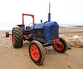 Seaside Traction (geograph 1693163).jpg 1,600 × 1,333; 430 KB
-
 Seaweed on Withernsea Post (geograph 3108745).jpg 2,248 × 4,000; 2.03 MB
-
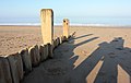 Shadows on the beach - geograph.org.uk - 1249115.jpg 640 × 404; 245 KB
-
 Shingle Beach, Hornsea - geograph.org.uk - 1326214.jpg 640 × 480; 87 KB
-
 Slipway to Beach, Withernsea - geograph.org.uk - 1743172.jpg 800 × 600; 106 KB
-
 Slipway to Mappleton Sands - geograph.org.uk - 1442087.jpg 640 × 480; 49 KB
-
 South beach, Withernsea - geograph.org.uk - 1515585.jpg 640 × 480; 54 KB
-
 South Promenade, Hornsea - geograph.org.uk - 856029.jpg 465 × 640; 108 KB
-
 Southern groyne, Mappleton Sands - geograph.org.uk - 269701.jpg 640 × 480; 79 KB
-
 Southernmost groyne, Withernsea (geograph 6054893).jpg 1,600 × 1,200; 288 KB
-
 Southernmost groyne, Withernsea (geograph 6054980).jpg 1,600 × 1,200; 178 KB
-
 Spurn 7.jpg 3,072 × 2,304; 2.79 MB
-
 Spurn Beach - geograph.org.uk - 1257636.jpg 640 × 427; 71 KB
-
 Spurn Groynes^ - geograph.org.uk - 828899.jpg 640 × 480; 60 KB
-
 Spurn Lighthouse - geograph.org.uk - 19784.jpg 640 × 480; 78 KB
-
 Spurn Peninsula - geograph.org.uk - 315871.jpg 640 × 477; 77 KB
-
 Spurn Point high light - geograph.org.uk - 817501.jpg 640 × 480; 59 KB
-
 Spurn Point IMG 7906.JPG - panoramio.jpg 1,200 × 801; 399 KB
-
 Spurn Point IMG 8167 - panoramio.jpg 1,055 × 704; 66 KB
-
 Spurn traffic - geograph.org.uk - 43015.jpg 640 × 480; 75 KB
-
 Steps down to the beach at Withernsea (geograph 2097589).jpg 800 × 600; 225 KB
-
 Steps down to the beach, Withernsea (geograph 3607047).jpg 1,024 × 768; 160 KB
-
 Steps to the beach Withernsea - geograph.org.uk - 751528.jpg 640 × 427; 71 KB
-
 Steps to the Sea - geograph.org.uk - 1412894.jpg 480 × 640; 80 KB
-
 Stone Thrower on Withernsea Beach - geograph.org.uk - 1195799.jpg 640 × 517; 119 KB
-
 Stormy waters - geograph.org.uk - 1219849.jpg 640 × 427; 58 KB
-
 Sunrise at Withernsea beach.jpg 2,048 × 1,020; 134 KB
-
 Tangled net and groyne at Spurn Point - geograph.org.uk - 890255.jpg 640 × 480; 101 KB
-
 Tangled Nets - geograph.org.uk - 282720.jpg 480 × 640; 104 KB
-
 Tangled Nets - geograph.org.uk - 944610.jpg 640 × 480; 102 KB
-
 The "beach" near Paull Lighthouses - geograph.org.uk - 8060.jpg 640 × 430; 101 KB


.jpg)
.jpg)
.jpg)


.jpg)

.jpg)
.jpg)
.jpg)

.jpg)
.jpg)
.jpg)
.jpg)
.jpg)
.jpg)


.jpg)


.jpg)
.jpg)


.jpg)
.jpg)

.jpg)


.jpg)


.jpg)


.jpg)


.jpg)
.jpg)


.jpg)


_-_geograph.org.uk_-_1515275.jpg)


.jpg)

.jpg)
.jpg)


.jpg)
.jpg)
.jpg)
.jpg)
.jpg)
.jpg)


.jpg)
.jpg)

.jpg)


.jpg)


.jpg)

.jpg)


.jpg)

.jpg)
.jpg)


.jpg)
.jpg)


.jpg)
.jpg)


