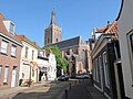
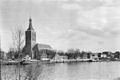
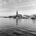
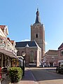
Category:Grote of Sint-Stephanuskerk, Hasselt (Overijssel)
Jump to navigation
Jump to search
| Object location | | View all coordinates using: OpenStreetMap |
|---|
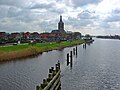
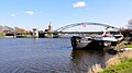
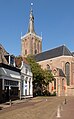
church building in Zwartewaterland, Netherlands  | |||||
| Upload media | |||||
| Instance of | |||||
|---|---|---|---|---|---|
| Dedicated to | |||||
| Location | Hasselt, Overijssel, Netherlands | ||||
| Street address |
| ||||
| Heritage designation |
| ||||
| official website | |||||
 | |||||
Nederlands: Hervormde Kerk
|
This is a category about rijksmonument number 20900
|
| Address |
|
Subcategories
This category has the following 3 subcategories, out of 3 total.
Media in category "Grote of Sint-Stephanuskerk, Hasselt (Overijssel)"
The following 81 files are in this category, out of 81 total.
-
 20131022 Grote Kerk Hasselt.jpg 3,602 × 4,802; 2.1 MB
-
 20131022 Zicht op Hasselt1.jpg 4,408 × 3,305; 1.81 MB
-
 20131022 Zicht op Hasselt2.jpg 4,896 × 3,672; 2.96 MB
-
 20131022 Zicht op Hasselt3.jpg 4,514 × 3,385; 1.99 MB
-
 20151217 Zicht op Hasselt met Stephanuskerk aan het Zwarte Water.jpg 4,896 × 3,672; 1.65 MB
-
 20151217 Zicht op Hasselt met Zwartewaterbrug en Stephanuskerk aan het Zwarte Water.jpg 4,912 × 1,080; 430 KB
-
 20151217 Zicht op Hasselt.jpg 4,896 × 3,672; 327 KB
-
 8061 Hasselt, Netherlands - panoramio (19).jpg 2,048 × 1,155; 924 KB
-
 Avondmaalsbeker - Hasselt - 20102885 - RCE.jpg 946 × 1,200; 115 KB
-
 Burg.Royerplein - Hasselt - 20102678 - RCE.jpg 1,197 × 1,200; 313 KB
-
 Diversen - Hasselt - 20103025 - RCE.jpg 1,200 × 840; 199 KB
-
 Diversen - Hasselt - 20103026 - RCE.jpg 1,200 × 873; 177 KB
-
 Ext.koorzijde naar het noord-westen - Hasselt - 20102823 - RCE.jpg 965 × 1,200; 226 KB
-
 Exterieur - Hasselt - 20102807 - RCE.jpg 1,200 × 935; 358 KB
-
 Exterieur - Hasselt - 20102808 - RCE.jpg 882 × 1,200; 266 KB
-
 Exterieur - Hasselt - 20102809 - RCE.jpg 891 × 1,200; 284 KB
-
 Exterieur - Hasselt - 20102810 - RCE.jpg 879 × 1,200; 251 KB
-
 Exterieur - Hasselt - 20102811 - RCE.jpg 886 × 1,200; 319 KB
-
 Exterieur - Hasselt - 20102877 - RCE.jpg 960 × 1,200; 178 KB
-
 Exterieur - Hasselt - 20102880 - RCE.jpg 965 × 1,200; 196 KB
-
 Exterieur aanzicht - Zwollerkerspel - 20231416 - RCE.jpg 1,200 × 811; 158 KB
-
 Exterieur ingangspartij noord-zijde - Hasselt - 20102830 - RCE.jpg 966 × 1,200; 320 KB
-
 Exterieur naar het noord-oosten (sacristie) - Hasselt - 20102804 - RCE.jpg 959 × 1,200; 375 KB
-
 Exterieur naar het noord-oosten - Hasselt - 20102803 - RCE.jpg 957 × 1,200; 213 KB
-
 Exterieur naar het noord-westen - Hasselt - 20102806 - RCE.jpg 950 × 1,200; 218 KB
-
 Exterieur noord-zijde - Hasselt - 20102831 - RCE.jpg 967 × 1,200; 224 KB
-
 Exterieur noordzijde - Hasselt - 20102878 - RCE.jpg 958 × 1,200; 275 KB
-
 Exterieur toren - Hasselt - 20102879 - RCE.jpg 954 × 1,200; 183 KB
-
 Exterieur zuid-oost zijde - Hasselt - 20102876 - RCE.jpg 960 × 1,200; 244 KB
-
 Exterieur zuid-west zijde - Hasselt - 20102872 - RCE.jpg 941 × 1,200; 202 KB
-
 Exterieur zuid-west zijde - Hasselt - 20102875 - RCE.jpg 1,010 × 1,200; 205 KB
-
 Exterieur zuidzijde - Hasselt - 20102873 - RCE.jpg 960 × 1,200; 200 KB
-
 Gezicht op de stad Hasselt.jpg 2,592 × 1,552; 763 KB
-
 Gezicht op Hasselt.jpg 1,600 × 962; 264 KB
-
 Gezicht op het Raadhuis en de kerk - Hasselt - 20102661 - RCE.jpg 898 × 1,200; 203 KB
-
 Grote-of St.Stephanuskerk, Hassel, NL, ingangsdeur.JPG 2,000 × 3,008; 1.47 MB
-
 Hasselt, de Grote of Sint-Stephanuskerk in stadszicht RM20900 IMG 2104 2018-04-07 15.09.jpg 5,203 × 3,157; 9.38 MB
-
 Hasselt, dec 2004 013.jpg 2,816 × 2,112; 2.15 MB
-
 Hasselt, Grutte- of Stefanustsjerke.jpg 3,419 × 4,775; 7.81 MB
-
 Hasselt, herf. Stefanustsjerke.jpg 5,077 × 3,630; 18.88 MB
-
 Hasselt, kerk1 foto1 2011-05-21 09.22.jpg 4,353 × 3,265; 9.11 MB
-
 Hasselt, Stefanustsjerke, sakristy.jpg 2,915 × 4,077; 6.37 MB
-
 Hasselt, Stefanustsjerke, súdlike tagong.jpg 3,643 × 5,101; 8.27 MB
-
 Hasselt.jpg 360 × 270; 11 KB
-
 Hasselt2004.JPG 360 × 270; 19 KB
-
 Justitiebastion - Hasselt - 20102724 - RCE.jpg 1,197 × 1,200; 260 KB
-
 Lager, voorgevels - Hasselt - 20102976 - RCE.jpg 800 × 1,200; 148 KB
-
 Middenpilaster, toegangsdeur, Grote- of Sint Stephanuskerk, Hasselt.JPG 2,000 × 3,008; 1.29 MB
-
 Muurschildering - Hasselt - 20102815 - RCE.jpg 908 × 1,200; 182 KB
-
 Muurschildering St.Christoforus - Hasselt - 20102814 - RCE.jpg 915 × 1,200; 192 KB
-
 Over het Zwarte Water gezien - Hasselt - 20102794 - RCE.jpg 915 × 1,200; 138 KB
-
 Overzicht - Hasselt - 20102663 - RCE.jpg 1,200 × 803; 166 KB
-
 Overzicht Gasthuisstraat - Hasselt - 20102691 - RCE.jpg 1,192 × 1,200; 287 KB
-
 Overzicht Kade - Hasselt - 20102717 - RCE.jpg 1,190 × 1,200; 364 KB
-
 Overzicht Kade - Hasselt - 20102718 - RCE.jpg 1,192 × 1,200; 343 KB
-
 Overzicht Kade - Hasselt - 20102721 - RCE.jpg 1,193 × 1,200; 216 KB
-
 Overzicht Kade - Hasselt - 20102722 - RCE.jpg 1,192 × 1,200; 319 KB
-
 Overzicht noordgevel - Hasselt - 20350580 - RCE.jpg 1,179 × 1,200; 342 KB
-
 Overzicht Ridderstraat - Hasselt - 20102754 - RCE.jpg 1,197 × 1,200; 340 KB
-
 Overzicht Ridderstraat - Hasselt - 20102992 - RCE.jpg 807 × 1,200; 183 KB
-
 Overzicht stadsbeeld vanuit het westen - Hasselt - 20102664 - RCE.jpg 1,188 × 1,200; 270 KB
-
 Overzicht stadsbeeld vanuit het zuiden - Hasselt - 20102665 - RCE.jpg 1,191 × 1,200; 228 KB
-
 Poort noordbeuk - Hasselt - 20102857 - RCE.jpg 799 × 1,200; 220 KB
-
 Sacristie naar het noord-westen - Hasselt - 20102805 - RCE.jpg 960 × 1,200; 407 KB
-
 Schildering noord-oost pijler toren - Hasselt - 20102884 - RCE.jpg 951 × 1,200; 158 KB
-
 Sint Stephanuskerk Hasselt.jpg 1,944 × 2,592; 390 KB
-
 Stad Hasselt aan het Zwartewater.jpg 2,304 × 1,728; 1.35 MB
-
 Stadsaanzicht vanaf de brug over het Zwarte Water - Hasselt - 20350579 - RCE.jpg 1,191 × 1,200; 262 KB
-
 Stadsaanzicht vanaf de overkant van het Zwarte Water - Hasselt - 20350578 - RCE.jpg 1,179 × 1,200; 301 KB
-
 Straatbeeld met zicht op toren van de Grote Kerk - Hasselt - 20103037 - RCE.jpg 894 × 1,200; 169 KB
-
 Tekening van vensters, 1653 - Hasselt - 20102846 - RCE.jpg 1,200 × 804; 152 KB
-
 Tekening van vensters, 1653 - Hasselt - 20102847 - RCE.jpg 1,200 × 803; 152 KB
-
 Toren - Hasselt - 20102796 - RCE.jpg 888 × 1,200; 182 KB
-
 Van het Zuiden na restauratie - Hasselt - 20102866 - RCE.jpg 802 × 1,200; 180 KB
-
 Vensters, tekening uit 1653 - Hasselt - 20102849 - RCE.jpg 1,200 × 804; 137 KB
-
 Zicht op gedeelte van de zuidgevel en de kerktoren - Hasselt - 20369858 - RCE.jpg 1,200 × 1,200; 170 KB
-
 Zicht op Hasselt.jpg 2,592 × 1,944; 432 KB
-
 Zicht op Hasselt2.jpg 2,592 × 1,580; 272 KB
-
 Zicht op Hasselt3.jpg 2,554 × 1,428; 328 KB
-
 Zuid-oost zijde, exterieur - Hasselt - 20102874 - RCE.jpg 950 × 1,200; 220 KB
-
 Zwartewaterland-Hasselt, de Grote-of Stephanuskerk RM 20900 IMG 8441 2023-09-11 11.56.jpg 2,865 × 4,608; 8.19 MB


.jpg)


_-_Hasselt_-_20102804_-_RCE.jpg)


