Category:Grote of Sint-Michaëlskerk (Oudewater)
Jump to navigation
Jump to search
| Object location | | View all coordinates using: OpenStreetMap |
|---|
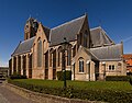
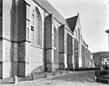
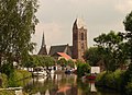
church building in Oudewater, Netherlands  | |||||
| Upload media | |||||
| Instance of | |||||
|---|---|---|---|---|---|
| Location | Oudewater, Utrecht, Netherlands | ||||
| Street address |
| ||||
| Heritage designation |
| ||||
| Inception |
| ||||
| Significant event |
| ||||
 | |||||
Kerk
|
This is a category about rijksmonument number 32067
|
Toren
|
This is a category about rijksmonument number 32068
|
| Address |
|
Subcategories
This category has only the following subcategory.
Media in category "Grote of Sint-Michaëlskerk (Oudewater)"
The following 100 files are in this category, out of 100 total.
-
 2010 Michaelskerk Oudewater.jpg 2,912 × 4,368; 2.72 MB
-
 3421 Oudewater, Netherlands - panoramio (75).jpg 3,264 × 4,896; 3.56 MB
-
 3421 Oudewater, Netherlands - panoramio (79).jpg 3,264 × 4,896; 3.66 MB
-
 3421 Oudewater, Netherlands - panoramio (81).jpg 4,896 × 3,264; 2.98 MB
-
 Aanzicht - Oudewater - 20179981 - RCE.jpg 3,107 × 3,125; 2.13 MB
-
 Church at Oudewater.jpg 3,168 × 4,752; 11.2 MB
-
 De Grote of Sint-Michaëlskerk te Oudewater.jpg 5,482 × 4,444; 20.2 MB
-
 De Grote of Sint-Michaëlskerk te Oudewater2.jpg 7,059 × 5,510; 33.9 MB
-
 De Grote of Sint-Michaëlskerk te Oudewater3.jpg 5,976 × 4,575; 22.57 MB
-
 Dorpsgezicht met molen en Kerk - Oudewater - 20179567 - RCE.jpg 2,712 × 2,116; 1.67 MB
-
 Exterieur noord-zijde - Oudewater - 20179696 - RCE.jpg 3,072 × 2,451; 1.97 MB
-
 Exterieur oost-zijde - Oudewater - 20179698 - RCE.jpg 3,042 × 2,440; 2.5 MB
-
 Exterieur oost-zijde noordelijke zijbeuk - Oudewater - 20179697 - RCE.jpg 2,480 × 3,053; 2.37 MB
-
 Exterieur OVERZICHT ZUIDWESTHOEK - Oudewater - 20311521 - RCE.jpg 3,044 × 3,074; 4.79 MB
-

-
 Exterieur toren west-zijde - Oudewater - 20179695 - RCE.jpg 2,462 × 3,059; 2 MB
-
 Exterieur voormalige kosterswoning - Oudewater - 20179716 - RCE.jpg 2,928 × 2,342; 2.39 MB
-
 Exterieur WESTGEVEL, EERSTE TRAVEE, SCHADE - Oudewater - 20311523 - RCE.jpg 3,047 × 3,077; 5.56 MB
-
 Exterieur zuid-oost zijde - Oudewater - 20179699 - RCE.jpg 3,082 × 2,445; 2.08 MB
-
 Exterieur zuid-west zijde - Oudewater - 20179725 - RCE.jpg 3,077 × 2,468; 2.46 MB
-
 Exterieur zuid-zijde - Oudewater - 20179692 - RCE.jpg 3,047 × 2,440; 1.89 MB
-
 Exterieur zuid-zijde - Oudewater - 20179700 - RCE.jpg 3,100 × 2,463; 2.56 MB
-
 Exterieur zuid-zijde - Oudewater - 20179733 - RCE.jpg 3,077 × 2,434; 2.21 MB
-
 Exterieur ZUIDGEVEL, STEUNBEER, SCHADE - Oudewater - 20311520 - RCE.jpg 3,042 × 3,059; 4.98 MB
-
 Exterieur ZUIDGEVEL, STEUNBEER, SCHADE - Oudewater - 20311525 - RCE.jpg 3,046 × 3,057; 5.39 MB
-
 Exterieur ZUIDWEST GEVEL, STEUNBEER - Oudewater - 20311522 - RCE.jpg 3,043 × 3,060; 5.11 MB
-
 Exterieur ZUIDWEST GEVEL, STEUNBEER - Oudewater - 20311526 - RCE.jpg 3,047 × 3,060; 5.43 MB
-
 Exterieur ZUIDWESTHOEK, SCHADE - Oudewater - 20311524 - RCE.jpg 3,043 × 3,059; 4.86 MB
-
 Haastrecht en Oudewater 076.jpg 2,592 × 1,944; 1,022 KB
-
 Hollandse IJssel Oudewater 04.JPG 4,288 × 2,848; 3.07 MB
-
 Interieur hoofdkoor - Oudewater - 20179723 - RCE.jpg 2,446 × 2,922; 1.42 MB
-
 Interieur koor - Oudewater - 20179720 - RCE.jpg 2,447 × 3,048; 1.45 MB
-
 Interieur naar het oosten - Oudewater - 20179654 - RCE.jpg 2,706 × 2,128; 1.25 MB
-
 Interieur naar het oosten - Oudewater - 20179726 - RCE.jpg 2,463 × 3,089; 971 KB
-
 Interieur naar het oosten - Oudewater - 20179734 - RCE.jpg 2,480 × 3,048; 993 KB
-
 Interieur naar het westen - Oudewater - 20179690 - RCE.jpg 3,077 × 2,480; 1.04 MB
-
 Interieur naar het westen - Oudewater - 20179691 - RCE.jpg 2,440 × 3,029; 1.15 MB
-
 Interieur naar het zuid-oosten - Oudewater - 20179727 - RCE.jpg 3,066 × 2,434; 1,009 KB
-
 Interieur naar het zuid-westen - Oudewater - 20179721 - RCE.jpg 2,464 × 3,060; 1.48 MB
-
 Interieur noord zijbeuk naar het oosten - Oudewater - 20179655 - RCE.jpg 2,718 × 2,134; 1.25 MB
-
 Interieur noordelijke zijbeuk naar het oosten - Oudewater - 20179730 - RCE.jpg 2,457 × 3,083; 972 KB
-
 Interieur noordelijke zijbeuk naar het westen - Oudewater - 20179729 - RCE.jpg 2,440 × 3,100; 905 KB
-
 Interieur van uit noordelijke zijbeuk naar het zuid-westen - Oudewater - 20179656 - RCE.jpg 2,140 × 2,676; 1.17 MB
-
 Interieur van uit zuidelijke zijbeuk naar het noord-westen - Oudewater - 20179657 - RCE.jpg 2,724 × 2,122; 1.14 MB
-
 Interieur vanuit het oosten getekend E.C.Ramms 1861 - Oudewater - 20179653 - RCE.jpg 2,140 × 2,700; 2.01 MB
-
 Interieur voormalige sacristie zuid-oost zijde - Oudewater - 20179731 - RCE.jpg 2,480 × 3,100; 1.01 MB
-
 Interieur, aanzicht orgel, orgelnummer 1203 - Oudewater - 20349213 - RCE.jpg 1,500 × 3,001; 676 KB
-
 Interieur, aanzicht orgel, orgelnummer 1203 - Oudewater - 20374045 - RCE.jpg 2,440 × 2,950; 967 KB
-
 Interieur, muurschildering in de sacristie - Oudewater - 20383992 - RCE.jpg 3,090 × 3,082; 3 MB
-

-
 Interieur, overzicht naar het noordoosten - Oudewater - 20179658 - RCE.jpg 2,800 × 3,797; 2.9 MB
-
 Interieur, wandkast in de sacristie - Oudewater - 20383990 - RCE.jpg 3,045 × 3,073; 2.73 MB
-
 Interieur, wandkast in de sacristie - Oudewater - 20383991 - RCE.jpg 3,090 × 3,064; 3.42 MB
-
 Interieur, wandkast in de sacristie - Oudewater - 20383994 - RCE.jpg 1,200 × 1,184; 267 KB
-
 Kerk - Oudewater - 20179632 - RCE.jpg 2,140 × 2,706; 1.4 MB
-
 Kerk detail oost-zijde - Oudewater - 20179639 - RCE.jpg 2,128 × 2,718; 2.17 MB
-
 Kerk detail oost-zijde - Oudewater - 20179640 - RCE.jpg 2,128 × 2,724; 2.31 MB
-
 Kerk naar het oosten - Oudewater - 20179638 - RCE.jpg 2,706 × 2,136; 2.04 MB
-
 Kerk overzicht naar het noord-westen - Oudewater - 20179637 - RCE.jpg 2,724 × 2,116; 2.29 MB
-
 KerkOudewater.JPG 2,430 × 1,770; 1.06 MB
-
 Klokkestoel toren - Oudewater - 20179707 - RCE.jpg 3,077 × 2,460; 2.1 MB
-
 Klokkestoel toren - Oudewater - 20179708 - RCE.jpg 3,079 × 2,460; 2.28 MB
-
 Koorsluiting vanuit het noorden (ca.1850) - Oudewater - 20179651 - RCE.jpg 2,134 × 2,688; 2.49 MB
-
 Night in Oudewater 01.JPG 4,288 × 2,848; 3.31 MB
-
 Night in Oudewater 02.JPG 4,288 × 2,848; 2.38 MB
-
 Noord IJsselkade 2-6, Oudewater, Netherlands - panoramio (38).jpg 2,048 × 1,148; 422 KB
-
 Orgel - Oudewater - 20179665 - RCE.jpg 2,146 × 2,712; 1.26 MB
-
 Oudewater 157.jpg 640 × 480; 318 KB
-
 Oudewater 214.jpg 300 × 400; 108 KB
-
 Oudewater, de Sint Michaelskerk RM32067 vanaf de West IJsselkade IMG 8928 2019-04-20 13.52.jpg 4,864 × 3,648; 11.36 MB
-
 Oudewater, kerk1 foto3 2009-04-13 16.53.JPG 2,304 × 3,072; 2.31 MB
-
 Oudewater, stadszicht met kerk1 2009-04-13 16.41.JPG 3,072 × 2,304; 1.95 MB
-
 Overzicht - Oudewater - 20180123 - RCE.jpg 3,316 × 2,240; 1.84 MB
-

-

-
 Plattegrond midden 14e eeuw - Oudewater - 20179735 - RCE.jpg 2,120 × 2,715; 1.26 MB
-
 Portaal in zuid zijbeuk (ca.1850) - Oudewater - 20179652 - RCE.jpg 2,098 × 2,700; 1.42 MB
-
 RM32067 Oudewater - Kerk.jpg 1,944 × 2,592; 1.26 MB
-
 RM32068 Oudewater - Toren.jpg 1,944 × 2,592; 1.73 MB
-
 Topgevel van voormalige kosterswoning - Oudewater - 20179680 - RCE.jpg 2,342 × 2,909; 1.44 MB
-
 Toren - Oudewater - 20179635 - RCE.jpg 2,383 × 3,268; 1.27 MB
-
 Toren - Oudewater - 20179636 - RCE.jpg 2,401 × 3,231; 1.49 MB
-
 Toren - Oudewater - 20179713 - RCE.jpg 2,098 × 2,862; 1.55 MB
-
 Toren - Oudewater - 20179714 - RCE.jpg 2,098 × 2,862; 1.56 MB
-
 Toren naar het noord-westen - Oudewater - 20179627 - RCE.jpg 2,146 × 2,718; 1.26 MB
-
 Toren naar het zuid-oosten - Oudewater - 20179628 - RCE.jpg 2,146 × 2,712; 1.25 MB
-
 Toren noord-zijde - Oudewater - 20179629 - RCE.jpg 2,134 × 2,658; 1.22 MB
-
 Toren zuid-west zijde - Oudewater - 20179694 - RCE.jpg 2,480 × 3,072; 1.48 MB
-
 Toren zuid-zijde - Oudewater - 20179693 - RCE.jpg 2,480 × 3,100; 1.18 MB
-
 Voet van de toren - Oudewater - 20179630 - RCE.jpg 2,116 × 2,658; 1.73 MB
-
 Voet van de toren - Oudewater - 20179631 - RCE.jpg 2,116 × 2,658; 1.75 MB
-
 Voormalige sacristie zuid-oost zijde - Oudewater - 20179732 - RCE.jpg 2,463 × 3,077; 933 KB
-

-

-
 Zicht vanuit het noordwesten - Oudewater - 20327826 - RCE.jpg 2,724 × 2,092; 760 KB
-
 Zicht vanuit het noordwesten - Oudewater - 20327847 - RCE.jpg 2,736 × 2,224; 671 KB
-
 Zuid-zijde naar het noord-westen - Oudewater - 20179648 - RCE.jpg 2,134 × 2,724; 1.47 MB
-
 Zuidelijke zijbeuk naar het oosten (ca.1850) - Oudewater - 20179649 - RCE.jpg 2,134 × 2,700; 1.5 MB
-
 Zuidelijke zijbeuk naar het oosten (ca.1850) - Oudewater - 20179650 - RCE.jpg 2,146 × 2,694; 1.56 MB
-
 Zuidelijke zijbeuk naar het westen - Oudewater - 20179728 - RCE.jpg 2,480 × 3,059; 995 KB

.jpg)
.jpg)
.jpg)


_-_Oudewater_-_20264600_-_RCE.jpg)


_-_Oudewater_-_20179651_-_RCE.jpg)


.jpg)


_-_Oudewater_-_20179652_-_RCE.jpg)


_-_Oudewater_-_20179649_-_RCE.jpg)
_-_Oudewater_-_20179650_-_RCE.jpg)
