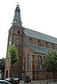
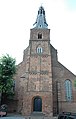
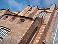
Category:Grote of Laurenskerk (Weesp)
Jump to navigation
Jump to search
| Object location | | View all coordinates using: OpenStreetMap |
|---|
church building in Weesp, Netherlands  | |||||
| Upload media | |||||
| Instance of | |||||
|---|---|---|---|---|---|
| Location | Weesp, Amsterdam, North Holland, Netherlands | ||||
| Street address |
| ||||
| Located on street | |||||
| Heritage designation |
| ||||
| Inception |
| ||||
 | |||||
Nederlands: Grote of Laurenskerk - anno 15e eeuw - Protestantse kerk
|
This is a category about rijksmonument number 38550
|
| Address |
|
Subcategories
This category has only the following subcategory.
Media in category "Grote of Laurenskerk (Weesp)"
The following 46 files are in this category, out of 46 total.
-
 Exterieur koor naar het noorden - Weesp - 20252202 - RCE.jpg 956 × 1,200; 341 KB
-
 Exterieur koor vanuit oosten - Weesp - 20252287 - RCE.jpg 960 × 1,200; 232 KB
-
 Exterieur noordwand - Weesp - 20252283 - RCE.jpg 1,200 × 958; 262 KB
-
 Exterieur ZUIDGEVEL, RAAM - Weesp - 20312415 - RCE.jpg 1,192 × 1,200; 523 KB
-
 Exterieur ZUIDGEVEL, RAAM - Weesp - 20312416 - RCE.jpg 1,186 × 1,200; 469 KB
-
 Exterieur zuidwand van de kerk vanuit 't westen. - Weesp - 20252286 - RCE.jpg 1,200 × 955; 240 KB
-
 Exterieur zuidzijde kerk vanaf het stadhuis - Weesp - 20252285 - RCE.jpg 1,200 × 960; 238 KB
-
 Grote of Laurenskerk Weesp.jpg 2,088 × 2,936; 1.32 MB
-
 INT. SCHILDERINGEN OP KOLOM - Weesp - 20312423 - RCE.jpg 1,193 × 1,200; 249 KB
-
 Kerktoren te Weesp, RP-T-1949-588.jpg 3,708 × 5,924; 2.93 MB
-
 Nieuwstad - Weesp 2016 3.JPG 3,264 × 4,928; 5.14 MB
-
 Noordgevel - Weesp - 20252211 - RCE.jpg 1,200 × 956; 211 KB
-
 Noordgevel naar het oosten - Weesp - 20252215 - RCE.jpg 955 × 1,200; 285 KB
-
 Noordgevel naar het oosten - Weesp - 20252216 - RCE.jpg 960 × 1,200; 267 KB
-
 Noordgevel naar het westen - Weesp - 20252218 - RCE.jpg 949 × 1,200; 260 KB
-
 Noordgevel oost-zijde - Weesp - 20252213 - RCE.jpg 1,200 × 947; 222 KB
-
 Noordgevel oost-zijde - Weesp - 20252217 - RCE.jpg 963 × 1,200; 307 KB
-
 Noordgevel west-zijde - Weesp - 20252212 - RCE.jpg 1,200 × 947; 222 KB
-
 Oost-zijde - Weesp - 20252224 - RCE.jpg 960 × 1,200; 256 KB
-
 Overzicht Kerkstraat vanaf de Hoogstraat - Weesp - 20252020 - RCE.jpg 1,185 × 1,200; 320 KB
-
 Overzicht Middenstraat in de richting van de kerk. - Weesp - 20252064 - RCE.jpg 1,192 × 1,200; 352 KB
-
 Overzicht Middenstraat in de richting van de kerk. - Weesp - 20252065 - RCE.jpg 1,190 × 1,200; 301 KB
-
 Overzicht Middenstraat in de richting van de kerk. - Weesp - 20252066 - RCE.jpg 1,195 × 1,200; 343 KB
-
 Preekstoel - Weesp - 20252297 - RCE.jpg 956 × 1,200; 178 KB
-
 Torenspits vanuit 't zuiden - Weesp - 20252284 - RCE.jpg 956 × 1,200; 208 KB
-
 Torenvoet van uit het zuid-westen - Weesp - 20252282 - RCE.jpg 953 × 1,200; 272 KB
-
 Vechtstreek 23.jpg 1,900 × 2,531; 1.16 MB
-
 Vechtstreek 25.jpg 2,304 × 3,072; 1.68 MB
-
 Vechtstreek 35.jpg 2,203 × 1,597; 756 KB
-
 Weesp - panoramio - Rokus C (4).jpg 1,789 × 2,646; 920 KB
-
 Weesp - protestantse kerk - panoramio - Rokus C (1).jpg 2,000 × 3,008; 1.15 MB
-
 Weesp - protestantse kerk - panoramio - Rokus C.jpg 2,000 × 3,008; 1.51 MB
-
 Weesp - protestantse kerk - panoramio.jpg 1,872 × 2,931; 1.02 MB
-
 Weesp Kerkstraat 10 (2) 38550.JPG 2,448 × 3,264; 1.67 MB
-
 Weesp Kerkstraat 10 (3) 38550.JPG 2,448 × 3,264; 2.18 MB
-
 Weesp Kerkstraat 10 (4) 38550.JPG 3,264 × 2,448; 2.28 MB
-
 Weesp panorama.jpg 6,161 × 2,475; 3.76 MB
-
 Zuid-gevel - Weesp - 20252219 - RCE.jpg 1,200 × 949; 242 KB
-
 Zuid-gevel aanbouw - Weesp - 20252222 - RCE.jpg 955 × 1,200; 317 KB
-
 Zuid-gevel exterieur naar het oosten - Weesp - 20252201 - RCE.jpg 959 × 1,200; 295 KB
-
 Zuid-gevel ingang - Weesp - 20252220 - RCE.jpg 1,200 × 958; 344 KB
-
 Zuid-gevel oost-zijde - Weesp - 20252221 - RCE.jpg 955 × 1,200; 331 KB
-
 Zuid-gevel oost-zijde - Weesp - 20252236 - RCE.jpg 1,200 × 936; 257 KB
-
 Zuid-gevel oost-zijde - Weesp - 20252237 - RCE.jpg 955 × 1,200; 265 KB
-
 Zuid-gevel oost-zijde detail - Weesp - 20252223 - RCE.jpg 955 × 1,200; 356 KB
-


.jpg)
.jpg)


_38550.JPG)
_38550.JPG)
_38550.JPG)


