Category:Grote Spuistraat 30, Dordrecht
Jump to navigation
Jump to search
| Object location | | View all coordinates using: OpenStreetMap |
|---|
 | |||||
| Upload media | |||||
| Instance of |
| ||||
|---|---|---|---|---|---|
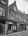
| Location | Dordrecht, South Holland, Netherlands | ||||
| Street address |
| ||||
| Located on street | |||||
| Heritage designation |
| ||||
 | |||||
|
This is a category about rijksmonument number 13429
|
| Address |
|
Media in category "Grote Spuistraat 30, Dordrecht"
The following 3 files are in this category, out of 3 total.
-
 Dordrecht Grote Spuistraat30.jpg 2,504 × 3,528; 4.95 MB
-
 Spuistr. 30, voorgevel - Dordrecht - 20062555 - RCE.jpg 956 × 1,200; 237 KB
-
 Voorgevel - Dordrecht - 20062074 - RCE.jpg 964 × 1,200; 209 KB

