Category:Grote Kerkstraat 69, Leeuwarden
Jump to navigation
Jump to search
| Object location | | View all coordinates using: OpenStreetMap |
|---|
house in Leeuwarden, Netherlands  | |||||
| Upload media | |||||
| Instance of | |||||
|---|---|---|---|---|---|
| Location | Leeuwarden, Friesland, Netherlands | ||||
| Heritage designation |
| ||||
 | |||||
|
This is a category about rijksmonument number 24196
|
| Address |
|
Media in category "Grote Kerkstraat 69, Leeuwarden"
The following 18 files are in this category, out of 18 total.
-
 Achtergevel - Leeuwarden - 20132539 - RCE.jpg 1,188 × 1,200; 330 KB
-
 Gedeelte achtergevel - Leeuwarden - 20132540 - RCE.jpg 1,190 × 1,200; 356 KB
-
 Interieur - Leeuwarden - 20132529 - RCE.jpg 1,199 × 1,200; 262 KB
-
 Interieur - Leeuwarden - 20132530 - RCE.jpg 1,192 × 1,200; 325 KB
-
 Interieur - Leeuwarden - 20132531 - RCE.jpg 1,191 × 1,200; 247 KB
-
 Interieur - Leeuwarden - 20132532 - RCE.jpg 1,185 × 1,200; 287 KB
-
 Interieur - Leeuwarden - 20132533 - RCE.jpg 1,199 × 1,200; 329 KB
-
 Interieur - Leeuwarden - 20132541 - RCE.jpg 1,190 × 1,200; 292 KB
-
 Interieur - Leeuwarden - 20132542 - RCE.jpg 1,185 × 1,200; 306 KB
-
 Interieur - Leeuwarden - 20132543 - RCE.jpg 1,193 × 1,200; 320 KB
-
 Interieur - Leeuwarden - 20132544 - RCE.jpg 1,194 × 1,200; 326 KB
-
 Interieur - Leeuwarden - 20132545 - RCE.jpg 1,193 × 1,200; 340 KB
-
 Interieur, keuken - Leeuwarden - 20132534 - RCE.jpg 1,197 × 1,200; 266 KB
-
 Interieur, keuken - Leeuwarden - 20132535 - RCE.jpg 1,197 × 1,200; 249 KB
-
 Interieur, zolder - Leeuwarden - 20132536 - RCE.jpg 1,190 × 1,200; 303 KB
-
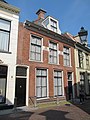 RM24196 Leeuwarden - Grote Kerkstraat 69.jpg 1,944 × 2,592; 1.37 MB
-
 Voorgevel - Leeuwarden - 20132537 - RCE.jpg 805 × 1,200; 191 KB
-
 Voorgevel - Leeuwarden - 20132538 - RCE.jpg 1,195 × 1,200; 298 KB


