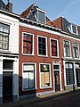
Category:Grote Kerkstraat 49, Leeuwarden
Jump to navigation
Jump to search
| Object location | | View all coordinates using: OpenStreetMap |
|---|
building in Leeuwarden, Netherlands  | |||||
| Upload media | |||||
| Instance of | |||||
|---|---|---|---|---|---|
| Location | Leeuwarden, Friesland, Netherlands | ||||
| Heritage designation |
| ||||
 | |||||
|
This is a category about rijksmonument number 24191
|
| Address |
|
Media in category "Grote Kerkstraat 49, Leeuwarden"
The following 6 files are in this category, out of 6 total.
-
 Gevel - Leeuwarden - 20132520 - RCE.jpg 959 × 1,200; 296 KB
-
 Gevelwand - Leeuwarden - 20132518 - RCE.jpg 1,200 × 964; 262 KB
-
 Interieur, deurpartij - Leeuwarden - 20132488 - RCE.jpg 949 × 1,200; 149 KB
-
 Leeuwarden - Grote Kerkstraat 49.jpg 3,000 × 4,000; 4.01 MB
-
 Voorgevel - Leeuwarden - 20132519 - RCE.jpg 961 × 1,200; 248 KB
-
 Voorgevels - Leeuwarden - 20132522 - RCE.jpg 804 × 1,200; 192 KB


