Category:Grote Kerkstraat 228, Leeuwarden
Jump to navigation
Jump to search
| Object location | | View all coordinates using: OpenStreetMap |
|---|
house in Leeuwarden, Netherlands  | |||||
| Upload media | |||||
| Instance of | |||||
|---|---|---|---|---|---|
| Location | Leeuwarden, Friesland, Netherlands | ||||
| Heritage designation |
| ||||
 | |||||
|
This is a category about rijksmonument number 24207
|
| Address |
|
Media in category "Grote Kerkstraat 228, Leeuwarden"
The following 24 files are in this category, out of 24 total.
-
 Exterieur ACHTERGEVEL - Leeuwarden - 20286310 - RCE.jpg 1,198 × 1,200; 417 KB
-
 Exterieur GEDEELTE VOORGEVEL - Leeuwarden - 20286308 - RCE.jpg 1,198 × 1,200; 328 KB
-
 Exterieur OVERZICHT - Leeuwarden - 20286307 - RCE.jpg 1,190 × 1,200; 309 KB
-
 Exterieur OVERZICHT ACHTERGEVEL - Leeuwarden - 20286309 - RCE.jpg 1,180 × 1,200; 396 KB
-

-

-
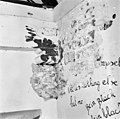
 INTERIEUR, BEGANE GROND, LINKER VOORKAMER, MUURWERK - Leeuwarden - 20286312 - RCE.jpg 1,198 × 1,200; 398 KB
-

-
 INTERIEUR, BEGANE GROND, OVERZICHT, LINKER VOORKAMER - Leeuwarden - 20286311 - RCE.jpg 1,193 × 1,200; 351 KB
-
 INTERIEUR, BEGANE GROND, RECHTER VOORKAMER, MUURWERK - Leeuwarden - 20286313 - RCE.jpg 1,188 × 1,200; 370 KB
-
 INTERIEUR, BEGANE GROND, RECHTER VOORKAMER, MUURWERK - Leeuwarden - 20286314 - RCE.jpg 1,198 × 1,200; 382 KB
-

-
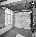
 INTERIEUR, EERSTE VERDIEPING, MUURWERK ACHTERZIJDE - Leeuwarden - 20286323 - RCE.jpg 1,191 × 1,200; 283 KB
-
 INTERIEUR, EERSTE VERDIEPING, SLEUTELSTUK - Leeuwarden - 20286324 - RCE.jpg 1,192 × 1,200; 297 KB
-
 INTERIEUR, EERSTE VERDIEPING, SPILTRAP - Leeuwarden - 20286320 - RCE.jpg 1,200 × 1,200; 264 KB
-
 INTERIEUR, EERSTE VERDIEPING, TRAPPENHUIS, SLEUTELSTUK - Leeuwarden - 20286321 - RCE.jpg 1,200 × 1,194; 279 KB
-
 INTERIEUR, EERSTE VERDIEPING, VOORKAMER, MUURWERK - Leeuwarden - 20286322 - RCE.jpg 1,188 × 1,200; 275 KB
-
 INTERIEUR, OVERZICHT HAL, SPILTRAP - Leeuwarden - 20286318 - RCE.jpg 1,193 × 1,200; 234 KB
-
 INTERIEUR, SPILTRAP - Leeuwarden - 20286319 - RCE.jpg 1,195 × 1,200; 271 KB
-
 INTERIEUR, VLIERING, OVERZICHT KAPCONSTRUCTIE - Leeuwarden - 20286328 - RCE.jpg 1,191 × 1,200; 305 KB
-
 INTERIEUR, ZOLDER, KAPCONSTRUCTIE, DETAIL - Leeuwarden - 20286327 - RCE.jpg 1,190 × 1,200; 346 KB
-
 INTERIEUR, ZOLDER, OVERZICHT, KAPCONSTRUCTIE* - Leeuwarden - 20286326 - RCE.jpg 1,193 × 1,200; 279 KB
-
 Ljouwert, Waalske Tsjerke.jpg 3,746 × 5,630; 11.78 MB
-
 RM24207 Leeuwarden - Grote Kerkstraat 228.jpg 2,592 × 1,944; 1.14 MB


