Category:Grote Kerkstraat 17, Leeuwarden
Jump to navigation
Jump to search
| Object location | | View all coordinates using: OpenStreetMap |
|---|
 | |||||
| Upload media | |||||
| Instance of | |||||
|---|---|---|---|---|---|
| Location | Leeuwarden, Friesland, Netherlands | ||||
| Heritage designation |
| ||||
 | |||||
|
This is a category about rijksmonument number 24179
|
| Address |
|
Media in category "Grote Kerkstraat 17, Leeuwarden"
The following 10 files are in this category, out of 10 total.
-
 20140531 Poortje Grote Kerkstraat 17 (Stadhouderlijke Rijschool) Leeuwarden NL.jpg 2,400 × 2,400; 2.05 MB
-
 Ingang - Leeuwarden - 20403361 - RCE.jpg 886 × 1,200; 238 KB
-
 Leeuwarden - Grote Kerkstraat 17 - poortomlijsting.jpg 3,000 × 4,000; 4 MB
-
 Leeuwarden - Grote Kerkstraat 17 - Stadhouderlijke Rijschool.jpg 4,000 × 3,000; 5.16 MB
-
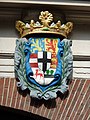
 Leeuwarden - Grote Kerkstraat 17 - wapen 1.jpg 3,000 × 4,000; 3.88 MB
-
 Leeuwarden - Grote Kerkstraat 17 - wapen 2.jpg 3,000 × 4,000; 4.19 MB
-
 Overzicht voorgevel - Leeuwarden - 20133079 - RCE.jpg 1,200 × 894; 258 KB
-
 Poortje - Leeuwarden - 20403362 - RCE.jpg 878 × 1,200; 257 KB
-
 Voorgevel - Leeuwarden - 20403360 - RCE.jpg 888 × 1,200; 225 KB
-
 WLM - 23dingenvoormusea - Stadhouderlijke Rijschool.jpg 3,888 × 2,592; 4.5 MB
_Leeuwarden_NL.jpg)


