Category:Grote Houtstraat 47, Haarlem
Jump to navigation
Jump to search
| Object location | | View all coordinates using: OpenStreetMap |
|---|
 | |||||
| Upload media | |||||
| Instance of |
| ||||
|---|---|---|---|---|---|
| Location | Haarlem, North Holland, Netherlands | ||||
| Street address |
| ||||
| Located on street | |||||
| Heritage designation |
| ||||
 | |||||
|
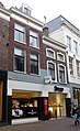
This is a category about rijksmonument number 19210
|
| Address |
|
Media in category "Grote Houtstraat 47, Haarlem"
The following 2 files are in this category, out of 2 total.
-
 Gevels - Haarlem - 20097307 - RCE.jpg 805 × 1,200; 198 KB
-
 Grote Houtstraat 47-49 Haarlem RM19210.jpg 1,507 × 2,458; 1.81 MB
