Category:Groot Zand, Breda
Jump to navigation
Jump to search
| Object location | | View all coordinates using: OpenStreetMap |
|---|
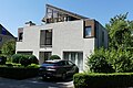
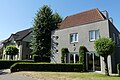
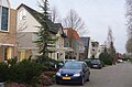
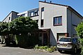
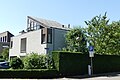
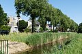
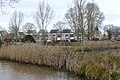
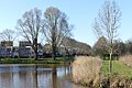
Nederlands: Afbeeldingen van woningen en de straat Groot Zand gelegen in de wijk Overkroeten in het grote stadsdeel de Haagse Beemden in het noorden van Breda in de provincie Noord-Brabant in het zuiden van Nederland
street in Breda, the Netherlands | |||||
| Upload media | |||||
| Instance of | |||||
|---|---|---|---|---|---|
| Location | Breda, North Brabant, Netherlands | ||||
| Street address |
| ||||
 | |||||
Media in category "Groot Zand, Breda"
The following 29 files are in this category, out of 29 total.
-
 Einde straat Groot Zand DSCF9629.jpg 2,816 × 1,864; 2.61 MB
-
 Groot Zand Breda P1160586.jpg 4,000 × 2,672; 5.98 MB
-
 Groot Zand Breda P1160587.jpg 4,000 × 2,672; 6.08 MB
-
 Groot Zand Breda P1160588.jpg 4,000 × 2,672; 5.92 MB
-
 Groot Zand Breda P1160589.jpg 4,000 × 2,672; 5.99 MB
-
 Groot Zand Breda P1160590.jpg 4,000 × 2,672; 5.69 MB
-
 Groot Zand Breda P1160591.jpg 4,000 × 2,672; 5.71 MB
-
 Groot Zand Breda P1160593.jpg 4,000 × 2,672; 5.73 MB
-
 Groot Zand Breda P1160594.jpg 4,000 × 2,672; 5.79 MB
-
 Groot Zand Breda P1160595.jpg 4,000 × 2,672; 5.94 MB
-
 Heksenwiel DSCF8950.JPG 2,816 × 1,864; 2.58 MB
-
 Heksenwiel DSCF9631.JPG 2,816 × 1,864; 2.55 MB
-
 Heksenwiel DSCF9632.JPG 2,816 × 1,864; 2.53 MB
-
 Hoog Zand Overkroeten P1160580.jpg 4,000 × 2,672; 5.75 MB
-
 Hoog Zand Overkroeten P1160582.jpg 4,000 × 2,672; 6.11 MB
-
 Hoog Zand Overkroeten P1160583.jpg 4,000 × 2,672; 5.45 MB
-
 Hoog Zand Overkroeten P1160584.jpg 2,912 × 1,920; 3.73 MB
-
 Hoog Zand Overkroeten P1160585.jpg 4,000 × 2,672; 5.73 MB
-
 Hoog Zand Overkroeten P1320328.jpg 4,000 × 2,672; 5.77 MB
-
 Hoog Zand P1160600.jpg 4,000 × 2,672; 5.83 MB
-
 Nature of Overkroeten P1420481.jpg 4,000 × 2,672; 5.96 MB
-
 Nature of Overkroeten P1460566.jpg 4,000 × 2,672; 6.2 MB
-
 Nature of Overkroeten P1460567.jpg 4,000 × 2,672; 6.17 MB
-
 Nature of Overkroeten P1460568.jpg 4,000 × 2,672; 6.28 MB
-
 Nature of Overkroeten P1460569.jpg 4,000 × 2,672; 6.24 MB
-
 Straat Groot Zand Overkroeten P1120029.jpg 4,000 × 2,672; 5.9 MB
-
 Straat Groot Zand P1120030.jpg 4,000 × 2,672; 6.13 MB
-
 Straten in Overkroeten DSCF0939.jpg 2,816 × 2,112; 2.71 MB
-
 Woningen Overkroeten P1160579.jpg 4,000 × 2,672; 5.97 MB


