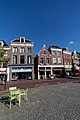
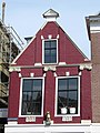
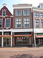
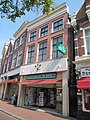
Category:Groentemarkt 1, Leeuwarden
Jump to navigation
Jump to search
| Object location | | View all coordinates using: OpenStreetMap |
|---|
 | |||||
| Upload media | |||||
| Instance of |
| ||||
|---|---|---|---|---|---|
| Location | Leeuwarden, Friesland, Netherlands | ||||
| Street address |
| ||||
| Located on street | |||||
| Heritage designation |
| ||||
 | |||||
|
This is a category about rijksmonument number 24161
|
| Address |
|
Media in category "Groentemarkt 1, Leeuwarden"
The following 8 files are in this category, out of 8 total.
-
 Leeuwarden - panoramio - L-BBE (15).jpg 3,744 × 5,616; 8.36 MB
-
 Leeuwarden - panoramio - L-BBE (16).jpg 3,501 × 5,251; 6.44 MB
-
 Leeuwarden - panoramio - L-BBE (17).jpg 3,394 × 5,091; 4.95 MB
-
 Leeuwarden Groentemarkt 1.jpg 3,000 × 4,000; 925 KB
-
 RM24161 Leeuwarden - Groentemarkt 1.jpg 1,944 × 2,592; 1.22 MB
-
 RM24162 Leeuwarden - Groentemarkt 3.jpg 1,944 × 2,592; 1.31 MB
-
 RM24163 Leeuwarden - Groentemarkt 5.jpg 1,944 × 2,592; 1.44 MB
-
 Voorgevels - Leeuwarden - 20132383 - RCE.jpg 1,200 × 806; 183 KB
.jpg)
.jpg)
.jpg)


