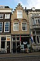
Category:Groenmarkt 6, Dordrecht
Jump to navigation
Jump to search
| Object location | | View all coordinates using: OpenStreetMap |
|---|
 | |||||
| Upload media | |||||
| Instance of |
| ||||
|---|---|---|---|---|---|
| Location | Dordrecht, South Holland, Netherlands | ||||
| Street address |
| ||||
| Heritage designation |
| ||||
 | |||||
|
This is a category about rijksmonument number 13359
|
| Address |
|
Media in category "Groenmarkt 6, Dordrecht"
The following 4 files are in this category, out of 4 total.
-
 Dordrecht - Groenmarkt 6 en 8.JPG 3,056 × 4,592; 4.75 MB
-
 Overzicht - Dordrecht - 20061816 - RCE.jpg 1,200 × 833; 272 KB
-
 Overzicht - Dordrecht - 20061835 - RCE.jpg 804 × 1,200; 183 KB
-
 Voorgevels - Dordrecht - 20061834 - RCE.jpg 804 × 1,200; 190 KB


