Category:Groenestraat 148, Kampen
Jump to navigation
Jump to search
| Object location | | View all coordinates using: OpenStreetMap |
|---|
building in Kampen, Netherlands  | |||||
| Upload media | |||||
| Instance of | |||||
|---|---|---|---|---|---|
| Location | Kampen, Overijssel, Netherlands | ||||
| Heritage designation |
| ||||
 | |||||
|
This is a category about rijksmonument number 23037
|
| Address |
|
Media in category "Groenestraat 148, Kampen"
The following 15 files are in this category, out of 15 total.
-
 Houten achtergevel - Kampen - 20318704 - RCE.jpg 1,192 × 1,200; 442 KB
-
 Interieur kamer met kachel - Kampen - 20332368 - RCE.jpg 1,176 × 1,200; 269 KB
-
 Interieur overzicht woonkamer - Kampen - 20332367 - RCE.jpg 1,183 × 1,200; 245 KB
-
 Interieur, deur naar kelder - Kampen - 20332379 - RCE.jpg 1,181 × 1,200; 216 KB
-
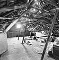
 Interieur, gedeelte zolder - Kampen - 20332375 - RCE.jpg 1,176 × 1,200; 259 KB
-
 Interieur, gedeelte zolder - Kampen - 20332376 - RCE.jpg 1,183 × 1,200; 223 KB
-
 Interieur, gedeelte zolder - Kampen - 20332377 - RCE.jpg 1,178 × 1,200; 253 KB
-
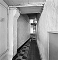 Interieur, overzicht gang - Kampen - 20332371 - RCE.jpg 1,171 × 1,200; 223 KB
-
 Interieur, overzicht kapconstructie - Kampen - 20332381 - RCE.jpg 1,185 × 1,200; 364 KB
-
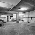 Interieur, overzicht kelder - Kampen - 20332372 - RCE.jpg 1,185 × 1,200; 281 KB
-
 Interieur, trap naar zolder - Kampen - 20332380 - RCE.jpg 1,183 × 1,200; 249 KB
-
 Kampen - Groenestraat 148.jpg 1,944 × 2,592; 1.16 MB
-
 Kampen 9-2011 (8).JPG 2,592 × 1,944; 995 KB
-
 Overzicht voorgevels - Kampen - 20318696 - RCE.jpg 1,181 × 1,200; 281 KB
-
 Voorgevels - Kampen - 20123161 - RCE.jpg 1,189 × 1,200; 284 KB


.JPG)

