Category:Grimston, East Riding of Yorkshire
Jump to navigation
Jump to search
English: Grimston is a hamlet in the East Riding of Yorkshire, England, in an area known as Holderness. It is situated approximately 6 miles (9.7 km) north west of Withernsea town centre.
village in East Riding of Yorkshire, England, UK  | |||||
| Upload media | |||||
| Instance of | |||||
|---|---|---|---|---|---|
| Location | East Garton, East Riding of Yorkshire, Yorkshire and the Humber, England | ||||
 | |||||
Media in category "Grimston, East Riding of Yorkshire"
The following 20 files are in this category, out of 20 total.
-
 Beacon Hill, Grimston - geograph.org.uk - 430976.jpg 640 × 480; 83 KB
-
 Bracken Hill Grimston.jpg 640 × 444; 94 KB
-
 Farm road, Grimston - geograph.org.uk - 45920.jpg 640 × 480; 80 KB
-
 Farmland, Grimston - geograph.org.uk - 1442418.jpg 640 × 480; 58 KB
-
 Garton Gap - geograph.org.uk - 430842.jpg 475 × 640; 96 KB
-
 Great Parks, Garton - geograph.org.uk - 430837.jpg 472 × 640; 102 KB
-

-
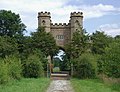 Grimston Lodge - geograph.org.uk - 498804.jpg 640 × 493; 113 KB
-
 Grimston Park Cliff.jpg 480 × 640; 68 KB
-
 Grimston, aerial 2015 - geograph.org.uk - 4582736.jpg 640 × 427; 55 KB
-
 Grimston.jpg 640 × 480; 135 KB
-
 Main Street - geograph.org.uk - 261250.jpg 640 × 480; 75 KB
-
 Moat Farm Grimston.jpg 640 × 461; 96 KB
-
 Ruined WW2 defences and gas valve - geograph.org.uk - 5478879.jpg 1,024 × 768; 147 KB
-
 Say Hello, Wave Goodbye - geograph.org.uk - 456340.jpg 640 × 443; 58 KB
-
 Smithy Cottage Grimston.jpg 640 × 449; 135 KB
-
 The cliff top near Bracken Hill - geograph.org.uk - 2096348.jpg 800 × 600; 252 KB
-
 Track, Grimston - geograph.org.uk - 1442413.jpg 640 × 480; 58 KB
-
 Turmar - geograph.org.uk - 498822.jpg 480 × 640; 140 KB
-
 Turmar Farm - geograph.org.uk - 71941.jpg 640 × 480; 141 KB


