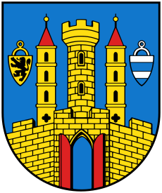
Category:Grimma
Jump to navigation
Jump to search
Urban municipalities:
Borna · Grimma · Markkleeberg · Wurzen · Bad Lausick · Brandis · Böhlen · Colditz · Frohburg · Geithain · Groitzsch · Kitzscher · Markranstädt · Naunhof · Pegau · Regis-Breitingen · Rötha · Trebsen · Zwenkau
Rural municipalities:
Belgershain · Bennewitz · Borsdorf · Elstertrebnitz · Großpösna · Lossatal · Machern · Neukieritzsch · Otterwisch · Parthenstein · Thallwitz
Former municipalities:
Deutzen · Espenhain · Eulatal · Falkenhain · Großbothen · Hohburg · Kitzen · Kohren-Sahlis · Mutzschen · Narsdorf · Thümmlitzwalde · Zschadraß
town in the Free State of Saxony, Germany | |||||
| Upload media | |||||
| Instance of |
| ||||
|---|---|---|---|---|---|
| Location |
| ||||
| Located in or next to body of water | |||||
| Head of government |
| ||||
| Population |
| ||||
| Area |
| ||||
| Elevation above sea level |
| ||||
| official website | |||||
 | |||||
Grimma is a larger town in the rural district Leipzig in the west of Saxony.
Subcategories
This category has the following 12 subcategories, out of 12 total.
Media in category "Grimma"
The following 8 files are in this category, out of 8 total.
-
De-Grimma.ogg 1.6 s; 15 KB
-
Einwohnerentwicklung von Grimma.svg 800 × 400; 42 KB
-
GRIMMA nieder.svg 512 × 427; 21 KB
-
Wappen Grimma.svg 510 × 610; 93 KB
-
Wappen Stadt Grimma.png 799 × 916; 476 KB
-
J36 837 Hochwasserschutzmauer.jpg 5,709 × 3,806; 6.38 MB
-
J36 838 Hochwasserschutzmauer.jpg 5,934 × 3,956; 5.06 MB
-
Karte von Grimma (um 1750).tif 8,935 × 6,568; 20.7 MB


