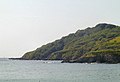
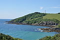
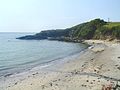
Category:Gribbin Head
Jump to navigation
Jump to search
headland on the south coast of Cornwall, England, UK  | |||||
| Upload media | |||||
| Instance of | |||||
|---|---|---|---|---|---|
| Location |
| ||||
 | |||||
Subcategories
This category has only the following subcategory.
G
- Gribbin Daymark, Gribbin Head (30 F)
Media in category "Gribbin Head"
The following 46 files are in this category, out of 46 total.
-
 Cardinal buoy for Cannis - geograph.org.uk - 166326.jpg 640 × 480; 255 KB
-
 Cattle on Gribbin Head - geograph.org.uk - 2103245.jpg 1,024 × 768; 274 KB
-
 Cliffs on Gribbin Head - geograph.org.uk - 5498687.jpg 640 × 480; 205 KB
-
 Cliffs, Gribbin Head - geograph.org.uk - 5659933.jpg 640 × 426; 81 KB
-
 Cliffs, Gribbin Head - geograph.org.uk - 5659950.jpg 640 × 426; 78 KB
-
 Coast near Gribbin Head - geograph.org.uk - 29714.jpg 640 × 436; 101 KB
-
 Coast path on Gribbin Head - geograph.org.uk - 4891893.jpg 800 × 600; 119 KB
-
 Coastal Rocks at Gribbin Head - geograph.org.uk - 5134064.jpg 640 × 428; 79 KB
-
 Fowey - Polridmouth Cove - 2.jpg 5,207 × 3,477; 6.26 MB
-
 Fowey, towards Gribbin Head - geograph.org.uk - 1380852.jpg 640 × 427; 423 KB
-
 Grassland slope on Gribbin Head - geograph.org.uk - 1239658.jpg 640 × 480; 93 KB
-
 Gribben Head - geograph.org.uk - 1243520.jpg 640 × 427; 45 KB
-
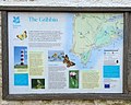 Gribben Head Information Board.jpg 1,940 × 1,552; 979 KB
-
 Gribben Head viewed from Charlestown, Cornwall - UK, November 10 2012. (8192879678).jpg 2,857 × 2,070; 1.93 MB
-
 Gribben, Polridmouth.jpg 640 × 424; 87 KB
-
 Gribbin Head - geograph.org.uk - 493347.jpg 640 × 480; 42 KB
-
 Gribbin Head - geograph.org.uk - 5659948.jpg 640 × 426; 84 KB
-
 Gribbin Head Daymark - geograph.org.uk - 691736.jpg 640 × 373; 28 KB
-
 Gribbin Head from Charlestown (5392).jpg 4,288 × 2,848; 4.42 MB
-
 Gribbin Head from the east (9695).jpg 4,288 × 2,848; 5.96 MB
-
 Gribbin Head from the east (9696).jpg 4,288 × 2,848; 6.59 MB
-
 Gribbin Head ^ Tower - geograph.org.uk - 3027961.jpg 3,385 × 930; 664 KB
-
 Lanteglos, Lantic Bay - geograph.org.uk - 1380891.jpg 640 × 427; 381 KB
-
 Lantic Bay - geograph.org.uk - 533714.jpg 640 × 480; 81 KB
-
 Little Gribbin - geograph.org.uk - 4891770.jpg 800 × 600; 128 KB
-
 Partly-wooded clifftop - geograph.org.uk - 1231711.jpg 640 × 480; 230 KB
-
 Pasture at Gribbin Head - geograph.org.uk - 1231717.jpg 640 × 480; 223 KB
-
 Platt and Gribbin Head - geograph.org.uk - 1239583.jpg 640 × 480; 85 KB
-
 Platt beach - geograph.org.uk - 5659944.jpg 640 × 426; 111 KB
-
 Polridmouth West Beach - geograph.org.uk - 29710.jpg 640 × 480; 128 KB
-
 Rocks, near Little Gribbin - geograph.org.uk - 5664400.jpg 640 × 426; 96 KB
-
 Shag Rock - geograph.org.uk - 5659935.jpg 640 × 426; 78 KB
-

-
 The cliffs at Platt, on the west of Gribbin Head - geograph.org.uk - 6002733.jpg 3,510 × 4,680; 5.34 MB
-
 The coast path approaching Gribbin Head - geograph.org.uk - 4891762.jpg 800 × 600; 148 KB
-
 The coast path near Gribbin Head - geograph.org.uk - 4891665.jpg 800 × 600; 132 KB
-
 The eastern slopes of Gribbin Head - geograph.org.uk - 2103252.jpg 1,024 × 768; 210 KB
-
 The Platt, Gribbin Head - geograph.org.uk - 2124246.jpg 640 × 478; 104 KB
-

-
 View across Lantic Bay - geograph.org.uk - 728696.jpg 640 × 480; 71 KB
-
 View west from Gribbin Head - geograph.org.uk - 2103240.jpg 1,024 × 768; 203 KB
-
 Woodland, Gribbin Head - geograph.org.uk - 5659925.jpg 640 × 426; 80 KB
-
 Woodland, Gribbin Head - geograph.org.uk - 5659940.jpg 640 × 426; 75 KB
-
 Little Gribbin - geograph.org.uk - 30178.jpg 640 × 480; 145 KB
-
 Platt Cove, Gribbin Head - geograph.org.uk - 29719.jpg 640 × 479; 129 KB
-
 Rocks at Little Gribbin - geograph.org.uk - 30110.jpg 640 × 480; 177 KB


.jpg)


.jpg)
.jpg)
.jpg)


