Category:Grenzstein 28 (Kroppenstedt)
Jump to navigation
Jump to search
| Object location | | View all coordinates using: OpenStreetMap |
|---|
| NO WIKIDATA ID FOUND! Search for Grenzstein 28 (Kroppenstedt) on Wikidata | |
| Upload media |
Media in category "Grenzstein 28 (Kroppenstedt)"
The following 7 files are in this category, out of 7 total.
-
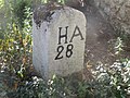
 Kroppenstedt, Grenzstein Nr. 28 vor Heimatmuseum (1).jpg 1,536 × 2,048; 543 KB
-
 Kroppenstedt, Grenzstein Nr. 28 vor Heimatmuseum (2).jpg 1,536 × 2,048; 772 KB
-
 Kroppenstedt, Grenzstein Nr. 28 vor Heimatmuseum (3).jpg 3,000 × 4,000; 3.59 MB
-
 Kroppenstedt, Grenzstein Nr. 28 vor Heimatmuseum (4).jpg 3,000 × 4,000; 4.06 MB
-
 Kroppenstedt, Grenzstein Nr. 28 vor Heimatmuseum (5).jpg 4,000 × 3,000; 3.19 MB
-
 Kroppenstedt, Grenzstein Nr. 28 vor Heimatmuseum (6) Tafel.jpg 4,000 × 3,000; 3.91 MB
-
 Kroppenstedt, Haus Am Kirchhof 2.jpg 2,934 × 3,655; 3.12 MB
.jpg)
.jpg)
.jpg)
.jpg)
.jpg)
_Tafel.jpg)
