Category:Grenzadler (Oberhof)
Jump to navigation
Jump to search
boundary marker  | |||||
| Upload media | |||||
| Instance of | |||||
|---|---|---|---|---|---|
| Part of |
| ||||
| Location |
| ||||
 | |||||
Media in category "Grenzadler (Oberhof)"
The following 10 files are in this category, out of 10 total.
-
 20151008 xl P1000142 Oberhof Stadt am Rennsteig und Umgebung.JPG 4,896 × 3,672; 6.29 MB
-
 ARENA Oberhof.jpg 3,145 × 1,769; 2.79 MB
-
 Bushaltestelle Grenzadler Oberhof.jpg 2,592 × 1,456; 885 KB
-
 Grenzadler Information Board.JPG 6,000 × 4,000; 12.48 MB
-
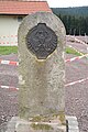 Grenzadler, Oberhof.jpg 4,000 × 6,000; 8.67 MB
-
 Oberhof-Grenzadler-1.jpg 2,267 × 3,023; 2.06 MB
-
 Oberhof-Grenzadler-2.jpg 2,598 × 3,464; 1.78 MB
-
 Oberhof-Grenzadler.jpg 2,977 × 5,540; 2.03 MB
-
 Oberhof. Der Rennsteig am Grenzadler. - geograph.org.uk - 8019.jpg 640 × 480; 47 KB
-
 Thüringer Hütte am Grenzadler in Oberhof.jpg 2,592 × 1,456; 1,006 KB


