Category:Green lanes in County Durham
Jump to navigation
Jump to search

Media in category "Green lanes in County Durham"
The following 15 files are in this category, out of 15 total.
-
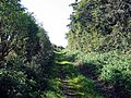
 'Green Lane' - geograph.org.uk - 178107.jpg 640 × 479; 160 KB
-
 Bushy Lane - geograph.org.uk - 1498262.jpg 640 × 480; 152 KB
-
 Green lane at Satley - geograph.org.uk - 358699.jpg 640 × 480; 101 KB
-
 Green Lane near South Sharpley - geograph.org.uk - 314246.jpg 640 × 480; 108 KB
-
 Grindon Lane. - geograph.org.uk - 178059.jpg 640 × 343; 85 KB
-
 Lane , Hutton Magna - geograph.org.uk - 352185.jpg 640 × 478; 126 KB
-
 A bend in the road. - geograph.org.uk - 528168.jpg 640 × 359; 55 KB
-
 Field to the north of Green Lane - geograph.org.uk - 150774.jpg 640 × 480; 126 KB
-
 Green Lane , Nr. Hutton Magna - geograph.org.uk - 352177.jpg 640 × 430; 126 KB
-
 Green Lane - geograph.org.uk - 200139.jpg 640 × 479; 101 KB
-
 Green Lane to Embleton Farm - geograph.org.uk - 150773.jpg 640 × 480; 121 KB
-
 Lutterington Whin - geograph.org.uk - 510491.jpg 640 × 480; 96 KB
-
 Road leading to Middlehope Lodge - geograph.org.uk - 205329.jpg 640 × 480; 86 KB
-
 Skelgate Lane, Reeth. - geograph.org.uk - 448253.jpg 480 × 640; 194 KB
-
 Whinfield House. - geograph.org.uk - 178124.jpg 640 × 479; 89 KB


