Category:Great and Little Chishill
Jump to navigation
Jump to search
civil parish in South Cambridgeshire, Cambridgeshire, England | |||||
| Upload media | |||||
| Instance of | |||||
|---|---|---|---|---|---|
| Location | South Cambridgeshire, Cambridgeshire, East of England, England | ||||
 | |||||
Subcategories
This category has the following 2 subcategories, out of 2 total.
G
L
Media in category "Great and Little Chishill"
The following 63 files are in this category, out of 63 total.
-
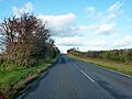
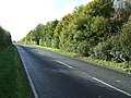
 A505 - geograph.org.uk - 4779313.jpg 640 × 426; 35 KB
-
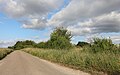
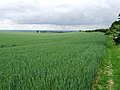
 Arable land on Chrishall Common - geograph.org.uk - 2455700.jpg 640 × 480; 79 KB
-
 B1039 Chishill Road dips down to Cumberton Bottom - geograph.org.uk - 3778052.jpg 4,320 × 3,240; 4.01 MB
-
 B1368 Cambridge Road - geograph.org.uk - 4738721.jpg 640 × 480; 100 KB
-
 Bare ground by B1039 - geograph.org.uk - 4062557.jpg 1,600 × 1,200; 663 KB
-
 Barley Road, Cambridgeshire - geograph.org.uk - 5000281.jpg 3,089 × 2,048; 3.05 MB
-
 Bogmoor Road, Great Chishill - geograph.org.uk - 6356749.jpg 1,920 × 1,280; 1.42 MB
-
 Bogmoor Road, Shaftenhoe End - geograph.org.uk - 6356745.jpg 1,848 × 1,162; 1.4 MB
-
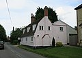
 Bridgefoot Farm Cottage - geograph.org.uk - 832396.jpg 640 × 480; 95 KB
-
 Bridleway crossing New Road - geograph.org.uk - 4062390.jpg 1,600 × 1,200; 520 KB
-
 Clay Hill - geograph.org.uk - 877040.jpg 640 × 480; 102 KB
-
 Coach House Hotel and Restaurant - geograph.org.uk - 832323.jpg 640 × 480; 56 KB
-
 Coach House Hotel, Flint Cross - geograph.org.uk - 898413.jpg 640 × 480; 72 KB
-
 Colts Croft, Great Chishill - geograph.org.uk - 5588463.jpg 2,048 × 1,536; 1.49 MB
-
-
 Crossroads in the centre of Great Chishill - geograph.org.uk - 6356752.jpg 1,920 × 1,280; 1.31 MB
-
 Dippetty road - geograph.org.uk - 832585.jpg 640 × 480; 69 KB
-
 Down Plantation - geograph.org.uk - 4738567.jpg 640 × 480; 85 KB
-
 Entrance to quarry on the A505, Flint Cross - geograph.org.uk - 3054757.jpg 1,600 × 1,200; 620 KB
-
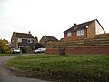
 Farm Buildings - geograph.org.uk - 5571929.jpg 1,024 × 768; 193 KB
-
 Field boundary - geograph.org.uk - 4062407.jpg 1,600 × 1,200; 618 KB
-
 Field Boundary - geograph.org.uk - 5571946.jpg 1,024 × 768; 215 KB
-
 Field by Hall Lane, Chrishall - geograph.org.uk - 6216661.jpg 1,814 × 1,212; 2.42 MB
-
 Field by Hall Lane, Chrishall - geograph.org.uk - 6216664.jpg 1,920 × 1,280; 1.85 MB
-
 Field by New Road - geograph.org.uk - 4062503.jpg 1,600 × 1,160; 445 KB
-
-
 Hedgerow at edge of rape field - geograph.org.uk - 832562.jpg 640 × 480; 87 KB
-
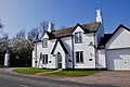
 Heydon House - geograph.org.uk - 832460.jpg 640 × 480; 87 KB
-
 Heydon Road, Great Chishill - geograph.org.uk - 6356808.jpg 1,920 × 1,280; 2.07 MB
-
 Houses on Heydon Road, Great Chishill - geograph.org.uk - 6356807.jpg 1,920 × 1,280; 1.56 MB
-
 Huge field by New Road - geograph.org.uk - 4062411.jpg 1,600 × 1,200; 497 KB
-
 Huge field by New Road - geograph.org.uk - 4062420.jpg 1,600 × 1,200; 585 KB
-
 Icknield Way - geograph.org.uk - 4738598.jpg 640 × 480; 101 KB
-
 Little Chishill Road, Shaftenhoe End - geograph.org.uk - 6356742.jpg 1,920 × 1,280; 910 KB
-
 Looking South - geograph.org.uk - 5571935.jpg 768 × 1,024; 209 KB
-
 Milestone Farm -The Office - geograph.org.uk - 832494.jpg 640 × 480; 121 KB
-
 New Buildings Farm - geograph.org.uk - 4738582.jpg 640 × 480; 93 KB
-
 New Road - geograph.org.uk - 4738574.jpg 640 × 480; 90 KB
-
 New Road - geograph.org.uk - 4738591.jpg 640 × 428; 64 KB
-
 North Hall Farm - geograph.org.uk - 832410.jpg 640 × 480; 71 KB
-
 North Hall Farm Cottages - detail - geograph.org.uk - 832435.jpg 640 × 480; 79 KB
-
 North Hall Farm Cottages - geograph.org.uk - 832427.jpg 640 × 480; 70 KB
-
 North Hall Farm gateway - geograph.org.uk - 832443.jpg 640 × 480; 102 KB
-
 Not dead yet - geograph.org.uk - 832617.jpg 480 × 640; 90 KB
-

-

-

-
 Old Milestone - geograph.org.uk - 3206623.jpg 768 × 1,024; 333 KB
-
 Old Milestone - geograph.org.uk - 3206634.jpg 1,024 × 768; 286 KB
-
 Open Fields - geograph.org.uk - 5571877.jpg 1,024 × 768; 191 KB
-
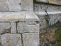
 Ordnance Survey Cut Mark - geograph.org.uk - 4210534.jpg 480 × 640; 137 KB
-
 Ordnance Survey Cut Mark - geograph.org.uk - 4710098.jpg 4,000 × 3,000; 4.75 MB
-
 Reservoir, Great Chishill - geograph.org.uk - 2484925.jpg 1,024 × 768; 133 KB
-
 Ripening barley - geograph.org.uk - 4062427.jpg 1,600 × 1,200; 662 KB
-
 Road to New Buildings Farm - geograph.org.uk - 832594.jpg 640 × 480; 62 KB
-
 The A505, Flint Cross - geograph.org.uk - 4362062.jpg 1,468 × 992; 573 KB
-
 The Icknield Way - geograph.org.uk - 832453.jpg 640 × 480; 74 KB
-
 Two Tone Fields - geograph.org.uk - 5571885.jpg 768 × 1,024; 245 KB
-
 Unhappy house^ - geograph.org.uk - 4062467.jpg 1,600 × 1,142; 393 KB
-
 View from New Road - geograph.org.uk - 4062506.jpg 1,600 × 1,200; 576 KB
-
 Welcome to Cambridgeshire - geograph.org.uk - 832509.jpg 640 × 480; 68 KB
-

-
 Wild oats (Avena fatua) - geograph.org.uk - 832557.jpg 640 × 480; 90 KB


_-_geograph.org.uk_-_4277223.jpg)


_-_geograph.org.uk_-_832557.jpg)