Category:Great Wilne
Jump to navigation
Jump to search
English: Great Wilne is a small village in Derbyshire, England on the border with Leicestershire. It is 7 miles south east of Derby. It is a village split from its church of St Chads by the river. The church is at the very small hamlet of Church Wilne which can only be approached by a short walk via the bridge over the River Derwent, or by a fair car journey which necessitates travelling out of the county.
village in Derbyshire, United Kingdom | |||||
| Upload media | |||||
| Instance of | |||||
|---|---|---|---|---|---|
| Location | Shardlow and Great Wilne, South Derbyshire, Derbyshire, East Midlands, England | ||||
 | |||||
Subcategories
This category has the following 2 subcategories, out of 2 total.
B
- Bridge 1, Trent and Mersey Canal (10 F)
D
- Derwent Mouth Lock (21 F)
Media in category "Great Wilne"
The following 31 files are in this category, out of 31 total.
-
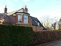
 24 and 26 Wilne Lane, Great Wilne.jpg 1,280 × 910; 313 KB
-
 36 Wilne Lane, Great Wilne.jpg 1,280 × 856; 377 KB
-
 A Classic River Cliff - geograph.org.uk - 932397.jpg 640 × 426; 254 KB
-
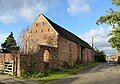 Barn, Wilne Farm.jpg 1,280 × 901; 402 KB
-
 Derwent Mouth.jpg 640 × 339; 115 KB
-
 Fallen trees in the River Derwent - geograph.org.uk - 584516.jpg 640 × 482; 119 KB
-
 Field and bales at Great Wilne - geograph.org.uk - 5654001.jpg 800 × 521; 106 KB
-
 Fields north of Great Wilne - geograph.org.uk - 5550888.jpg 1,280 × 1,280; 301 KB
-
 Fishing pond near Great Wilne - geograph.org.uk - 2219349.jpg 1,024 × 768; 376 KB
-
 Flooded footpath - geograph.org.uk - 772346.jpg 640 × 480; 54 KB
-
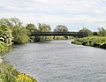 Footbridge at Great Wilne - geograph.org.uk - 11913.jpg 640 × 494; 142 KB
-
 Grassland near Great Wilne - geograph.org.uk - 3415808.jpg 3,936 × 2,912; 1.52 MB
-
 Buttressed Barn at Great Wilne - geograph.org.uk - 11929.jpg 640 × 561; 154 KB
-
 Former Chapel in Great Wilne - geograph.org.uk - 161797.jpg 640 × 480; 113 KB
-
 Great Wilne - geograph.org.uk - 3671782.jpg 1,600 × 1,200; 531 KB
-
 GreatWilne2.JPG 1,054 × 744; 600 KB
-
 Old Methodist chapel at Great Wilne - geograph.org.uk - 2219558.jpg 1,024 × 768; 229 KB
-
 Old Willow Trunk - geograph.org.uk - 932390.jpg 426 × 640; 258 KB
-
 Split Willow - geograph.org.uk - 932385.jpg 427 × 640; 281 KB
-
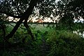
 Sunset at Derwent Mouth Lock - geograph.org.uk - 575638.jpg 640 × 482; 77 KB
-
 Sunset Through an Old Willow Hedge - geograph.org.uk - 932412.jpg 640 × 427; 303 KB
-
 Timber Framed House at Great Wilne - geograph.org.uk - 14927.jpg 640 × 520; 163 KB
-
 Traffic Jam near Great Wilne - geograph.org.uk - 551493.jpg 640 × 482; 104 KB
-
 Trees on The Derwent - geograph.org.uk - 1156080.jpg 640 × 480; 161 KB
-
 Trees on The Trent - geograph.org.uk - 1156078.jpg 640 × 480; 152 KB
-
 Trees on The Trent - geograph.org.uk - 1156090.jpg 640 × 480; 148 KB
-

-
 Trent turbulence - geograph.org.uk - 744742.jpg 640 × 407; 246 KB
-
 Wilne Farmhouse.jpg 1,280 × 960; 373 KB
-
 Wilne Lane in Great Wilne - geograph.org.uk - 5654007.jpg 800 × 578; 110 KB
-
 Farmhouse at Great Wilne - geograph.org.uk - 11916.jpg 640 × 517; 164 KB


