Category:Great Snoring
Jump to navigation
Jump to search
village in the United Kingdom .jpg) | |||||
| Upload media | |||||
| Instance of | |||||
|---|---|---|---|---|---|
| Location | North Norfolk, Norfolk, East of England, England | ||||
| Population |
| ||||
| Area |
| ||||
| Said to be the same as | Great Snoring (Wikimedia duplicated page, civil parish) | ||||
 | |||||
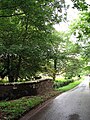
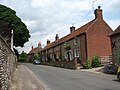
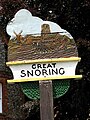
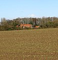
English: Great Snoring (archaic English: Snoring Magna) is a rural village in North Norfolk by the River Stiffkey, in the east of England. Its population in the 2001 census was 168, a dramatic decrease since 1841 when it was 556 (this included 81 people in the Walsingham Union Workhouse).
Subcategories
This category has the following 2 subcategories, out of 2 total.
G
- Great Snoring War Memorial (1 F)
Media in category "Great Snoring"
The following 117 files are in this category, out of 117 total.
-
 Barns at Hill House Farm - geograph.org.uk - 4180532.jpg 640 × 480; 105 KB
-
 Bridge in Great Snoring - geograph.org.uk - 6017385.jpg 768 × 1,024; 271 KB
-
 Bridge over the River Stiffkey - geograph.org.uk - 950096.jpg 640 × 480; 192 KB
-
 Cereal crop by Duck End Farm - geograph.org.uk - 3947065.jpg 640 × 402; 143 KB
-
 Cereal crop by Vinepark Farm - geograph.org.uk - 3947071.jpg 640 × 480; 170 KB
-
 Cow parsley growing on verge - geograph.org.uk - 3947072.jpg 554 × 640; 301 KB
-
-

-
 Ditch beside the road - geograph.org.uk - 950243.jpg 480 × 640; 178 KB
-

-
 Entrance into fields - geograph.org.uk - 950284.jpg 480 × 640; 151 KB
-
 Farm Track - geograph.org.uk - 4180539.jpg 640 × 480; 132 KB
-
 Farm track near Hill House Farm - geograph.org.uk - 3849524.jpg 3,088 × 2,056; 3.02 MB
-
 Farmland near Great Snoring, Norfolk - geograph.org.uk - 2810180.jpg 4,320 × 3,240; 5.69 MB
-
 Field gate - geograph.org.uk - 950309.jpg 640 × 480; 142 KB
-
 Field near Vinepark Farm - geograph.org.uk - 4180542.jpg 640 × 480; 118 KB
-
 Flowering oilseed rape - geograph.org.uk - 3947056.jpg 640 × 398; 139 KB
-
 Ford at Thorpland Hall - geograph.org.uk - 2855482.jpg 3,872 × 2,592; 2.4 MB
-
 Grassy verge - geograph.org.uk - 848808.jpg 480 × 640; 206 KB
-

-
 GreatSnoring(David Williams).jpg 640 × 480; 129 KB
-

-
 Hill House Farm, Little Walsingham - geograph.org.uk - 4180530.jpg 640 × 480; 99 KB
-
 Inside the walls of the workhouse - geograph.org.uk - 4180556.jpg 640 × 480; 195 KB
-
 Minor road into Great Snoring - geograph.org.uk - 4180534.jpg 640 × 480; 165 KB
-
 Oilseed rape crop by Boundary Plantation - geograph.org.uk - 3947052.jpg 640 × 480; 181 KB
-
 Oilseed rape crop by Hill House Farm - geograph.org.uk - 3947038.jpg 640 × 480; 169 KB
-
 Old oak tree beside rural lane - geograph.org.uk - 3947074.jpg 640 × 631; 251 KB
-
 Overgrown ruin by Thursford Castle - geograph.org.uk - 2296067.jpg 640 × 480; 221 KB
-
 Path past Manor House - geograph.org.uk - 848663.jpg 480 × 640; 178 KB
-
 Primitive Methodist Chapel - geograph.org.uk - 848647.jpg 640 × 480; 166 KB
-
 Recently tidied-up verge - geograph.org.uk - 950279.jpg 480 × 640; 168 KB
-
 Redundant pasture - geograph.org.uk - 950251.jpg 640 × 480; 184 KB
-
 Road from Great Snoring to Little Snoring - geograph.org.uk - 3841057.jpg 1,600 × 1,103; 433 KB
-
 Road junction in Great Snoring - geograph.org.uk - 4629791.jpg 800 × 531; 131 KB
-
 Road to Great Snoring - geograph.org.uk - 3839975.jpg 1,600 × 1,065; 194 KB
-
 Road to Great Snoring - geograph.org.uk - 4180544.jpg 640 × 480; 108 KB
-
 Sheep pastures by Duck End Farm - geograph.org.uk - 3947069.jpg 640 × 480; 207 KB
-
 Single track road to Cannister Hall Farm - geograph.org.uk - 5950825.jpg 2,592 × 1,944; 2.87 MB
-
 Small woodland west of Thursford Green - geograph.org.uk - 2296070.jpg 640 × 480; 229 KB
-
 Soaking wet wheat - geograph.org.uk - 950295.jpg 480 × 640; 153 KB
-
 Tall tree in hedgerow - geograph.org.uk - 950301.jpg 480 × 640; 134 KB
-
 Telephone box in Great Snoring - geograph.org.uk - 4180517.jpg 640 × 480; 139 KB
-
 The battlefield cross of Lt. Charles Ramsey Bayly (RFA) - geograph.org.uk - 4583440.jpg 2,592 × 3,456; 2.67 MB
-
 The centre of Great Snoring - geograph.org.uk - 6017386.jpg 768 × 1,024; 139 KB
-
 The derelict chapel at Thursford Castle - geograph.org.uk - 4180548.jpg 640 × 480; 214 KB
-
 The derelict chapel at Thursford Castle - geograph.org.uk - 4180552.jpg 640 × 480; 157 KB
-
 The former Unicorn Inn - geograph.org.uk - 848644.jpg 640 × 480; 168 KB
-
 The Street past the village green - geograph.org.uk - 848626.jpg 480 × 640; 170 KB
-
 The War Memorial plaque at Great Snoring - geograph.org.uk - 4583434.jpg 3,456 × 2,592; 3.82 MB
-
 Thundery sky above barleyfield - geograph.org.uk - 848799.jpg 640 × 480; 168 KB
-
 Thursford Castle - geograph.org.uk - 3947081.jpg 640 × 449; 174 KB
-

-
-

-

-

-

-

-

-
-

-

-

-

-

-

-

-

-

-
 Thursford Road near Duck End Farm - geograph.org.uk - 3849370.jpg 3,000 × 2,000; 6.45 MB
-
 Top Farm - geograph.org.uk - 848618.jpg 640 × 459; 155 KB
-
 Track to Boundary Plantation - geograph.org.uk - 3947041.jpg 640 × 480; 242 KB
-
 Trees beside wheat crop - geograph.org.uk - 950239.jpg 640 × 480; 150 KB
-
-
 Tudor brick - geograph.org.uk - 572694.jpg 640 × 427; 90 KB
-
 Tudor Manor House - geograph.org.uk - 572689.jpg 640 × 427; 95 KB
-
 View across a wet pasture - geograph.org.uk - 950265.jpg 480 × 640; 172 KB
-
 View across fields - geograph.org.uk - 950313.jpg 480 × 640; 145 KB
-
 View east across The Street - geograph.org.uk - 848638.jpg 640 × 480; 160 KB
-
 View east along Thursford Road - geograph.org.uk - 848616.jpg 640 × 456; 129 KB
-
 View east from Great Snoring Road - geograph.org.uk - 950276.jpg 640 × 480; 149 KB
-
 View north along Great Snoring Road - geograph.org.uk - 950102.jpg 480 × 640; 161 KB
-
 View north along Little Snoring Road - geograph.org.uk - 848781.jpg 640 × 480; 146 KB
-
 View north along The Street - geograph.org.uk - 848625.jpg 640 × 480; 148 KB
-
 View northwest - geograph.org.uk - 952991.jpg 640 × 480; 192 KB
-
 View SE across muddy track - geograph.org.uk - 571267.jpg 640 × 480; 92 KB
-
 View south along Great Snoring Road - geograph.org.uk - 950095.jpg 480 × 640; 201 KB
-
 View south along Great Snoring Road - geograph.org.uk - 950299.jpg 480 × 640; 85 KB
-
 View south along The Street - geograph.org.uk - 848619.jpg 640 × 480; 125 KB
-
 View towards Hill House Farm - geograph.org.uk - 571245.jpg 640 × 480; 47 KB
-
 View west across fields - geograph.org.uk - 848792.jpg 640 × 480; 177 KB
-
 Village sign - geograph.org.uk - 848632.jpg 480 × 640; 156 KB
-
 Village sign, Great Snoring - geograph.org.uk - 4180527.jpg 480 × 640; 119 KB
-
 Vinepark Farm - geograph.org.uk - 1123123.jpg 616 × 640; 156 KB
-

-
 Wet ground - geograph.org.uk - 950255.jpg 480 × 640; 199 KB
-
 Wheat crop by Ash Plantation - geograph.org.uk - 3947043.jpg 640 × 371; 142 KB
-
 Wheat crop in the rain - geograph.org.uk - 950292.jpg 640 × 448; 110 KB
-
 A fine red brick house - geograph.org.uk - 848621.jpg 640 × 480; 142 KB
-

-
 Attractive flint and brick house - geograph.org.uk - 848635.jpg 640 × 480; 192 KB
-
 Barns, Duck End Farm - geograph.org.uk - 456590.jpg 640 × 480; 133 KB
-
 East along Boundary Plantation - geograph.org.uk - 472798.jpg 640 × 480; 143 KB
-
 Empty cattle sheds - geograph.org.uk - 571250.jpg 640 × 480; 81 KB
-
 Farmhouse, Top Farm - geograph.org.uk - 472739.jpg 640 × 480; 130 KB
-

-
 Field drain - geograph.org.uk - 571235.jpg 480 × 640; 76 KB
-
 Horse and pasture, Duck End Farm - geograph.org.uk - 456592.jpg 640 × 480; 146 KB
-
 New Road - track to Coldblow Farm - geograph.org.uk - 420850.jpg 640 × 480; 135 KB
-
 North towards Hill House Farm - geograph.org.uk - 472819.jpg 640 × 480; 102 KB
-

-

-
 Track leading towards cattle sheds - geograph.org.uk - 571241.jpg 480 × 640; 70 KB
-
 Track to a cattle yard - geograph.org.uk - 571246.jpg 640 × 480; 70 KB
-

-
 Village green and sign, Great Snoring - geograph.org.uk - 456593.jpg 640 × 480; 112 KB


_-_geograph.org.uk_-_4583440.jpg)


