Category:Great Lumley
Jump to navigation
Jump to search
Deutsch: Great Lumley ist ein Dorf im englischen County Durham im Süden Chester-le-Streets. Das Dorf wird architektonisch von dem 1392 durch Sir Ralph Lumley von einem Herrenhaus zur Burg umgebauten Lumley Castle dominiert.
English: Great Lumley is a village in County Durham, England. It is situated to the south east of Chester-le-Street and is near Lumley Castle. It has a population of 3,843.
village in United Kingdom  | |||||
| Upload media | |||||
| Instance of | |||||
|---|---|---|---|---|---|
| Location | County Durham, North East England, England | ||||
 | |||||
Subcategories
This category has the following 3 subcategories, out of 3 total.
C
- Christ Church, Great Lumley (6 F)
- Cocken Bridge (2 F)
T
Media in category "Great Lumley"
The following 68 files are in this category, out of 68 total.
-
 A1(M) near Pea Flatts Farm - geograph.org.uk - 5831351.jpg 1,024 × 790; 106 KB
-
 Back Lane - geograph.org.uk - 4524364.jpg 640 × 480; 74 KB
-
 Barley field from Scorer's Lane - geograph.org.uk - 5428746.jpg 1,500 × 1,125; 1.73 MB
-
 Bend on Back Lane - geograph.org.uk - 3802643.jpg 4,608 × 3,456; 5.3 MB
-

-

-

-
 Cambridge Drive, Great Lumley - geograph.org.uk - 4523903.jpg 640 × 480; 70 KB
-
 Charles Pit Cottages - geograph.org.uk - 3831732.jpg 4,608 × 3,456; 4.89 MB
-
 Christ Church Vicarage, Great Lumley - geograph.org.uk - 3831477.jpg 4,608 × 3,456; 4.92 MB
-

-
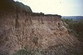 Cliff above River Wear, 1968 - geograph.org.uk - 3309867.jpg 640 × 427; 74 KB
-
 Cocken Lane - geograph.org.uk - 4523898.jpg 640 × 480; 59 KB
-
 Crop field beside Old Mill Lane - geograph.org.uk - 4524353.jpg 640 × 480; 69 KB
-
 Crop field off Old Mill Lane - geograph.org.uk - 4499494.jpg 640 × 480; 63 KB
-
 Entering Great Lumley - geograph.org.uk - 4523886.jpg 640 × 480; 58 KB
-
 Entering Great Lumley - geograph.org.uk - 4523907.jpg 640 × 480; 70 KB
-
 Farm track to Lumley Riding - geograph.org.uk - 3802695.jpg 4,608 × 3,456; 4.68 MB
-

-
 Field entrance off Old Mill Lane - geograph.org.uk - 4524356.jpg 640 × 480; 73 KB
-
 Field with bushes and trees beyond - geograph.org.uk - 5428750.jpg 1,500 × 817; 994 KB
-
 Front Street, Great Lumley - geograph.org.uk - 4524342.jpg 640 × 480; 63 KB
-
 Frozen Wear - geograph.org.uk - 2205249.jpg 3,456 × 2,592; 3.26 MB
-
 George Pit Lane, Great Lumley - geograph.org.uk - 3831528.jpg 4,608 × 3,456; 4.69 MB
-
 Grassland off Back Lane - geograph.org.uk - 4499530.jpg 640 × 480; 47 KB
-
 Grazing off Lumley New Road - geograph.org.uk - 4524373.jpg 640 × 480; 83 KB
-

-

-
 Looking down Cocken Lane - geograph.org.uk - 3831757.jpg 4,608 × 3,456; 5.35 MB
-
 Looking east along Front Street, Great Lumley - geograph.org.uk - 3831450.jpg 4,608 × 3,456; 4.45 MB
-
 Looking north up Back Lane, Great Lumley - geograph.org.uk - 3831354.jpg 4,608 × 3,456; 3.8 MB
-

-
 Lumley Forge Farm, 1968 - geograph.org.uk - 3329433.jpg 640 × 339; 63 KB
-
 Lumley New Road (B1284) - geograph.org.uk - 4524376.jpg 640 × 480; 69 KB
-
 Meander in River Wear - geograph.org.uk - 2205203.jpg 2,592 × 3,456; 3.31 MB
-
 Minor road towards Great Lumley - geograph.org.uk - 4523882.jpg 640 × 480; 107 KB
-
 Old Mill Lane - geograph.org.uk - 4524355.jpg 640 × 480; 85 KB
-
 Old Mill Lane - geograph.org.uk - 4524359.jpg 640 × 480; 83 KB
-
 Pea Flatts Farm - geograph.org.uk - 3831516.jpg 4,608 × 3,456; 5.1 MB
-

-
 Playing field, Great Lumley - geograph.org.uk - 4499489.jpg 640 × 480; 62 KB
-
 Post Office, Great Lumley - geograph.org.uk - 4524339.jpg 640 × 480; 62 KB
-
 River Wear at riverside walk - geograph.org.uk - 2205209.jpg 2,592 × 3,456; 3.27 MB
-
 River Wear from Riverside walk - geograph.org.uk - 2205197.jpg 3,456 × 2,592; 3.26 MB
-
 River Wear meander in the snow - geograph.org.uk - 2205225.jpg 2,592 × 3,456; 3.26 MB
-
 River Wear riverside walk in snow - geograph.org.uk - 2205222.jpg 3,456 × 2,592; 3.33 MB
-
 River Wear, 1968 - geograph.org.uk - 3329444.jpg 640 × 379; 85 KB
-
 Road east of Great Lumley - geograph.org.uk - 3831502.jpg 4,608 × 3,456; 4.92 MB
-
 Road to Lumley Grange - geograph.org.uk - 4524351.jpg 640 × 480; 80 KB
-
 Seat, Back Lane, Great Lumley - geograph.org.uk - 351804.jpg 640 × 480; 68 KB
-
 Snow and ice on River Wear - geograph.org.uk - 2205230.jpg 3,456 × 2,592; 3.34 MB
-
 Stainmore Drive, Great Lumley - geograph.org.uk - 4523893.jpg 640 × 480; 67 KB
-
 Start of George Pit Lane, Great Lumley - geograph.org.uk - 3831745.jpg 4,608 × 3,456; 5.42 MB
-
 The Old England, Great Lumley - geograph.org.uk - 4523909.jpg 640 × 480; 79 KB
-
 Trees on George Pit lane, Great Lumley - geograph.org.uk - 3831714.jpg 4,608 × 3,456; 5.52 MB
-
 View along Back Lane - geograph.org.uk - 3802648.jpg 4,608 × 3,456; 5.03 MB
-
 View down Fenton Well Lane, Great Lumley - geograph.org.uk - 3831431.jpg 4,608 × 3,456; 4.46 MB
-
 View northwest from Back Lane, Great Lumley - geograph.org.uk - 3831372.jpg 4,608 × 3,456; 4.82 MB
-
 View through the sculpture at Great Lumley - geograph.org.uk - 3831424.jpg 4,608 × 3,456; 5.25 MB
-
 View west, Great Lumley - geograph.org.uk - 3831407.jpg 4,608 × 3,456; 4.69 MB
-

-
 A not-terrible-useful footpath - geograph.org.uk - 351801.jpg 640 × 480; 71 KB
-
 Fenton Well Lane, Great Lumley - geograph.org.uk - 351802.jpg 640 × 480; 70 KB
-
 Fields and wood, Cocken - geograph.org.uk - 351805.jpg 640 × 480; 94 KB
-

-
 Low Cocken Farm and the River Wear - geograph.org.uk - 351797.jpg 640 × 480; 66 KB
-
 Wear Valley, Cocken - geograph.org.uk - 351778.jpg 640 × 480; 72 KB
-
 Young plantation near Great Lumley - geograph.org.uk - 351806.jpg 640 × 480; 84 KB
_near_Pea_Flatts_Farm_-_geograph.org.uk_-_5831351.jpg)


,_before_opening,_1968_-_geograph.org.uk_-_3329134.jpg)

_-_geograph.org.uk_-_4524376.jpg)


