Category:Great Ayton
Jump to navigation
Jump to search
village in the United Kingdom  | |||||
| Upload media | |||||
| Instance of | |||||
|---|---|---|---|---|---|
| Location | Hambleton, North Yorkshire, Yorkshire and the Humber, England | ||||
| Population |
| ||||
| Area |
| ||||
| Said to be the same as | Great Ayton (Wikimedia duplicated page, civil parish) | ||||
| official website | |||||
 | |||||
Subcategories
This category has the following 16 subcategories, out of 16 total.
A
- Ayton Hall, Great Ayton (4 F)
B
- The Buck, Great Ayton (5 F)
C
- Cliff Rigg quarry (7 F)
- Cooks' Cottage (18 F)
F
- Great Ayton Friends' School (5 F)
G
- Great Ayton railway station (3 F)
- Great Ayton War Memorial (2 F)
- Greenhow Moor (lowlands) (2 F)
J
L
R
- Roseberry Mine (4 F)
- Royal Oak Hotel, Great Ayton (6 F)
Media in category "Great Ayton"
The following 200 files are in this category, out of 577 total.
(previous page) (next page)-
 "Capt. Cook's Cottage" Obelisk - geograph.org.uk - 61648.jpg 640 × 480; 109 KB
-
 "Hunter's Scar" in Ayton Banks Wood - geograph.org.uk - 1845379.jpg 4,000 × 2,842; 721 KB
-
 22º Halo - geograph.org.uk - 4500370.jpg 640 × 480; 59 KB
-
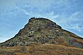
 A closer look at Roseberry Topping - geograph.org.uk - 5046417.jpg 6,000 × 4,000; 6.44 MB
-
 A fine day for a stroll up Roseberry - geograph.org.uk - 5973091.jpg 640 × 427; 83 KB
-
 A gap in the wall - geograph.org.uk - 5288879.jpg 4,320 × 3,240; 2.59 MB
-
 A horse’s route up Roseberry - geograph.org.uk - 6114394.jpg 640 × 427; 116 KB
-
 A mossy bagel - geograph.org.uk - 6089867.jpg 640 × 427; 202 KB
-
 A stack of swiss rolls - geograph.org.uk - 2254473.jpg 1,024 × 768; 137 KB
-
 A172 towards Middlesbrough - geograph.org.uk - 2690623.jpg 640 × 480; 65 KB
-
 A172 towards Stokesley - geograph.org.uk - 5023892.jpg 1,600 × 1,200; 553 KB
-
 A173 - following a blue coach - geograph.org.uk - 2647652.jpg 640 × 428; 82 KB
-
 A173 leaves Great Ayton - geograph.org.uk - 2647742.jpg 640 × 428; 113 KB
-
 Above Gribdale Gate - geograph.org.uk - 6628180.jpg 640 × 480; 133 KB
-
 Above Gribdale Terrace - geograph.org.uk - 5469130.jpg 1,920 × 1,280; 464 KB
-
 Access to Levenside - geograph.org.uk - 2308677.jpg 875 × 591; 162 KB
-
 Addison Road, Great Ayton (geograph 2690646).jpg 640 × 480; 59 KB
-
 Aeroplane trails across the sky - geograph.org.uk - 2128510.jpg 640 × 480; 47 KB
-
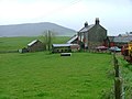
 Aireyholme Farm - geograph.org.uk - 2753305.jpg 640 × 427; 225 KB
-
 Aireyholme Farm - geograph.org.uk - 3604678.jpg 640 × 480; 179 KB
-
 Aireyholme Farm - geograph.org.uk - 6089890.jpg 640 × 360; 77 KB
-
 Aireyholme Farm - geograph.org.uk - 6154653.jpg 1,024 × 768; 174 KB
-
 Aireyholme Farm - geograph.org.uk - 865294.jpg 427 × 640; 264 KB
-
 Aireyholme Farm and Great Ayton - geograph.org.uk - 2088183.jpg 3,968 × 2,976; 3.22 MB
-
 Aireyholme from Roseberry - geograph.org.uk - 4897275.jpg 640 × 384; 90 KB
-
 Aireyholme Lane - geograph.org.uk - 6234286.jpg 640 × 360; 76 KB
-
 Aireyholme Lane, Great Ayton - geograph.org.uk - 2083068.jpg 3,968 × 2,976; 2.75 MB
-
 Airy Holme Farm - geograph.org.uk - 10423.jpg 640 × 480; 83 KB
-
 Airy Holme Farm - geograph.org.uk - 925284.jpg 640 × 427; 141 KB
-
 Allotments, Great Ayton - geograph.org.uk - 23302.jpg 640 × 480; 63 KB
-
 And so into February - geograph.org.uk - 6046878.jpg 640 × 427; 96 KB
-
 Angrove North Farm - geograph.org.uk - 2690630.jpg 640 × 480; 44 KB
-
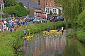 Annual Duck Race, River Leven - geograph.org.uk - 1877219.jpg 640 × 427; 298 KB
-
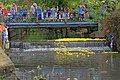 Annual Duck Race, River Leven - geograph.org.uk - 1877222.jpg 640 × 427; 303 KB
-
 Annual Duck Race, River Leven - geograph.org.uk - 1877226.jpg 640 × 427; 270 KB
-
 Another view from Roseberry Topping - geograph.org.uk - 874233.jpg 640 × 480; 118 KB
-
 Approaching the top of the Topping - geograph.org.uk - 5472368.jpg 1,920 × 1,280; 526 KB
-
 Ash tree in winter - geograph.org.uk - 2254487.jpg 1,024 × 768; 168 KB
-
 Atop Topping - geograph.org.uk - 5980877.jpg 1,213 × 1,600; 364 KB
-
 Ayton Bank - geograph.org.uk - 4794586.jpg 640 × 480; 129 KB
-
 Ayton Bank - geograph.org.uk - 4867661.jpg 640 × 384; 33 KB
-
 Ayton Banks Farm - geograph.org.uk - 124290.jpg 640 × 480; 53 KB
-
 Ayton Banks Ironstone Mine - geograph.org.uk - 143195.jpg 640 × 480; 108 KB
-
 Ayton Mine Powder House - geograph.org.uk - 4903808.jpg 640 × 384; 106 KB
-
 B1292 heading west - geograph.org.uk - 2690665.jpg 640 × 480; 84 KB
-
 Back Alley - geograph.org.uk - 4282528.jpg 479 × 640; 85 KB
-

-
 Barn conversion at Oak Tree Farm - geograph.org.uk - 3606500.jpg 1,600 × 1,064; 408 KB
-
 Black Bank - geograph.org.uk - 4453395.jpg 640 × 360; 79 KB
-
 Blue coach on A173 - geograph.org.uk - 2647633.jpg 640 × 428; 73 KB
-
 Blue-bores over Lonsdale - geograph.org.uk - 5908168.jpg 640 × 427; 56 KB
-
 Bluebells on Cliff Ridge - geograph.org.uk - 2963501.jpg 427 × 640; 284 KB
-
 Boat Race, River Leven - geograph.org.uk - 997079.jpg 640 × 383; 96 KB
-
 Boundary stone on Great Ayton Moor - geograph.org.uk - 3333028.jpg 1,500 × 843; 1.12 MB
-
 Boundary Stone, Great Ayton Moor - geograph.org.uk - 6154619.jpg 1,024 × 768; 252 KB
-
 Boundary Stone, Great Ayton Moor - geograph.org.uk - 6524924.jpg 640 × 360; 82 KB
-
 Bousdale Hill - geograph.org.uk - 3299529.jpg 640 × 427; 205 KB
-
 Boxing Day Hunt - geograph.org.uk - 4781970.jpg 640 × 480; 107 KB
-
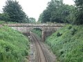
 Bridge (No 23) over single track railway - geograph.org.uk - 2253042.jpg 2,000 × 1,500; 3.39 MB
-
 Bridge over River Leven, Great Ayton - geograph.org.uk - 2535098.jpg 640 × 480; 75 KB
-
 Bridge over the Esk Valley Line, Great Ayton - geograph.org.uk - 5263366.jpg 4,320 × 2,432; 4.48 MB
-
 Bridge over the Leven at Great Ayton - geograph.org.uk - 1639516.jpg 640 × 480; 74 KB
-
 Bridge over the railway northeast of Great Ayton - geograph.org.uk - 5023808.jpg 1,600 × 1,200; 954 KB
-

-
 Bridleway to Aireyholme Farm - geograph.org.uk - 1151333.jpg 640 × 480; 150 KB
-
 Bridleway to Great Ayton Moor - geograph.org.uk - 6154614.jpg 1,024 × 768; 204 KB
-
 Burnt patch of Slacks wood - geograph.org.uk - 1848255.jpg 4,000 × 3,000; 3.43 MB
-
 Capt. Cook's Monument - geograph.org.uk - 4769669.jpg 640 × 360; 49 KB
-
 Capt. Cook's Way - geograph.org.uk - 285757.jpg 480 × 640; 90 KB
-
 Captain Cook Birthplace Monument, Great Ayton - geograph.org.uk - 5428662.jpg 3,888 × 5,184; 5.73 MB
-
 Captain Cook, navigator and discoverer (1930) (20533770705).jpg 2,256 × 1,592; 1.32 MB
-

-
 Cedar of Lebanon, High Street, Great Ayton - geograph.org.uk - 3782721.jpg 1,600 × 1,067; 329 KB
-
 Cedar Tree on the High Street - geograph.org.uk - 4652244.jpg 640 × 480; 130 KB
-
 Cemetery, Great Ayton - geograph.org.uk - 2690654.jpg 640 × 480; 116 KB
-
 Chambered Cairn, Great Ayton Moor - geograph.org.uk - 6029690.jpg 640 × 427; 155 KB
-
 Chapel Steps - geograph.org.uk - 4282517.jpg 479 × 640; 124 KB
-
-
 Cleveland Way - geograph.org.uk - 2836239.jpg 640 × 480; 98 KB
-
 Cleveland Way - geograph.org.uk - 6628179.jpg 640 × 480; 100 KB
-
 Cleveland Way approach to Roseberry Topping - geograph.org.uk - 4102501.jpg 4,000 × 3,000; 5.09 MB
-
 Cleveland Way crossing Roseberry Common - geograph.org.uk - 4102504.jpg 4,000 × 3,000; 4.92 MB
-
 Cleveland Way Marker Stone - geograph.org.uk - 754064.jpg 640 × 427; 53 KB
-
 Cleveland Way on Roseberry Topping - geograph.org.uk - 6670487.jpg 1,600 × 1,200; 350 KB
-
 Cleveland Way signpost - geograph.org.uk - 5368255.jpg 1,200 × 1,800; 453 KB
-
 Cleveland Way to Roseberry Topping - geograph.org.uk - 5289168.jpg 3,240 × 4,320; 2.91 MB
-
 Cliff Ridge Quarry - geograph.org.uk - 1657491.jpg 427 × 640; 285 KB
-
 Cliff Ridge Quarry - geograph.org.uk - 1657509.jpg 640 × 427; 271 KB
-
 Cliff Ridge Whinstone Quarry - geograph.org.uk - 2188985.jpg 640 × 427; 263 KB
-
 Cliff Ridge Wood - geograph.org.uk - 3299516.jpg 640 × 427; 251 KB
-
 Cliff Ridge Wood - geograph.org.uk - 4828339.jpg 640 × 384; 108 KB
-
 Cliff Rigg - geograph.org.uk - 3299524.jpg 640 × 427; 176 KB
-
 Cliff Rigg - geograph.org.uk - 5253477.jpg 640 × 427; 132 KB
-
 Cliff Rigg and Newton Wood - geograph.org.uk - 3800749.jpg 640 × 427; 60 KB
-
 Cliff Rigg and Newton Wood - geograph.org.uk - 6291153.jpg 640 × 360; 113 KB
-
 Cliff Rigg and Roseberry - geograph.org.uk - 6133442.jpg 640 × 427; 89 KB
-
 Cockshaw Quarry - geograph.org.uk - 4867674.jpg 640 × 480; 127 KB
-
 Cook's View Nursery - geograph.org.uk - 2254454.jpg 1,024 × 768; 104 KB
-
 D Petch, Butcher - geograph.org.uk - 4282523.jpg 640 × 360; 50 KB
-
 Dances with sheep - geograph.org.uk - 6081167.jpg 640 × 427; 124 KB
-
 Dandelions, Near Cliffe House - geograph.org.uk - 1877133.jpg 640 × 427; 308 KB
-
 Date stone on the village hall, High Street - geograph.org.uk - 3840132.jpg 1,629 × 1,296; 470 KB
-
 Descent to the car park at Gribdale Terrace - geograph.org.uk - 2088186.jpg 3,968 × 2,976; 3.06 MB
-
 Detail of plaque on bridge over River Leven - geograph.org.uk - 3782556.jpg 1,202 × 1,694; 375 KB
-
 Dikes Lane near Gribdale Terrace - geograph.org.uk - 923651.jpg 640 × 427; 200 KB
-
 Dikes Lane, Great Ayton - geograph.org.uk - 2083065.jpg 3,968 × 2,976; 2.78 MB
-
 Distant glimpse of Captain Cook’s Monument - geograph.org.uk - 2088175.jpg 3,968 × 2,976; 3.04 MB
-
 Distant view of Aireyholme Farm - geograph.org.uk - 2083099.jpg 3,968 × 2,976; 3.23 MB
-
 Disused cistern, Ayton Bank - geograph.org.uk - 6166272.jpg 640 × 360; 145 KB
-
 Diverging paths, Cliff Ridge Wood - geograph.org.uk - 5263375.jpg 4,320 × 2,432; 4.48 MB
-
 Dog Waste Bin - geograph.org.uk - 865364.jpg 427 × 640; 254 KB
-
 Ducks on the River Leven - geograph.org.uk - 1639529.jpg 640 × 480; 87 KB
-
 Dusk over Ayton - geograph.org.uk - 2924738.jpg 640 × 427; 225 KB
-
 Eastward from Roseberry Topping - geograph.org.uk - 5980888.jpg 1,600 × 1,191; 333 KB
-
 Enclosure on Great Ayton Moor - geograph.org.uk - 5699139.jpg 2,000 × 1,499; 1.31 MB
-
 End of the road on Percy cross rigg. - geograph.org.uk - 5664366.jpg 640 × 309; 39 KB
-
 Entrance to East Angrove - geograph.org.uk - 1703696.jpg 3,072 × 2,304; 1.54 MB
-
 Entrance to Whin Stone View - geograph.org.uk - 5023873.jpg 1,600 × 1,200; 703 KB
-
 Esk Valley Railway Line - geograph.org.uk - 5263370.jpg 4,320 × 2,432; 4.39 MB
-

-
 Extraction Lane, High Intake Plantation - geograph.org.uk - 1004034.jpg 427 × 640; 248 KB
-
 Farmland near Rye Hill Farm - geograph.org.uk - 2672099.jpg 800 × 615; 41 KB
-
 Farmland off the B1292 - geograph.org.uk - 2690663.jpg 640 × 480; 83 KB
-
 Farmland off Tunstall Lane - geograph.org.uk - 2690673.jpg 640 × 480; 65 KB
-
 Farmland, California - geograph.org.uk - 2672269.jpg 800 × 518; 63 KB
-
 Farmland, High Pastures - geograph.org.uk - 2690622.jpg 640 × 480; 79 KB
-
 Felled area of high intake plantation - geograph.org.uk - 1848368.jpg 4,000 × 3,000; 3.52 MB
-
 Fence Near Rye Hill - geograph.org.uk - 1158732.jpg 640 × 427; 71 KB
-
 Fenn trap - geograph.org.uk - 6154549.jpg 640 × 427; 168 KB
-
 Field and forest - geograph.org.uk - 6412293.jpg 4,994 × 3,724; 3.53 MB
-
 Field Near Cliff Cottage - geograph.org.uk - 105124.jpg 640 × 482; 47 KB
-
 Field to the north of Langbaurgh Grange - geograph.org.uk - 2254430.jpg 1,024 × 768; 149 KB
-
 Fields on the Edge of Great Ayton - geograph.org.uk - 213982.jpg 640 × 384; 68 KB
-
 First snow of the winter - geograph.org.uk - 5956941.jpg 640 × 360; 70 KB
-

-
 Footbridge across the River Leven - geograph.org.uk - 3782545.jpg 1,600 × 1,067; 557 KB
-
 Footpath Sign, Great Ayton - geograph.org.uk - 1932019.jpg 1,280 × 853; 381 KB
-
 Footpath Through Hall Fields - geograph.org.uk - 2188989.jpg 427 × 640; 248 KB
-
 Forestry on Coate Moor - geograph.org.uk - 1848246.jpg 4,000 × 3,000; 3.63 MB
-
 Forestry track in Slacks wood - geograph.org.uk - 1859959.jpg 4,000 × 3,000; 3.3 MB
-
 Former mill leat, Great Ayton - geograph.org.uk - 3782736.jpg 2,058 × 1,372; 861 KB
-

-
 Friends' Meeting House, Great Ayton - geograph.org.uk - 2101203.jpg 1,024 × 768; 159 KB
-
 Gated wasteland west of new roundabout - geograph.org.uk - 2254446.jpg 1,024 × 768; 179 KB
-
 Gatehouse cottage on Dikes Lane, Great Ayton - geograph.org.uk - 5428675.jpg 4,684 × 3,568; 4.08 MB
-
 Gateway to Roseberry, Great Ayton Moor - geograph.org.uk - 5264539.jpg 4,320 × 2,432; 4.38 MB
-
 Glasshouses, Off Tunstall Lane - geograph.org.uk - 265204.jpg 640 × 383; 64 KB
-
 Graffiti From The Top of Roseberry - geograph.org.uk - 136036.jpg 480 × 640; 113 KB
-
 Grazing land at Gribdale - geograph.org.uk - 3604790.jpg 640 × 480; 185 KB
-
 Grazing land off Tunstall Lane - geograph.org.uk - 2690672.jpg 640 × 480; 91 KB
-
 Great Ayton - geograph.org.uk - 1099723.jpg 640 × 480; 59 KB
-
 Great Ayton - geograph.org.uk - 2600026.jpg 640 × 427; 91 KB
-
 Great Ayton - geograph.org.uk - 2647734.jpg 640 × 428; 103 KB
-
 Great Ayton and the Kindertransport - geograph.org.uk - 5979575.jpg 640 × 427; 100 KB
-
 Great Ayton and the Vale of Leven - geograph.org.uk - 1633288.jpg 640 × 427; 303 KB
-
 Great Ayton Bridge - geograph.org.uk - 6300834.jpg 640 × 360; 92 KB
-
 Great Ayton Conservative Club - geograph.org.uk - 277704.jpg 640 × 383; 75 KB
-
 Great Ayton Cricket Club - geograph.org.uk - 2427348.jpg 1,600 × 1,200; 296 KB
-
 Great Ayton Cricket Club - Pavilion - geograph.org.uk - 2427345.jpg 1,600 × 1,200; 247 KB
-
 Great Ayton Cricket Pitch Seating - geograph.org.uk - 299050.jpg 480 × 640; 110 KB
-
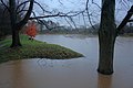 Great Ayton Flood Defences - geograph.org.uk - 3243961.jpg 640 × 427; 228 KB
-
 Great Ayton Flood Defences - geograph.org.uk - 3243964.jpg 640 × 427; 243 KB
-
 Great Ayton from Cliff Rigg - geograph.org.uk - 6137271.jpg 640 × 360; 68 KB
-
 Great Ayton from Roseberry Topping - geograph.org.uk - 2088166.jpg 3,968 × 2,976; 2.68 MB
-
 Great Ayton High Street - geograph.org.uk - 106673.jpg 361 × 480; 41 KB
-
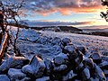
 Great Ayton Moor - geograph.org.uk - 2836224.jpg 640 × 480; 64 KB
-
 Great Ayton Moor - geograph.org.uk - 4595500.jpg 1,024 × 683; 134 KB
-
 Great Ayton Moor - geograph.org.uk - 4794591.jpg 640 × 480; 101 KB
-
 Great Ayton Moor - geograph.org.uk - 6375240.jpg 640 × 360; 35 KB
-
 Great Ayton Moor Enclosure - geograph.org.uk - 5699143.jpg 2,000 × 1,499; 1.38 MB
-
 Great Ayton under winter snow - geograph.org.uk - 6474756.jpg 1,799 × 1,199; 349 KB
-
 Great Ayton Waterfall - geograph.org.uk - 61897.jpg 640 × 480; 85 KB
-
 Great Ayton, North Yorkshire.jpg 640 × 480; 94 KB
-
 Green Bottoms - geograph.org.uk - 5222720.jpg 640 × 427; 71 KB
-
 Green grass off Green Lane - geograph.org.uk - 2254494.jpg 1,024 × 768; 108 KB
-
 Green Lane or Tunstall Lane - geograph.org.uk - 2254491.jpg 1,024 × 768; 194 KB
-
 Green Lane or Tunstall Lane - geograph.org.uk - 2254496.jpg 1,024 × 768; 143 KB
-
 Greenhow Burton - geograph.org.uk - 6034685.jpg 640 × 427; 54 KB
-
 Gribdale Gate - geograph.org.uk - 1332094.jpg 640 × 480; 107 KB
-
 Gribdale Gate - geograph.org.uk - 4377318.jpg 640 × 373; 64 KB
-
 Gribdale Gate - geograph.org.uk - 6084437.jpg 640 × 427; 131 KB
-
 Gribdale Gate - geograph.org.uk - 6340742.jpg 640 × 360; 97 KB
-
 Gribdale Stables, Dikes Lane - geograph.org.uk - 6347969.jpg 640 × 427; 108 KB
-
 Gribdale Terrace - geograph.org.uk - 5472363.jpg 1,920 × 1,280; 543 KB
-
 Gribdale Terrace - geograph.org.uk - 5887072.jpg 640 × 360; 100 KB
-
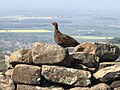 Grouse, Great Ayton Moor - geograph.org.uk - 6183324.jpg 1,024 × 768; 167 KB
-
 Guisborough Road (A173) - geograph.org.uk - 2690656.jpg 640 × 480; 115 KB
-
 Half an hour before sunrise - geograph.org.uk - 5222740.jpg 640 × 360; 49 KB
-
 Hall Fields Footpath - geograph.org.uk - 4271966.jpg 640 × 640; 187 KB
-
 Harvested Field - geograph.org.uk - 952740.jpg 640 × 427; 288 KB
-
 Harvested Field, Near Ayton Firs - geograph.org.uk - 974271.jpg 640 × 427; 242 KB
-
 Hawthorn hedgerow - geograph.org.uk - 5932419.jpg 640 × 427; 143 KB
-
 Hawthorn tree on Cliff Rigg - geograph.org.uk - 5906914.jpg 640 × 427; 102 KB
-
 Haze fire - geograph.org.uk - 6725781.jpg 640 × 360; 62 KB
-
 Heading out of North Yorkshire - geograph.org.uk - 2254483.jpg 1,024 × 768; 154 KB
-
 Hedgerow tree along Yarm Lane - geograph.org.uk - 2254354.jpg 1,024 × 768; 152 KB
-
 Heritage not advertisement on Station Road - geograph.org.uk - 2101216.jpg 1,024 × 768; 145 KB
-
 Heselton’s Mill Weir - geograph.org.uk - 4791407.jpg 640 × 480; 111 KB
-
 High Green , Great Ayton - geograph.org.uk - 4915070.jpg 3,264 × 1,836; 3.5 MB
-
 High Green, Great Ayton - geograph.org.uk - 2484711.jpg 3,296 × 2,472; 1.8 MB


.jpg)


_over_single_track_railway_-_geograph.org.uk_-_2253042.jpg)


_(20533770705).jpg)


_-_geograph.org.uk_-_2690656.jpg)


