Category:Great Amwell
Jump to navigation
Jump to search
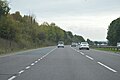
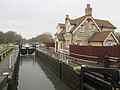
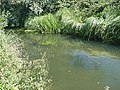
English: Great Amwell is a village in the county of Hertfordshire, England, located 1½ miles (S.E. by S.) from Ware, and about 20 miles north of London.
village in the county of Hertfordshire, England  Eglwys Sant Ioan Fedyddiwr, Great Amwell | |||||
| Upload media | |||||
| Instance of | |||||
|---|---|---|---|---|---|
| Location | East Hertfordshire, Hertfordshire, East of England, England | ||||
| Population |
| ||||
 | |||||
Subcategories
This category has the following 5 subcategories, out of 5 total.
Media in category "Great Amwell"
The following 172 files are in this category, out of 172 total.
-

-

-
 A10 from Hoe Lane bridge, Ware - geograph.org.uk - 1980795.jpg 1,280 × 960; 461 KB
-
 A10 near Rush Green - geograph.org.uk - 1980833.jpg 1,280 × 960; 460 KB
-
 A10, southbound - geograph.org.uk - 4793440.jpg 640 × 426; 45 KB
-

-

-

-
 Amwell Hill Pumping Station, Great Amwell - geograph.org.uk - 1978798.jpg 1,280 × 960; 484 KB
-
 Amwell Hill, Great Amwell - geograph.org.uk - 2917089.jpg 1,600 × 1,200; 524 KB
-
 Amwell Hill, SG12 - geograph.org.uk - 4524982.jpg 640 × 480; 140 KB
-
 Amwell Lane, SG12 (2) - geograph.org.uk - 4340908.jpg 640 × 480; 119 KB
-
 Amwell Lane, SG12 - geograph.org.uk - 4339941.jpg 640 × 480; 79 KB
-
 Amwell Lane, SG12 - geograph.org.uk - 4340175.jpg 640 × 480; 118 KB
-
 Amwell Marsh level crossing 1 2020-08-23.jpg 3,971 × 2,941; 6.53 MB
-
 Amwell Marsh level crossing 2 2020-08-23.jpg 4,032 × 3,024; 7.41 MB
-
 Amwell Marsh level crossing 3 2020-08-23.jpg 4,032 × 3,024; 5.48 MB
-
 Amwell Marsh Pumping Station (2) - geograph.org.uk - 4345397.jpg 480 × 640; 135 KB
-
 Amwell Marsh Pumping Station (3) - geograph.org.uk - 4345414.jpg 480 × 640; 84 KB
-
 Amwell Marsh Pumping Station - geograph.org.uk - 4345384.jpg 640 × 479; 102 KB
-
 Amwell Marsh Pumping Station - geograph.org.uk - 5463981.jpg 2,592 × 3,888; 2.07 MB
-
 Amwell Nature Reserve , birdwatchers - geograph.org.uk - 6071312.jpg 1,068 × 1,600; 447 KB
-
 Amwell Nature Reserve - geograph.org.uk - 6071308.jpg 1,600 × 1,068; 639 KB
-
 Amwell Nature Reserve – north western end of the lake - geograph.org.uk - 4824773.jpg 4,608 × 3,456; 3.73 MB
-
 Amwell Nature Reserve – view across the lake - geograph.org.uk - 4824775.jpg 4,608 × 3,456; 4.21 MB
-
 Amwell Spring, Great Amwell - geograph.org.uk - 1978778.jpg 1,280 × 960; 468 KB
-

-
 Bridge in Hoe Lane, Ware - geograph.org.uk - 1980793.jpg 1,280 × 960; 488 KB
-
 Canada geese near to Stanstead Lock - geograph.org.uk - 5128896.jpg 4,608 × 3,456; 4.69 MB
-
 Canal at Stanstead Lock - geograph.org.uk - 4824784.jpg 4,608 × 3,456; 3.51 MB
-
 Cast iron mile post in Great Amwell - geograph.org.uk - 1978757.jpg 960 × 1,280; 479 KB
-
 Cautherly Lane, Great Amwell - geograph.org.uk - 5471873.jpg 1,600 × 1,067; 501 KB
-
 Cetus - geograph.org.uk - 4342311.jpg 640 × 480; 70 KB
-
 Chardingleye Farm Lane - geograph.org.uk - 1978736.jpg 1,280 × 960; 480 KB
-
 County Council lorries - geograph.org.uk - 1980843.jpg 1,280 × 960; 467 KB
-
 Crossing New River - geograph.org.uk - 5496030.jpg 5,200 × 3,900; 2.19 MB
-
 Do not throw stones at this notice - geograph.org.uk - 4330222.jpg 640 × 480; 128 KB
-

-
 Downstream from Hardmead Lock - geograph.org.uk - 5128836.jpg 4,608 × 3,456; 4.3 MB
-
 Emma's Well - geograph.org.uk - 4354766.jpg 640 × 480; 140 KB
-

-

-
 Field southwest of Lower Road, SG12 - geograph.org.uk - 4354780.jpg 640 × 480; 69 KB
-

-

-
 Footbridge view from south-east of Hardmead Lock - geograph.org.uk - 5214501.jpg 4,608 × 3,456; 3.99 MB
-
 Geese on the towpath, near Ware - geograph.org.uk - 3582783.jpg 640 × 360; 64 KB
-
 George IV public house, Great Amwell - geograph.org.uk - 1978788.jpg 1,280 × 960; 483 KB
-
 Glimpse of Hardmead Lock from a footbridge - geograph.org.uk - 5128840.jpg 4,608 × 3,456; 5.54 MB
-
 Hardmead level crossing 1 2020-08-23.jpg 4,032 × 3,024; 7.27 MB
-
 Hardmead level crossing 2 2020-08-23.jpg 4,032 × 3,024; 5.95 MB
-
 Hardmead Lock - geograph.org.uk - 4824768.jpg 4,608 × 3,456; 3.42 MB
-
 Hardmead Lock – view north west - geograph.org.uk - 5124179.jpg 4,608 × 3,456; 3.71 MB
-
 Ind Coope 1856 - geograph.org.uk - 5471891.jpg 2,896 × 2,228; 1.83 MB
-

-

-
 Island in the New River at Great Amwell - geograph.org.uk - 4352196.jpg 480 × 640; 125 KB
-

-

-

-
 John Linnell - View of Amwell Hill, near Ware, in Hertfordshire, 1814.jpg 4,000 × 2,486; 3.26 MB
-
 Lake at Amwell Nature Reserve - geograph.org.uk - 5128846.jpg 4,608 × 3,456; 5.59 MB
-

-
 Level crossing by Stanstead Lock - geograph.org.uk - 4340918.jpg 640 × 480; 107 KB
-
 London Road, Great Amwell - geograph.org.uk - 1978848.jpg 1,280 × 960; 475 KB
-

-
 Memorial at Great Amwell on the River Lee or New River - geograph.org.uk - 6397129.jpg 1,600 × 1,085; 509 KB
-
 Memorial stone, Great Amwell, Hertfordshire - geograph.org.uk - 1747135.jpg 3,008 × 2,000; 3.78 MB
-

-
 Meridian Way - geograph.org.uk - 5463965.jpg 3,888 × 2,592; 2.38 MB
-
 Model Windmill - geograph.org.uk - 141008.jpg 640 × 480; 131 KB
-

-

-
 Monument to Sir Hugh Myddelton - geograph.org.uk - 4352201.jpg 480 × 640; 87 KB
-
 New River (River Lea Navigation) at Great Amwell - geograph.org.uk - 6397174.jpg 1,600 × 1,067; 721 KB
-

-
 New River, Great Amwell 2020-08-23.jpg 2,854 × 3,805; 4.24 MB
-

-

-
 Old Milepost - geograph.org.uk - 3207561.jpg 1,024 × 768; 323 KB
-
 Old Milepost - geograph.org.uk - 3207565.jpg 768 × 1,024; 296 KB
-
 Old signal box, St Margaret's Station - geograph.org.uk - 1982943.jpg 1,280 × 960; 466 KB
-
 Overbridges, A10 - geograph.org.uk - 4793425.jpg 640 × 426; 42 KB
-
 Pepper Hill, Amwell - geograph.org.uk - 5358298.jpg 2,238 × 1,636; 1.17 MB
-
 Poet's Corner, The New River. - geograph.org.uk - 141022.jpg 640 × 480; 152 KB
-
 PRIVATE PRoPERTY - geograph.org.uk - 4357123.jpg 640 × 480; 139 KB
-
 Public Restricted Byway 39 - geograph.org.uk - 1981261.jpg 1,280 × 960; 473 KB
-
 River Lea, Hertfordshire Way - geograph.org.uk - 4824766.jpg 4,608 × 3,456; 3.43 MB
-
 River Lee Navigation - geograph.org.uk - 6029159.jpg 3,264 × 2,448; 1.44 MB
-

-
 River Lee navigation, Amwell Nature Reserve - geograph.org.uk - 5214505.jpg 4,608 × 3,456; 3.45 MB
-

-
 Roundabout on the A414 going above the A10, Ware - geograph.org.uk - 2992974.jpg 1,600 × 1,200; 477 KB
-

-
 Sluice on the New River - geograph.org.uk - 1978715.jpg 1,280 × 960; 477 KB
-

-
 St. Margaret's station - geograph.org.uk - 4330226.jpg 640 × 480; 100 KB
-
 St. Margaret's station buildings - geograph.org.uk - 4330230.jpg 640 × 360; 66 KB
-
 St. Margarets (Herts) railway station - geograph.org.uk - 3365330.jpg 1,024 × 768; 247 KB
-
 Stanstead Lock (2) - geograph.org.uk - 4342307.jpg 640 × 480; 87 KB
-
 Stanstead Lock - geograph.org.uk - 4342304.jpg 640 × 480; 86 KB
-
 Stanstead Lock - geograph.org.uk - 4824780.jpg 4,608 × 3,456; 3.66 MB
-
 Stanstead Lock, River Lea Navigation - geograph.org.uk - 5128901.jpg 4,608 × 3,456; 3.77 MB
-
 Stanstead Lock, River Lee Navigation - geograph.org.uk - 3582777.jpg 640 × 360; 78 KB
-
 Stanstead Mill Stream at Amwell Magna - geograph.org.uk - 277288.jpg 640 × 480; 85 KB
-
 Stanstead Road, Great Amwell - geograph.org.uk - 3205953.jpg 2,048 × 1,536; 1.39 MB
-
 Telephone Kiosk, Amwell Hill, Great Amwell - geograph.org.uk - 1978802.jpg 960 × 1,280; 482 KB
-
 Telephone Kiosk, Amwell Hill, Great Amwell - geograph.org.uk - 1980603.jpg 960 × 1,280; 494 KB
-
 The A10 - geograph.org.uk - 4793442.jpg 640 × 426; 51 KB
-
 The A10 crosses King's Mead - geograph.org.uk - 5681047.jpg 1,738 × 2,437; 2.07 MB
-
 The A10 going over Stanstead Road - geograph.org.uk - 3205756.jpg 2,048 × 1,536; 1.93 MB
-

-

-

-

-

-

-

-

-

-
 The Mylne family tomb (2) - geograph.org.uk - 4354123.jpg 640 × 480; 116 KB
-
 The Mylne family tomb - detail - geograph.org.uk - 4352228.jpg 480 × 640; 136 KB
-
 The Mylne family tomb - geograph.org.uk - 4352222.jpg 640 × 480; 101 KB
-

-
 The New River at Great Amwell - geograph.org.uk - 4354182.jpg 640 × 480; 111 KB
-
 The New River at Great Amwell - geograph.org.uk - 5472968.jpg 3,888 × 2,592; 2.05 MB
-

-

-

-
 The New River by Amwell Lane (2) - geograph.org.uk - 4340076.jpg 640 × 480; 103 KB
-
 The New River by Amwell Lane - geograph.org.uk - 4340060.jpg 640 × 480; 114 KB
-

-

-

-
 The New River by Lower Road, SG12 - geograph.org.uk - 4354773.jpg 640 × 480; 123 KB
-

-

-

-

-
 The New River just east of Great Amwell - geograph.org.uk - 4352178.jpg 640 × 480; 103 KB
-

-

-

-

-

-

-

-

-

-

-

-

-

-

-

-

-

-

-
 The Waggon and Horses, Pepper Hill, Great Amwell - geograph.org.uk - 1980760.jpg 1,280 × 960; 487 KB
-

-
 Track at Stanstead Lock - geograph.org.uk - 4342315.jpg 640 × 480; 87 KB
-
 Track off Amwell Lane, SG12 - geograph.org.uk - 4340913.jpg 640 × 480; 142 KB
-
 Traffic on the A10 - geograph.org.uk - 1980813.jpg 1,280 × 960; 468 KB
-
 View across the A10 - geograph.org.uk - 3908809.jpg 1,600 × 1,064; 280 KB
-
 View from a bridge at Stanstead Abbotts - geograph.org.uk - 5128893.jpg 4,608 × 3,456; 3.91 MB
-

-

-
 Village sign, Great Amwell - geograph.org.uk - 1980583.jpg 1,280 × 960; 480 KB
-
 Walnut Tree Walk, Great Amwell - geograph.org.uk - 1978794.jpg 1,280 × 960; 476 KB
-

-

-
 Council Depot - geograph.org.uk - 135291.jpg 640 × 480; 87 KB
_signal_box_at_St._Margaret%27s_station_(2)_-_geograph.org.uk_-_4330231.jpg)
_signal_box_at_St._Margaret%27s_station_-_geograph.org.uk_-_4330227.jpg)


_-_geograph.org.uk_-_4524972.jpg)
_-_geograph.org.uk_-_4524977.jpg)


_-_geograph.org.uk_-_4340908.jpg)


_-_geograph.org.uk_-_4345397.jpg)
_-_geograph.org.uk_-_4345414.jpg)


_-_geograph.org.uk_-_4354763.jpg)


_-_geograph.org.uk_-_4352210.jpg)
_-_geograph.org.uk_-_4354761.jpg)

_-_geograph.org.uk_-_4354163.jpg)
_-_geograph.org.uk_-_4354758.jpg)


_at_Great_Amwell_-_geograph.org.uk_-_6397174.jpg)


_-_geograph.org.uk_-_4524948.jpg)


_railway_station_-_geograph.org.uk_-_3365330.jpg)
_-_geograph.org.uk_-_4342307.jpg)


_-_geograph.org.uk_-_4354137.jpg)
_-_geograph.org.uk_-_4354133.jpg)
_-_geograph.org.uk_-_4354143.jpg)
_-_geograph.org.uk_-_4354155.jpg)


_-_geograph.org.uk_-_4354123.jpg)


_-_geograph.org.uk_-_4354782.jpg)
_-_geograph.org.uk_-_4355707.jpg)

_-_geograph.org.uk_-_4340076.jpg)

_-_geograph.org.uk_-_4345394.jpg)

_-_geograph.org.uk_-_4354777.jpg)

_-_geograph.org.uk_-_4355716.jpg)

_-_geograph.org.uk_-_4352183.jpg)
_-_geograph.org.uk_-_4352189.jpg)

_-_geograph.org.uk_-_4345441.jpg)

_-_geograph.org.uk_-_4354776.jpg)

_-_geograph.org.uk_-_4330219.jpg)
_-_geograph.org.uk_-_4339970.jpg)
_-_geograph.org.uk_-_4339979.jpg)
_-_geograph.org.uk_-_4339984.jpg)


_-_geograph.org.uk_-_4355727.jpg)


_-_geograph.org.uk_-_4340910.jpg)

_at_Stanstead_Lock_-_geograph.org.uk_-_4342303.jpg)
_north_of_Stanstead_Lock_-_geograph.org.uk_-_4342308.jpg)
_south_of_Stanstead_Lock_-_geograph.org.uk_-_4342300.jpg)


_north_of_Stanstead_Lock_-_geograph.org.uk_-_4342349.jpg)
