Category:Gravimetric maps
Jump to navigation
Jump to search
English: Maps showing gravitational fields and related anomalies
Italiano: Mappe sul campo gravitazionale e relative anomalie
Subcategories
This category has the following 2 subcategories, out of 2 total.
B
- Bouguer anomaly (22 F)
Media in category "Gravimetric maps"
The following 46 files are in this category, out of 46 total.
-
PIA16587 - GRAIL's Gravity Field of the Moon.jpg 1,600 × 1,200; 854 KB
-
85E Ridge FreeAir.png 2,095 × 3,159; 1.18 MB
-
A Grace gravity model, showing Europe and Africa.jpg 500 × 500; 57 KB
-
Anomalies.jpg 1,600 × 1,292; 258 KB
-
Bouguer-zwaartekrachtanomalie Nederland.svg 540 × 540; 416 KB
-
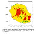
Chaleur974.jpg 969 × 905; 83 KB
-
Chicxulub Free-Air Gravity anomaly.png 834 × 620; 373 KB
-
Chicxulub2.jpg 688 × 592; 384 KB
-
Cirt-tuettensee-gravimetriemessung.JPG 504 × 428; 63 KB
-
Cornubian batholith.png 1,471 × 881; 480 KB
-
Cornubian Batholith.svg 1,390 × 738; 72 KB
-
Earth gravity.png 440 × 370; 186 KB
-
EGM2008 gravity anomaly map.svg 609 × 340; 6.97 MB
-
Free-Air gravity anomaly map around Britain and Ireland.png 505 × 589; 341 KB
-
Geocat.png 1,155 × 1,131; 408 KB
-
Global Gravity Anomaly Animation over LAND.gif 500 × 260; 11.17 MB
-
Global Gravity Anomaly Animation over OCEANS.gif 500 × 260; 11.17 MB
-
GMM-3 Mars Bouguer gravity map.tif 8,192 × 4,096; 43.15 MB
-
GRACE Global Gravity Animation PIA12146.jpg 455 × 455; 35 KB
-
GRACE globe animation.gif 455 × 455; 2.63 MB
-
Gravitational inhomogenity of Earth.jpg 550 × 550; 194 KB
-
Gravity anomalies on Earth.jpg 540 × 334; 84 KB
-
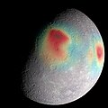
Gravity Anomalies on Mercury.jpg 2,400 × 2,400; 1.03 MB
-
Gravity Highs.jpg 867 × 666; 254 KB
-
Gravity in the netherlands (5153857582).jpg 1,000 × 698; 98 KB
-
Gravity over Mardin.jpg 1,289 × 693; 470 KB
-
Map of ocean floor based on earths gravity field.png 1,500 × 1,079; 3.51 MB
-
Mars gravitational field (MOLA dataset).png 2,880 × 1,300; 1.52 MB
-
Moon gravity acceleration map LGM2011.jpg 1,395 × 800; 448 KB
-
N-Atlantic-grav.png 504 × 339; 301 KB
-
Nj cboug.jpg 703 × 1,109; 234 KB
-
Northpook.jpg 547 × 777; 152 KB
-
Nw europe grav plot 2.png 742 × 841; 880 KB
-
Nw europe grav plot.png 475 × 548; 318 KB
-
Ocean gravity map.gif 1,010 × 597; 466 KB
-
Puget Lowland basins and faults.png 358 × 546; 1,012 KB
-
Southern ocean gravity hg.png 1,155 × 806; 1.18 MB
-
SW England Bouguer gravity anomaly map.png 371 × 336; 56 KB
-
Tacoma Fault and Basin.png 366 × 254; 457 KB
-
The Roer Valley rift system and bouguer anomalies.png 640 × 436; 593 KB
-
Topography gravity gale crater.jpg 1,969 × 1,000; 284 KB
-
USGS-PP1661d-fig22.png 340 × 411; 500 KB
-
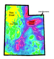
Utah-Gravity-Map-Simplified.png 990 × 1,080; 513 KB
-
Valversnelling in België.svg 1,045 × 850; 189 KB
-
Valversnelling in Nederland.svg 538 × 540; 674 KB


