Category:Graves of Sint-Lambertuskerk (Buren)
Jump to navigation
Jump to search
| Object location | | View all coordinates using: OpenStreetMap |
|---|
Nederlands: Afbeeldingen van de graven in de Sint-Lambertuskerk, Markt 4, 4116 BE Buren. Gelegen in Buren in de provincie Gelderland in Nederland
English: Pictures of graves in the Sint-Lambertuschurch, Markt 4, 4116 BE Buren. In Buren in the Dutch province of Gelderland in the Netherlands
Media in category "Graves of Sint-Lambertuskerk (Buren)"
The following 55 files are in this category, out of 55 total.
-
 Buren Sint-Lambertuskerk Grafkelder ingang.jpg 2,037 × 4,151; 3.13 MB
-
 Buren Sint-Lambertuskerk Grafsteen.jpg 1,983 × 3,488; 2.71 MB
-
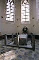
 Buren Sint-Lambertuskerk Graftombe Maria van Oranje.jpg 3,168 × 4,474; 4.49 MB
-
 Detail grafmonument in het koor - Buren - 20045419 - RCE.jpg 1,200 × 781; 196 KB
-
 Graf van prinses onder orgel - Buren - 20045368 - RCE.jpg 956 × 1,200; 276 KB
-
 Grafplaat, kelder koor - Buren - 20045410 - RCE.jpg 1,200 × 804; 259 KB
-
 Grafplaten in grafkelder koor - Buren - 20045402 - RCE.jpg 1,200 × 801; 154 KB
-
 Grafplaten in grafkelder koor - Buren - 20045403 - RCE.jpg 1,200 × 799; 203 KB
-
 Grafsteen - Buren - 20045381 - RCE.jpg 950 × 1,200; 236 KB
-
 Grafsteen - Buren - 20045382 - RCE.jpg 956 × 1,200; 289 KB
-
 Grafzerk in 't koor - Buren - 20045497 - RCE.jpg 1,197 × 1,200; 415 KB
-
 Grafzerk in 't koor - Buren - 20045498 - RCE.jpg 1,193 × 1,200; 367 KB
-
 Grafzerken - Buren - 20045345 - RCE.jpg 945 × 1,200; 243 KB
-
 Grafzerken - Buren - 20045346 - RCE.jpg 943 × 1,200; 278 KB
-
 Grafzerken - Buren - 20045504 - RCE.jpg 1,200 × 1,200; 513 KB
-
 Grafzerken - Buren - 20045505 - RCE.jpg 1,185 × 1,200; 483 KB
-
 Grafzerken - Buren - 20045506 - RCE.jpg 1,192 × 1,200; 491 KB
-
 Grafzerken - Buren - 20045507 - RCE.jpg 1,188 × 1,200; 394 KB
-
 Grafzerken - Buren - 20045508 - RCE.jpg 1,186 × 1,200; 410 KB
-
 Grafzerken - Buren - 20045509 - RCE.jpg 1,193 × 1,200; 420 KB
-
 Grafzerken - Buren - 20045510 - RCE.jpg 1,195 × 1,200; 436 KB
-
 Grafzerken - Buren - 20045511 - RCE.jpg 1,200 × 1,200; 529 KB
-
 Grafzerken - Buren - 20045512 - RCE.jpg 1,192 × 1,200; 514 KB
-
 Grafzerken - Buren - 20045513 - RCE.jpg 1,200 × 1,200; 494 KB
-
 Grafzerken - Buren - 20045514 - RCE.jpg 1,192 × 1,200; 427 KB
-
 Grafzerken - Buren - 20045515 - RCE.jpg 1,188 × 1,200; 520 KB
-
 Grafzerken - Buren - 20045516 - RCE.jpg 1,186 × 1,200; 399 KB
-
 Grafzerken - Buren - 20045517 - RCE.jpg 1,193 × 1,200; 516 KB
-
 Grafzerken - Buren - 20045518 - RCE.jpg 1,196 × 1,200; 524 KB
-
 Grafzerken - Buren - 20045519 - RCE.jpg 1,198 × 1,200; 507 KB
-
 Grafzerken - Buren - 20045520 - RCE.jpg 1,191 × 1,200; 530 KB
-
 Grafzerken - Buren - 20045521 - RCE.jpg 1,195 × 1,200; 406 KB
-
 Grafzerken - Buren - 20045522 - RCE.jpg 1,188 × 1,200; 457 KB
-
 Grafzerken - Buren - 20045523 - RCE.jpg 1,192 × 1,200; 480 KB
-
 Grafzerken - Buren - 20045524 - RCE.jpg 1,188 × 1,200; 450 KB
-
 Grafzerken - Buren - 20045525 - RCE.jpg 1,197 × 1,200; 476 KB
-
 Grafzerken - Buren - 20045526 - RCE.jpg 1,193 × 1,200; 476 KB
-
 Grafzerken - Buren - 20045527 - RCE.jpg 1,195 × 1,200; 534 KB
-
 Grafzerken - Buren - 20045528 - RCE.jpg 1,192 × 1,200; 550 KB
-
 Grafzerken - Buren - 20045529 - RCE.jpg 1,198 × 1,200; 483 KB
-
 Grafzerken - Buren - 20045530 - RCE.jpg 1,200 × 1,200; 408 KB
-
 Grafzerken - Buren - 20045531 - RCE.jpg 1,195 × 1,200; 426 KB
-
 Ingang grafkelder in het koor - Buren - 20045369 - RCE.jpg 1,200 × 958; 231 KB
-
 Ingang grafkelder in het koor - Buren - 20045370 - RCE.jpg 1,200 × 957; 241 KB
-
 Interieur grafmonument - Buren - 20045536 - RCE.jpg 1,192 × 1,200; 280 KB
-
 Interieur grafzerk - Buren - 20045537 - RCE.jpg 1,197 × 1,200; 216 KB
-
 Interieur grafzerk - Buren - 20045538 - RCE.jpg 1,193 × 1,200; 409 KB
-
 Interieur grafzerk - Buren - 20045539 - RCE.jpg 1,193 × 1,200; 397 KB
-
 Interieur grafzerk - Buren - 20045540 - RCE.jpg 1,192 × 1,200; 501 KB
-
 Interieur grafzerk - Buren - 20045541 - RCE.jpg 1,195 × 1,200; 485 KB
-
 Interieur grafzerk - Buren - 20045542 - RCE.jpg 1,188 × 1,200; 437 KB
-
 Interieur grafzerk - Buren - 20045543 - RCE.jpg 1,191 × 1,200; 442 KB
-

-
-


,_REPRODUCTIE_VAN_ORIGINEEL_IN_ARCHIEF_NEDERLANDS_HERVORMDE_KERK_-_Buren_-_20260892_-_RCE.jpg)

