Category:Gravel roads in the United States
Jump to navigation
Jump to search
Countries of North America: Canada · Costa Rica · Guatemala · United States of America‡
Other territories: Martinique
‡: partly located in North America
Other territories: Martinique
‡: partly located in North America
Subcategories
This category has the following 3 subcategories, out of 3 total.
Media in category "Gravel roads in the United States"
The following 79 files are in this category, out of 79 total.
-
 1225 in the forest.jpg 6,016 × 4,000; 6.42 MB
-
 2014 Bald Eagle State Park gravel track with border.jpg 3,119 × 2,344; 3.04 MB
-
 2014 Bald Eagle State Park gravel track.jpg 3,072 × 2,304; 2.42 MB
-

-
 Abandoned section of old Rte 66.jpg 3,888 × 2,592; 7.28 MB
-
 Acadia All American Road - Acadia Carriage Roads - NARA - 7716808.jpg 2,576 × 1,932; 1.58 MB
-
 BonSecour02.jpg 1,472 × 1,104; 272 KB
-
 Boyers.JPG 2,272 × 1,704; 1.24 MB
-
 Brogan, Oregon, gravel road.jpg 4,000 × 3,000; 4.91 MB
-
 Burlington estate entrance.jpg 6,016 × 4,000; 7.21 MB
-
 Burnt River Canyon - DPLA - 7581d93b1a125b050f11396f4c1760ac.jpg 1,335 × 2,000; 1.34 MB
-
 Burnt River, Burnt River Canyon Road - DPLA - 7f22c8545e36de1c2097a90a55a3e981.jpg 2,000 × 1,335; 1.38 MB
-
 Cars parked along the Tamiami Trail (9092704223).jpg 600 × 478; 54 KB
-
 Carter south of Karwash, French Creek Township.jpg 6,016 × 4,000; 6.93 MB
-
 Central WA (7235147896).jpg 980 × 1,377; 827 KB
-
 Cerro Gordo, Minnesota (8103936470).jpg 5,993 × 3,996; 3.2 MB
-
 Chestnut Mt Rd, good gravel with bridge.jpg 6,016 × 4,000; 6.42 MB
-
 Chestnut Mt Rd, gravel with warning sign.jpg 6,016 × 4,000; 6.4 MB
-
 Chestnut Mt Rd, ungraded gravel.jpg 6,016 × 4,000; 6.5 MB
-
 Colorado High Plains.JPG 3,264 × 2,448; 3.1 MB
-
 Country Music Highway - Butcher Hollow Boulder at Junction - NARA - 7717847.jpg 3,005 × 1,986; 1.34 MB
-

-
 CullmanCR477signGravelRoad (29576824745).jpg 2,400 × 1,600; 2.52 MB
-
 Dalton Highway.jpg 1,363 × 898; 940 KB
-
 DekalbCR6GravelRoad-DekalbCR863sign (31182939971).jpg 2,400 × 1,600; 2.81 MB
-
 Dirt Road - Fremont - CA.jpg 3,198 × 2,399; 2.6 MB
-
 Fairplay B&W.jpg 7,484 × 4,818; 17.62 MB
-
 FEMA - 15174 - Photograph by Marvin Nauman taken on 09-09-2005 in Alabama.jpg 3,008 × 2,000; 3.56 MB
-
 Four Forks in Nelson County.jpg 6,016 × 4,000; 6.39 MB
-
 Gilman Pond Rd. - panoramio.jpg 1,536 × 2,048; 552 KB
-
 Glass Mountain in northern California in summer 2012 (5).JPG 4,000 × 3,000; 3 MB
-
 Gravel Road (Umatilla County, Oregon scenic images) (umaDA0030).jpg 488 × 324; 38 KB
-
 Gravel road with no dust.webp 3,024 × 4,032; 3.21 MB
-
 Gravel state highway southeast of Chappell.jpg 6,016 × 4,000; 6.35 MB
-
 Gravel surfacing looking north from Station 220 - NARA - 298234.jpg 1,820 × 3,000; 762 KB
-
 Hayman Fire (2).jpg 2,048 × 1,536; 713 KB
-
 Hedrick, Indiana.png 3,000 × 1,500; 6.13 MB
-
 Hill Country SNA Texas 2023.jpg 3,556 × 2,000; 5.1 MB
-
 Hopewell Church Covered Bridge.jpg 2,816 × 2,112; 1.53 MB
-
 Hyder AK.jpg 2,272 × 1,704; 1.31 MB
-
 Icy Warren County, Indiana road.png 2,000 × 3,000; 9.63 MB
-
 Indiana-Ohio state line road near Willshire.jpg 6,016 × 4,000; 6.14 MB
-
 Indiana-rural-road-dirt.jpg 2,560 × 1,920; 1.32 MB
-
 Limestone Run Road, Allegany State Park, New York - 20211110.jpg 4,032 × 3,024; 11.58 MB
-
 Looking back towards the big towers (12607863283).jpg 3,295 × 4,942; 5.04 MB
-
 Lund Highway, Utah. West to Lund.jpg 1,000 × 667; 318 KB
-
 Madison County Road 2175 in Arkansas.jpg 4,000 × 3,000; 3.73 MB
-
 Mount Massive from road by Twin Lakes.jpg 3,864 × 2,000; 3.66 MB
-
 Mountaineers and farmers trading mules and horses 1a34387v.jpg 932 × 645; 464 KB
-

-
 Mt. Massive broad view.jpg 1,600 × 1,200; 208 KB
-
 North Canal Township Park Entryway.JPG 2,816 × 2,112; 2.37 MB
-
 North Coast Inland Trail.jpg 6,016 × 4,000; 5.96 MB
-
 NREL Mesa Top Facilities sign.jpg 800 × 600; 186 KB
-
 Ohio fg02.jpg 1,600 × 1,200; 365 KB
-
 Old Arkansas 2-Mayton Segment.JPG 3,264 × 4,928; 10.35 MB
-
 Old home and shed avon va usa.jpg 4,032 × 3,024; 3.65 MB
-
 Outing (1885) (14779243421).jpg 1,922 × 1,468; 1.03 MB
-
 Point Reyes Marshall Rd.jpg 4,352 × 3,264; 9.54 MB
-
 PSM V56 D0550 Macadamized roadway with no provision for surface drainage.png 1,631 × 1,144; 177 KB
-
 PSM V56 D0552 Kings highway brooklyn with macadamized center.png 1,631 × 1,075; 278 KB
-

-
 Rural scenery in Allegany County, New York, October 2015 - 06.jpg 1,527 × 2,048; 1.26 MB
-
 Rural scenery in the Town of Friendship, New York, October 2015.jpg 2,048 × 1,502; 1.42 MB
-
 Saline Landing main street.jpg 2,816 × 1,584; 1.17 MB
-
 Schaef Road - panoramio.jpg 3,264 × 1,836; 4.08 MB
-
 Seminoe Mountains (Wyoming, USA) 5.jpg 4,283 × 2,465; 9.4 MB
-
 Short Creek Perry County.jpg 1,449 × 969; 537 KB
-
 Skylinedrive.jpg 1,818 × 1,228; 1.12 MB
-
 Slate Creek Bridge.jpg 500 × 333; 64 KB
-
 SR165Gravelroad.jpg 2,592 × 1,944; 1.2 MB
-
 Staunton-Parkersburg Turnpike - Rich Mountain Backway - NARA - 7722231.jpg 2,104 × 1,503; 2.79 MB
-
 Storm Building Colorado.jpg 6,792 × 4,200; 9.44 MB
-
 Sugargrove Road woodlands.jpg 6,016 × 4,000; 6.3 MB
-
 Unionville Vineyards Entrance.jpg 1,707 × 1,280; 839 KB
-
 Up "8-mile" - panoramio.jpg 3,264 × 2,448; 2.26 MB
-
 Vanaka Bank Road.jpg 887 × 636; 319 KB
-
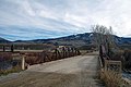
 Waltmire Bridge.jpg 3,264 × 2,448; 4.23 MB
-
 Wiley Road near Glass.jpg 6,016 × 4,000; 6.47 MB


.jpg)

.jpg)
.jpg)


.jpg)

.jpg)


.JPG)
_(umaDA0030).jpg)


.jpg)


.jpg)


_(14779243421).jpg)


_5.jpg)


