Category:Grass paths in Shropshire
Jump to navigation
Jump to search
Ceremonial counties of England: Bedfordshire · Buckinghamshire · Cambridgeshire · Cheshire · Cornwall · Cumbria · Derbyshire · Devon · Dorset · Durham · East Riding of Yorkshire · East Sussex · Essex · Gloucestershire · Greater London · Hampshire · Herefordshire · Hertfordshire · Isle of Wight · Kent · Lancashire · Leicestershire · Lincolnshire · Norfolk · North Yorkshire · Northamptonshire · Northumberland · Nottinghamshire · Oxfordshire · Rutland · Shropshire · Somerset · South Yorkshire · Staffordshire · Suffolk · Surrey · Warwickshire · West Sussex · West Yorkshire · Wiltshire · Worcestershire
City-counties:
Former historic counties:
Other former counties:
City-counties:
Former historic counties:
Other former counties:
Media in category "Grass paths in Shropshire"
The following 11 files are in this category, out of 11 total.
-
 Grass path in Wyre Forest - geograph.org.uk - 1623247.jpg 640 × 499; 151 KB
-
 Hardly used Green lane - geograph.org.uk - 999408.jpg 640 × 480; 115 KB
-
 Heather moorland on the Long Mynd - geograph.org.uk - 1712435.jpg 640 × 480; 97 KB
-
-
 Path up to Holy Trinity, Holdgate - geograph.org.uk - 1446771.jpg 640 × 480; 113 KB
-
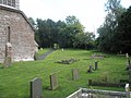
 Path within the churchyard at Cardington - geograph.org.uk - 1445911.jpg 640 × 480; 104 KB
-

-
 Strolling across the hillside - geograph.org.uk - 1211792.jpg 600 × 450; 247 KB
-
 Valley footpath - geograph.org.uk - 1311020.jpg 640 × 426; 118 KB
-
 Valley near Mardu - geograph.org.uk - 820945.jpg 640 × 480; 107 KB
-
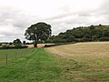 Great oak tree and The Cliffe - geograph.org.uk - 540860.jpg 640 × 480; 81 KB


