Category:Grand Bunker
Jump to navigation
Jump to search
| Object location | | View all coordinates using: OpenStreetMap |
|---|
|
This building is inscrit au titre des monuments historiques de la France. It is indexed in the base Mérimée, a database of architectural heritage maintained by the French Ministry of Culture, under the reference PA00132894
|
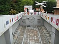
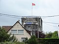
Museum of the Atlantic Wall fortification  | |||||
| Upload media | |||||
| Instance of |
| ||||
|---|---|---|---|---|---|
| Part of | |||||
| Location | Ouistreham, Calvados, Normandy, Metropolitan France, France | ||||
| Street address |
| ||||
| Commissioned by | |||||
| Occupant | |||||
| Heritage designation |
| ||||
| Inception |
| ||||
| Height |
| ||||
 | |||||
Français : Le grand Bunker à Ouistreham, ancien bunker faisant partie du mur de l'atlantique et actuel musée du mur de l'atlantique
Media in category "Grand Bunker"
The following 77 files are in this category, out of 77 total.
-
 Enfermaria Musèe Du Mur Atlantique.JPG 2,816 × 2,112; 2.53 MB
-
 Le Grand Bunker Musée du Mur de l'Atlantique 21-08-2013 16-15-53.JPG 4,288 × 2,848; 6.86 MB
-
 Le Grand Bunker Musée du Mur de l'Atlantique 21-08-2013 16-19-00.JPG 4,288 × 2,848; 6.89 MB
-
 Le Grand Bunker Musée du Mur de l'Atlantique 21-08-2013 8-50-26.JPG 3,459 × 1,948; 3.53 MB
-
 Le Grand Bunker Musée du Mur de l'Atlantique 8,8 cm Flak 21-08-2013 16-13-22.JPG 1,746 × 2,023; 2.59 MB
-
 Le Grand Bunker Musée du Mur de l'Atlantique afstandsmeter 21-08-2013 16-45-56.JPG 4,288 × 2,848; 5.63 MB
-
 Le Grand Bunker Musée du Mur de l'Atlantique LCM PA30-31 - 21-08-2013 17-00-29.JPG 4,285 × 2,413; 6.04 MB
-
 Le Grand Bunker Musée du Mur de l'Atlantique LCM PA30-31 - 21-08-2013 17-00-39.JPG 1,991 × 2,550; 3.05 MB
-

-
 Le Grand Bunker Musée du Mur de l'Atlantique radiokamer 21-08-2013 16-37-28.JPG 2,848 × 4,288; 5.87 MB
-
 Le Grand Bunker Musée du Mur de l'Atlantique wapenkamer 21-08-2013 16-23-45.JPG 4,288 × 2,848; 6.45 MB
-

-

-

-

-

-

-

-

-

-

-

-

-

-

-

-

-

-
-

-

-

-

-

-

-

-

-
-
-
 Le Grand Bunker, - Renault FT-17, Ouistreham, Lower Normandy, France - panoramio.jpg 2,816 × 2,112; 2.8 MB
-
 Le Grand Bunker, Half Track, Ouistreham, Lower Normandy, France - panoramio.jpg 2,816 × 2,112; 2.67 MB
-
 Le Grand Bunker, M3Stuart, Ouistreham, Lower Normandy, France - panoramio.jpg 2,816 × 2,112; 2.67 MB
-
 Le Grand Bunker, Ouistreham, France - panoramio.jpg 2,816 × 2,112; 2.33 MB
-
 Le Grand Bunker, Ouistreham, Lower Normandy, France - panoramio (1).jpg 2,816 × 2,112; 2.68 MB
-
 Le Grand Bunker, Ouistreham, Lower Normandy, France - panoramio (2).jpg 2,816 × 2,112; 2.55 MB
-
 Le Grand Bunker, Ouistreham, Lower Normandy, France - panoramio (3).jpg 2,816 × 2,112; 2.59 MB
-
 Le Grand Bunker, Ouistreham, Lower Normandy, France - panoramio (4).jpg 2,816 × 2,112; 2.35 MB
-
 Le Grand Bunker, Ouistreham, Lower Normandy, France - panoramio (5).jpg 2,816 × 2,112; 2.82 MB
-
 Le Grand Bunker, Ouistreham, Lower Normandy, France - panoramio (6).jpg 2,816 × 2,112; 2.33 MB
-
 Le Grand Bunker, Ouistreham, Lower Normandy, France - panoramio (7).jpg 2,816 × 2,112; 2.57 MB
-
 Le Grand Bunker, Ouistreham, Lower Normandy, France - panoramio (8).jpg 2,112 × 2,816; 2.43 MB
-
 Le Grand Bunker, Ouistreham, Lower Normandy, France - panoramio.jpg 2,816 × 2,112; 2.79 MB
-
 Le grand Bunker.JPG 2,048 × 1,536; 1.42 MB
-
 Le grand Bunker2.JPG 2,048 × 1,536; 1.41 MB
-
 Muratlantiq.jpg 182 × 236; 15 KB
-
 Normandy '12 - Day 5- Ouistreham (7466241602).jpg 4,000 × 2,672; 3.8 MB
-
 Normandy '12 - Day 5- Ouistreham (7466243980).jpg 4,000 × 2,672; 3.55 MB
-
 Normandy '12 - Day 5- Ouistreham (7466246712).jpg 2,672 × 4,000; 4.42 MB
-
 Normandy '12 - Day 5- Ouistreham (7466249558).jpg 4,000 × 2,672; 4.17 MB
-
 Normandy '12 - Day 5- Ouistreham (7466251870).jpg 2,672 × 4,000; 3.8 MB
-
 Normandy '12 - Day 5- Ouistreham (7466254664).jpg 2,672 × 4,000; 4.52 MB
-
 Normandy '12 - Day 5- Ouistreham (7466256516).jpg 3,958 × 2,560; 3.14 MB
-
 Normandy '12 - Day 5- Ouistreham (7466259346).jpg 2,672 × 4,000; 3.8 MB
-
 Normandy '12 - Day 5- Ouistreham (7466262096).jpg 2,672 × 4,000; 3.9 MB
-
 Normandy '12 - Day 5- Ouistreham (7466264968).jpg 3,654 × 2,672; 4.01 MB
-
 Normandy '12 - Day 5- Ouistreham (7466267868).jpg 4,000 × 2,672; 3.87 MB
-
 Normandy '12 - Day 5- Ouistreham (7466270754).jpg 4,000 × 2,672; 3.68 MB
-
 Normandy '12 - Day 5- Ouistreham (7466273666).jpg 4,000 × 2,672; 4.22 MB
-
 Normandy '12 - Day 5- Ouistreham (7466276236).jpg 4,000 × 2,672; 3.32 MB
-
 Normandy '12 - Day 5- Ouistreham (7466278534).jpg 4,000 × 2,672; 3.33 MB
-
 Normandy '12 - Day 5- Ouistreham (7466280344).jpg 3,712 × 2,519; 2.58 MB
-
 Normandy '12 - Day 5- Ouistreham (7466283182).jpg 4,000 × 2,672; 3.77 MB
-
 Normandy '12 - Day 5- Ouistreham (7466286106).jpg 2,672 × 4,000; 3.73 MB
-
 Normandy '12 - Day 5- Ouistreham (7466289250).jpg 2,672 × 4,000; 4.2 MB
-
 Normandy '12 - Day 5- Ouistreham (7466293162).jpg 4,000 × 2,426; 5.02 MB
-
 Obstacles de plage.png 884 × 380; 547 KB
-
 Ouistreham.jpg 1,288 × 966; 515 KB


.jpg)
.jpg)
.jpg)
.jpg)
.jpg)
.jpg)
.jpg)
.jpg)


.jpg)
.jpg)
.jpg)
.jpg)
.jpg)
.jpg)
.jpg)
.jpg)
.jpg)
.jpg)
.jpg)
.jpg)
.jpg)
.jpg)
.jpg)
.jpg)
.jpg)
.jpg)
.jpg)
.jpg)

