Category:Grafmonument Kaatsheuvel 524404
Jump to navigation
Jump to search
| Object location | | View all coordinates using: OpenStreetMap |
|---|
.jpg) | |||||
| Upload media | |||||
| Instance of |
| ||||
|---|---|---|---|---|---|
| Part of | |||||
| Location | Kaatsheuvel, Loon op Zand, North Brabant, Netherlands | ||||
| Street address |
| ||||
| Heritage designation |
| ||||
 | |||||
|
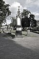
This is a category about rijksmonument number 524404
|
| Address |
|
Media in category "Grafmonument Kaatsheuvel 524404"
The following 3 files are in this category, out of 3 total.
-
 Grafmonument Kaatsheuvel RM 524404 (1).jpg 2,848 × 4,288; 5.04 MB
-
 Grafmonument Kaatsheuvel RM 524404 (2).jpg 2,848 × 4,288; 5.56 MB
-
 Grafmonument Kaatsheuvel RM 524404.jpg 2,848 × 4,288; 6.2 MB
.jpg)
