Category:Grade II listed buildings in the City of Wakefield
Jump to navigation
Jump to search
Subcategories
This category has the following 51 subcategories, out of 51 total.
A
B
- Blacksmith's Cottage, Heath (2 F)
- Boulby's Sundial (5 F)
C
- Camellia House, Bretton Hall (5 F)
- Cascade Bridge, Bretton Hall (14 F)
- Cobbler's Hall, Heath (2 F)
D
- Dandy Mill, Pontefract (5 F)
E
- Elephant and Castle, Wakefield (12 F)
G
- Gawthorpe water tower (9 F)
H
- Horbury Basin (6 F)
- Horbury Working Mens' Club (2 F)
- Horse Vaults, Pontefract (7 F)
K
- Kidcote, Horbury (5 F)
- The Kings Arms, Heath (10 F)
- Kirkthorpe Weir (18 F)
L
- Little Bridge, Kirkgate (14 F)
M
- Moorhouse, Heath (2 F)
O
- Ossett Town Hall (13 F)
P
- Pontefract Courthouse (9 F)
Q
S
T
- Thornes Lock (5 F)
U
- Unity Hall, Wakefield (16 F)
W
Media in category "Grade II listed buildings in the City of Wakefield"
The following 200 files are in this category, out of 306 total.
(previous page) (next page)-
 1, Navigation Yard - geograph.org.uk - 1518449.jpg 640 × 480; 86 KB
-
 10 and 12 High Street, Horbury.jpg 1,024 × 768; 196 KB
-
 10-23 St John's Square - geograph.org.uk - 1120655.jpg 640 × 480; 329 KB
-
 101-103 Westgate - geograph.org.uk - 1095515.jpg 640 × 480; 116 KB
-
 11 Market Street.jpg 4,000 × 3,000; 5.13 MB
-
 14-18 Little Westgate - geograph.org.uk - 1228778.jpg 480 × 640; 317 KB
-
 15a Wentworth Street - geograph.org.uk - 1128439.jpg 640 × 487; 325 KB
-
 17 and 17A, Bread Street, Wakefield.jpg 3,000 × 4,000; 810 KB
-
 17 Castle Road Stable.jpg 4,000 × 3,000; 4.87 MB
-
 19, Bread Street - geograph.org.uk - 2356697.jpg 768 × 1,024; 704 KB
-
 2-10, Northgate - geograph.org.uk - 1095478.jpg 640 × 510; 359 KB
-
 20-22 Little Westgate - geograph.org.uk - 1200074.jpg 640 × 480; 323 KB
-
 21 and 23, Bread Street, Wakefield.jpg 3,138 × 4,103; 960 KB
-
 23, Cross Square - geograph.org.uk - 1190421.jpg 631 × 640; 373 KB
-
 24-28 Little Westgate - geograph.org.uk - 1200081.jpg 640 × 609; 386 KB
-
 30, Little Westgate - geograph.org.uk - 1200094.jpg 480 × 640; 321 KB
-
 38, Westgate, Wakefield.jpg 3,000 × 4,000; 1.09 MB
-
 3D Kitchen and Bedrooms Ltd - geograph.org.uk - 1013857.jpg 640 × 484; 85 KB
-
 420 Aberford Road - geograph.org.uk - 1182515.jpg 640 × 480; 394 KB
-
 45 Ropergate, Pontefract.jpg 1,600 × 1,207; 601 KB
-
 47-51 Tithe Barn Street, Horbury.jpg 1,024 × 768; 169 KB
-
 49 Ropergate, Pontefract.jpg 640 × 490; 93 KB
-
 57 and 59, Westgate, Wakefield.jpg 4,000 × 3,000; 1.07 MB
-
 57-59 Westgate, Wakefield.jpg 1,280 × 1,004; 433 KB
-
 6 and 8, Silver Street, Wakefield.jpg 3,210 × 4,158; 986 KB
-
 60 and 62 Westgate - geograph.org.uk - 1048583.jpg 584 × 640; 103 KB
-
 62, George Street, Wakefield.jpg 4,000 × 3,000; 1.2 MB
-
 65, Westgate, Wakefield.jpg 3,000 × 4,000; 901 KB
-
 8 Market Place, Pontefract.jpg 1,093 × 1,600; 421 KB
-
 9 and 11 Bull Ring, Wakefield.jpg 640 × 480; 121 KB
-
 Ackroyds Florist - Cornmarket (geograph 2076128).jpg 640 × 578; 84 KB
-
 Ackworth - Ackworth Grange.jpg 640 × 480; 98 KB
-
 Ackworth House, Pontefract Road, High Ackworth - geograph.org.uk - 2102769.jpg 1,024 × 768; 217 KB
-
 Ackworth Plague Stone - geograph.org.uk - 303586.jpg 640 × 480; 117 KB
-
 Ackworth village cross.jpg 1,024 × 768; 377 KB
-
 Aire & Calder Navigation Offices, Wakefield (7568914746).jpg 2,403 × 1,716; 2.48 MB
-

-
 Alcove, Barnsley Road, Sandal (1) - geograph.org.uk - 2309722.jpg 1,024 × 768; 714 KB
-
 Almshouses on Robin Lane - geograph.org.uk - 777704.jpg 640 × 480; 91 KB
-
-
 Apple House, Trinity Church Gate - geograph.org.uk - 1178317.jpg 640 × 476; 344 KB
-
 Aqueduct Cottage - geograph.org.uk - 2416251.jpg 1,024 × 768; 876 KB
-
 Architect born here - geograph.org.uk - 880463.jpg 480 × 640; 66 KB
-
 Bank House, No1, Burton Street - geograph.org.uk - 943843.jpg 640 × 480; 65 KB
-
 Bar House, Doncaster Road - geograph.org.uk - 2250225.jpg 1,024 × 772; 684 KB
-
 Barleywood House, Barnsley Road, Sandal - geograph.org.uk - 2309718.jpg 1,024 × 768; 781 KB
-
 Barstow Square, Wakefield (8122938750).jpg 2,758 × 2,206; 3.8 MB
-
 Beastfair from Cornmarket, Pontefract (5th July 2019).jpg 3,872 × 2,176; 3.03 MB
-
 Beech Lawn, Heath.jpg 640 × 461; 112 KB
-

-
 Black Swan Hotel, Wakefield.jpg 2,552 × 1,696; 1.14 MB
-
 Bond Street Wakefield - geograph.org.uk - 994522.jpg 640 × 480; 85 KB
-
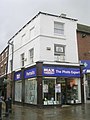
 Boots Opticians - Bridge Street (geograph 2074932).jpg 640 × 614; 87 KB
-
 Bread Street - geograph.org.uk - 1006043.jpg 480 × 640; 82 KB
-
 Bridge and Boathouse, Lower Lake.jpg 640 × 480; 122 KB
-
 Bridge and medieval gateway at Walton Hall.jpg 4,000 × 1,800; 2.7 MB
-
 Bridge over Barnsley Canal near Walton Hall.jpg 4,000 × 3,000; 5.06 MB
-
 Bridge over the Cut north of Cascade Bridge, Bretton Park.jpg 1,280 × 960; 578 KB
-
 Bridge over The Cut, Bretton - geograph.org.uk - 3274269.jpg 2,848 × 2,136; 1.52 MB
-
 British Heart Foundation - Beastfair (geograph 2075823).jpg 458 × 640; 66 KB
-
 British Heart Foundation - geograph.org.uk - 1042515.jpg 529 × 640; 119 KB
-
 Building south of 274 Barnsley Road.jpg 4,000 × 3,000; 7.83 MB
-
-
 Cannon Hall The Deer Shed.jpg 640 × 480; 116 KB
-

-
 Carr Lodge Park and Mansion - geograph.org.uk - 827711.jpg 640 × 480; 61 KB
-
 Castle Garth, Pontefract.JPG 1,364 × 1,024; 479 KB
-
 Castle Mount.jpg 1,864 × 880; 218 KB
-
 Cathedral Centre, Westmorland Street, Wakefield, West Yorkshire (8th December 2020).jpg 5,152 × 3,864; 4.46 MB
-
 Cemetery Chapels - geograph.org.uk - 576878.jpg 640 × 476; 40 KB
-
 Cherry Tree Farmhouse, South Elmsall.jpg 1,600 × 1,200; 302 KB
-
 Chess Sales Newsagents - Ropergate (geograph 2075813).jpg 480 × 640; 69 KB
-
 Chimney and Boiler House, Caphouse Colliery.jpg 424 × 640; 244 KB
-
 Church House, Darrington.jpg 1,024 × 768; 207 KB
-
 Circular Pond, Nostell Priory.jpg 768 × 1,024; 270 KB
-
 City Limits - geograph.org.uk - 946011.jpg 640 × 480; 100 KB
-
 Cleveland Lodge, Ackworth.jpg 1,024 × 682; 610 KB
-
 Cliff Field House, Burton Street - geograph.org.uk - 1128451.jpg 640 × 466; 404 KB
-

-
-

-
 Cocoon Designer Childrenswear - Beastfair (geograph 2075949).jpg 480 × 640; 71 KB
-
 Cottage, Woolley - geograph.org.uk - 2637707.jpg 1,600 × 1,200; 436 KB
-
 Crown Estate Agents - Ropergate (geograph 2075676).jpg 480 × 640; 75 KB
-
 Crowther Almshouse, Wakefield.jpg 4,052 × 3,070; 998 KB
-
 Culvert and sluice at Walton Hall.jpg 4,000 × 3,000; 4.75 MB
-
 Darrington Jubilee Church House - geograph.org.uk - 1859694.jpg 640 × 480; 168 KB
-
 Darrington Mill.jpg 640 × 480; 145 KB
-
 Derelict farm buildings - geograph.org.uk - 1395808.jpg 640 × 480; 130 KB
-
 Destiny Christian Church - geograph.org.uk - 1212089.jpg 640 × 480; 263 KB
-
 Drinking Fountain - geograph.org.uk - 1076585.jpg 639 × 432; 159 KB
-
 EE, Market Place, Pontefract (25th April 2019).jpg 3,864 × 5,152; 6.34 MB
-
 Elmwood House, Walton.jpg 1,024 × 768; 140 KB
-
 F W W Brown and Son - Queen Street - geograph.org.uk - 1710230.jpg 480 × 640; 56 KB
-
 Ferrybridge Engineering Workshops - geograph.org.uk - 299784.jpg 640 × 480; 103 KB
-
 Figure of Three Locks.jpg 1,024 × 683; 186 KB
-
 Floodlock - geograph.org.uk - 959898.jpg 640 × 480; 84 KB
-
 Forecourt walls to Carlton House - geograph.org.uk - 1138091.jpg 640 × 535; 279 KB
-
 Forecourt walls to north of Clarke Hall - geograph.org.uk - 1210423.jpg 641 × 475; 304 KB
-
 Former Board Room for the Aire and Calder Navigation Company.jpg 4,000 × 3,000; 4.78 MB
-
 Former Methodist Primary School, Thornhill Street, Wakefield.jpg 4,000 × 3,000; 4.87 MB
-
 Former Public Library, Wakefield.jpg 640 × 427; 253 KB
-
 Former School, Darrington.jpg 1,024 × 768; 215 KB
-
 Former Stables, Badsworth Hall.jpg 1,024 × 768; 276 KB
-
 Former ventilating tower - geograph.org.uk - 1212081.jpg 468 × 640; 298 KB
-
 Former Workhouse, Pontefract.jpg 4,608 × 3,456; 3.21 MB
-
 Garden Wall, Dower House, Heath.jpg 1,280 × 960; 538 KB
-
 Gardener's Cottage, Bretton Hall.jpg 1,280 × 850; 625 KB
-
 Gardener's Cottage, Heath Hall.jpg 1,280 × 960; 492 KB
-
 Gas Decontamination Centre, Horbury.jpg 1,024 × 768; 85 KB
-
 Gate piers at Walton Hall.jpg 4,000 × 3,000; 4.71 MB
-
 Gates and gate piers, Clarke Hall - geograph.org.uk - 5878238.jpg 1,024 × 768; 414 KB
-
 Gawthorpe Water Tower - geograph.org.uk - 1779250.jpg 640 × 450; 106 KB
-
 Georgian Houses - geograph.org.uk - 1042570.jpg 640 × 480; 112 KB
-
 Georgian Terrace, Northgate - geograph.org.uk - 1111150.jpg 640 × 479; 269 KB
-
 Ghia Menswear - Ropergate (geograph 2075817).jpg 480 × 640; 84 KB
-
 Grave of Charles Waterton.jpg 1,468 × 1,962; 575 KB
-
 Grove Hall Cottage - geograph.org.uk - 1167773.jpg 640 × 480; 354 KB
-
 Grove Hall, Near Ferrybridge - geograph.org.uk - 242609.jpg 640 × 480; 93 KB
-

-
 Guide Post, High Ackworth.jpg 600 × 800; 138 KB
-
 Guide Stone, Hardwick Lane.jpg 448 × 665; 71 KB
-
 Ha-ha, Heath House, Heath.jpg 1,280 × 960; 599 KB
-
 Haribo - Pontefract (geograph 5100744).jpg 640 × 480; 54 KB
-

-

-

-

-
-

-
-

-
 Heath conservation village - Marsh Close - geograph.org.uk - 1937308.jpg 640 × 480; 269 KB
-

-

-
-

-
 Hessle Old Hall (2) - geograph.org.uk - 2408443.jpg 1,024 × 768; 852 KB
-
 Hessle Old Hall (3) - geograph.org.uk - 2408450.jpg 1,024 × 768; 765 KB
-
 Hessle Old Hall, Hessle Common Lane - geograph.org.uk - 2255629.jpg 641 × 481; 78 KB
-
 Hodroyd Hall - geograph.org.uk - 209491.jpg 640 × 480; 112 KB
-
 Hofmanns Butchers - geograph.org.uk - 1013736.jpg 640 × 480; 114 KB
-
 Hogarths, Wakefield.jpg 3,000 × 4,000; 965 KB
-
 Holly House, Knottingley.jpg 1,600 × 1,064; 550 KB
-
 Holt's Cottage, Ackworth.jpg 1,024 × 768; 629 KB
-
 Horbury - Former Sunday School.jpg 640 × 552; 86 KB
-
 Horbury Convent - geograph.org.uk - 847160.jpg 640 × 480; 83 KB
-
 Horncastle Farm.jpg 800 × 600; 261 KB
-
 Horse trough - geograph.org.uk - 969027.jpg 640 × 480; 141 KB
-
 Houses opposite Church Lane, Darrington.jpg 1,024 × 768; 160 KB
-
 Hundhill Hall. - geograph.org.uk - 439838.jpg 640 × 480; 120 KB
-
 Huntwick Grange Farm House - geograph.org.uk - 249288.jpg 640 × 480; 94 KB
-
 Ice House^ - geograph.org.uk - 1395807.jpg 640 × 480; 115 KB
-
 Island wall and boathouses at Walton Hall 01.jpg 4,000 × 1,800; 2.52 MB
-
 Island wall and boathouses at Walton Hall 02.jpg 3,264 × 1,468; 1.45 MB
-
 Island wall and boathouses at Walton Hall 03.jpg 4,000 × 3,000; 5.2 MB
-
 Junior School, Queen Elizabeth Grammar - geograph.org.uk - 1120741.jpg 640 × 476; 376 KB
-
 K6 telephone kiosk - geograph.org.uk - 1013823.jpg 480 × 640; 126 KB
-
 Kings Arms Cottages, Heath - geograph.org.uk - 2072890.jpg 1,024 × 768; 232 KB
-

-
 Kirkthorpe Conservation Village, Stocks (3) - geograph.org.uk - 2389007.jpg 1,024 × 768; 942 KB
-

-
 Kirkthorpe Hall, Kirkthorpe - geograph.org.uk - 2079292.jpg 1,024 × 768; 249 KB
-
 Listed Building - geograph.org.uk - 1112974.jpg 640 × 564; 366 KB
-
 Listed building on Northgate, Horbury - geograph.org.uk - 6181424.jpg 1,024 × 768; 181 KB
-
-
 Lowther Hospital, Ackworth (16217600253).jpg 3,860 × 2,669; 7.28 MB
-
 Lychgate, St Cuthbert, Ackworth (16875332382).jpg 2,608 × 3,520; 7.75 MB
-
 Lydgate Manor, Horbury.jpg 1,024 × 768; 111 KB
-
 Magistrates Court - geograph.org.uk - 1026895.jpg 640 × 480; 97 KB
-
 Manor House, High Ackworth.jpg 1,024 × 768; 175 KB
-
 Max Spielmann - Beastfair (geograph 2075819).jpg 480 × 640; 64 KB
-
 Melbourne House, Carr Gate, Wakefield - geograph.org.uk - 332090.jpg 640 × 482; 86 KB
-
 Milepost northeast of West Bretton Traffic Island.jpg 1,200 × 1,600; 460 KB
-
 Milepost south of West Bretton Traffic Island.jpg 1,200 × 1,600; 423 KB
-
 Milepost south of West Bretton.jpg 1,200 × 1,600; 385 KB
-
 Milepost west of West Bretton Traffic Island.jpg 553 × 833; 72 KB
-
 Milestone - geograph.org.uk - 1042619.jpg 480 × 640; 133 KB
-
 Milestone north of High Ackworth.jpg 480 × 640; 375 KB
-
 Milestone north of Wentbridge.jpg 480 × 640; 288 KB
-
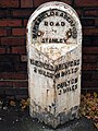
 Milestone, Aberford Road, Wakefield.jpg 1,200 × 1,600; 400 KB
-
 Milestone, Barnsley Road, Hemsworth.jpg 480 × 640; 298 KB
-
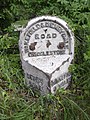 Milestone, Crigglestone.jpg 480 × 640; 366 KB
-
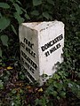
 Milestone, Doncaster Road, Thorpe Audlin.jpg 480 × 640; 455 KB
-
 Milestone, Hardwick Road, Pontefract.jpg 1,024 × 780; 154 KB
-
 Milestone, High Ackworth.jpg 480 × 640; 324 KB
-
 Milestone, New Road, Middlestown.jpg 500 × 725; 66 KB
-
 Milestone, Park Road, Pontefract.jpg 480 × 640; 406 KB
-
 Monument - geograph.org.uk - 975364.jpg 480 × 640; 98 KB
-
 Mount Zion Chapel - Queen Street - geograph.org.uk - 679082.jpg 640 × 512; 218 KB
-
 Mumbai Indian Restaurant - geograph.org.uk - 1005923.jpg 640 × 480; 97 KB
-
 Nationwide - Market Place (geograph 2075599).jpg 480 × 640; 58 KB
-
 NatWest Bank - geograph.org.uk - 1005937.jpg 480 × 640; 100 KB
-
 Neil Stuart Jewellers - geograph.org.uk - 1013701.jpg 480 × 640; 78 KB
-
 New Life Christian Centre - geograph.org.uk - 1044577.jpg 541 × 640; 139 KB
-
 New Life Christian Centre, Wakefield.jpg 4,000 × 3,000; 1.23 MB
-
 Newland Lodge, Goosehill - geograph.org.uk - 190178.jpg 640 × 480; 88 KB
-
 Newmillerdam Country Park - The Boat-House (1) - geograph.org.uk - 2174167.jpg 1,024 × 768; 770 KB
-
 Newmillerdam, the former Dam Mill (2) - geograph.org.uk - 2174346.jpg 1,024 × 768; 605 KB
-
 Night Club & Lap Dancing Club - Beastfair (geograph 2075891).jpg 442 × 640; 60 KB


.jpg)


.jpg)

_-_geograph.org.uk_-_2309722.jpg)


.jpg)
.jpg)


.jpg)


.jpg)


_-_geograph.org.uk_-_1138078.jpg)


.jpg)


.jpg)


_-_geograph.org.uk_-_1138093.jpg)
,_Leeds_Road_-_geograph.org.uk_-_1128463.jpg)

.jpg)

.jpg)


.jpg)


.jpg)


.jpg)


_-_geograph.org.uk_-_1936902.jpg)


_-_geograph.org.uk_-_2408443.jpg)
_-_geograph.org.uk_-_2408450.jpg)


_-_geograph.org.uk_-_2389007.jpg)


.jpg)
.jpg)


.jpg)


.jpg)


_-_geograph.org.uk_-_2174167.jpg)
_-_geograph.org.uk_-_2174346.jpg)
.jpg)