Category:Grade II listed buildings in Nottingham
Jump to navigation
Jump to search
Subcategories
This category has the following 105 subcategories, out of 105 total.
1
- 11, King Street, Nottingham (8 F)
- 13 Market Street (2 F)
- 14-30 King Street (5 F)
- 15, Market Street (1 F)
- 17, Castle Gate, Nottingham (3 F)
- 17, Market Street (1 F)
- 174 Derby Road, Nottingham (3 F)
- 19, Market Street (1 F)
2
- 22 Fletcher Gate (2 F)
- 25, Warser Gate (2 F)
3
- 3 and 5, Market Street (1 F)
- 31 and 33, Warser Gate (1 F)
- 33, Castle Gate, Nottingham (5 F)
- 35, Warser Gate (2 F)
4
- 49, Castle Gate, Nottingham (7 F)
5
- 51, Castle Gate, Nottingham (7 F)
- 53, Castle Gate, Nottingham (6 F)
- 55, Castle Gate, Nottingham (7 F)
- 57-59, Castle Gate, Nottingham (10 F)
6
- 62 and 64, Castle Boulevard (3 F)
7
- 7, Market Street (1 F)
8
- 84, Friar Lane (1 F)
9
- 9, Market Street (1 F)
A
- Albert Hall, Nottingham (10 F)
B
- The Bath Inn, Nottingham (2 F)
- Bell Inn, Nottingham (5 F)
- Bentinck Hotel, Nottingham (12 F)
- Blue Bell, Nottingham (1 F)
C
- Canal House, Nottingham (10 F)
- Carlton Laundry (4 F)
- Castle Court (7 F)
- Castle Meadow Campus (11 F)
- Cattle Market, Mansfield (9 F)
- Chaucer Court (1 F)
- Clarendon Chambers (1 F)
- Clawson Lodge (2 F)
- Cleaves Hall, Nottingham (5 F)
- Cock and Hoop, Nottingham (6 F)
- Colston House, Nottingham (1 F)
- Corn Exchange, Nottingham (3 F)
- Cripps Hall (17 F)
D
E
- Eldon Chambers, Nottingham (4 F)
- Exchange House, Nottingham (1 F)
- Express Buildings (1 F)
- Express Chambers (2 F)
F
- Flying Horse, Nottingham (6 F)
H
- Highfields House, Nottingham (6 F)
I
K
- Kean's Head, Nottingham (2 F)
L
- Langtry's, Nottingham (1 F)
- Lenton Grove (1 F)
- Lion Hotel, Clumber Street (2 F)
M
- Meadows Mill, Nottingham (3 F)
- Milbie House, Nottingham (1 F)
- Mortimer House (7 F)
N
- New Castle House, Nottingham (10 F)
- Norris Homes (7 F)
- 50 Carrington Street, Nottingham (17 F)
O
- Old Angel Inn (5 F)
- Ye Olde Trip to Jerusalem (53 F)
P
- Park Tunnel, Nottingham (19 F)
- Pit and Pendulum, Nottingham (3 F)
- Plumptre Hospital (4 F)
Q
- Queen's Chambers, Nottingham (10 F)
R
- Regency House, Nottingham (2 F)
- Rose of England, Nottingham (1 F)
S
- Severn's Building (10 F)
- St Martin's Cottages (1 F)
T
- The Cross Keys, Nottingham (3 F)
U
W
- Wollaton Hall Stable Block (25 F)
Y
Media in category "Grade II listed buildings in Nottingham"
The following 200 files are in this category, out of 527 total.
(previous page) (next page)-
 "Beechwood" - geograph.org.uk - 1845280.jpg 1,024 × 662; 365 KB
-
 "Beechwood" - geograph.org.uk - 1845287.jpg 1,024 × 683; 488 KB
-
 "Tower House", Park Row - geograph.org.uk - 1828100.jpg 762 × 1,024; 212 KB
-
 1 and 2 Castle Grove, Nottingham.jpg 1,280 × 960; 504 KB
-
 1 and 2 Park Terrace, Nottingham.jpg 1,280 × 960; 338 KB
-
 1 and 2 St Peter's Walk Nottingham.jpg 1,280 × 954; 526 KB
-
 1 And 2, Standard Hill, Nottingham (1).jpg 3,036 × 4,048; 3.87 MB
-
 1 And 2, Standard Hill, Nottingham (2).jpg 3,036 × 4,048; 3.82 MB
-
 1 and 3 Bridlesmith Gate, Nottingham.jpg 767 × 1,280; 299 KB
-
 1 Kaye's Walk and Eastgate House, Nottingham.jpg 1,280 × 913; 504 KB
-
 1 Middle Pavement, Nottingham.jpg 934 × 1,280; 268 KB
-
 1 Plumptre Street, Nottingham.jpg 984 × 1,280; 333 KB
-
 1, 3 and 5 Regent Street, Nottingham.jpg 1,280 × 994; 260 KB
-
 1, Broadway.jpg 2,977 × 3,969; 2.36 MB
-
 1-3 South Parade, Nottingham.jpg 3,648 × 5,472; 5.85 MB
-
 1-4 Bramcote Lane, Wollaton.jpg 1,280 × 960; 296 KB
-
 10 and 11 Park Terrace, Nottingham.jpg 1,280 × 952; 217 KB
-
 10 and 12 Plumptre Street, Nottingham.jpg 921 × 1,280; 283 KB
-
 10 George Street, Nottingham.jpg 1,280 × 1,280; 358 KB
-
 10 Low Pavement, Nottingham (geograph 1911456).jpg 480 × 640; 84 KB
-
 10-11 Angel Row, Nottingham.jpg 1,124 × 1,280; 381 KB
-
 106-124 Derby Road, Nottingham.jpg 1,280 × 960; 412 KB
-
 11 and 13, Market Street.jpg 3,648 × 5,472; 6.56 MB
-
 11 Bridlesmith Gate, Nottingham.jpg 3,648 × 5,472; 6.74 MB
-
 11 Hounds Gate, Nottingham.jpg 860 × 1,280; 274 KB
-
 11 Low Pavement, Nottingham.jpg 1,280 × 1,009; 330 KB
-
 11 St Peter's Gate, Nottingham.jpg 906 × 1,280; 415 KB
-
 110 to 138 Mansfield Road, Nottingham.jpg 1,280 × 960; 433 KB
-
 12 and 14 Forest Road East, Nottingham.jpg 1,280 × 960; 367 KB
-
 12 Broad Street, Nottingham.jpg 929 × 1,280; 301 KB
-
 12 Low Pavement, Nottingham - geograph.org.uk - 1911459.jpg 480 × 640; 87 KB
-
 12 Shakespeare Street, Nottingham.jpg 1,280 × 1,280; 402 KB
-
 12 Victoria Street, Nottingham - geograph.org.uk - 4067591.jpg 465 × 640; 167 KB
-

-
 126-128 Derby Road, Nottingham - geograph.org.uk - 6228911.jpg 1,280 × 1,280; 357 KB
-
 13 Low Pavement, Nottingham.jpg 1,280 × 1,280; 319 KB
-
 13-15 Bridlesmith Gate, Nottingham.jpg 3,648 × 5,472; 5.33 MB
-
 14, High Pavement.jpg 2,377 × 3,169; 1.58 MB
-
 14-22 Shakespeare Street, Nottingham - geograph.org.uk - 4113722.jpg 640 × 463; 167 KB
-
 14-24 Regent Street, Nottingham.jpg 1,280 × 1,012; 366 KB
-
 15 Carlton Street, Nottingham.jpg 966 × 1,280; 389 KB
-
 15 Carlton Street.jpg 3,648 × 5,472; 5.05 MB
-
 15 Park Valley, Nottingham.jpg 1,071 × 1,280; 243 KB
-
 15-16 Long Row.jpg 3,648 × 5,472; 5.84 MB
-
 16 Pilcher Gate, Nottingham - geograph.org.uk - 4113090.jpg 640 × 520; 265 KB
-
 16 Stoney Street, Nottingham - geograph.org.uk - 4090677.jpg 486 × 640; 203 KB
-
 16-18 Victoria Street, Nottingham (geograph 4067588).jpg 480 × 640; 164 KB
-
 16-20 Goose Gate, Nottingham - geograph.org.uk - 4107078.jpg 456 × 640; 182 KB
-
 17 and 19, Market Street.jpg 3,648 × 5,472; 6.91 MB
-
 17 Regent Street, Nottingham.jpg 982 × 1,280; 280 KB
-
 17 St James' Street, Nottingham.jpg 877 × 1,280; 353 KB
-
 18 And 18A, The Square, Retford (1).jpg 1,534 × 2,013; 857 KB
-
 19 Low Pavement, Nottingham (geograph 4058284).jpg 640 × 543; 169 KB
-
 19 Regent Street, Nottingham.jpg 1,172 × 1,280; 329 KB
-
 19 Stoney Street, Nottingham.jpg 930 × 1,280; 374 KB
-
 196-198 Mansfield Road - geograph.org.uk - 5349078.jpg 4,223 × 3,167; 2 MB
-
 2 and 2A Stoney Street, Nottingham.jpg 922 × 1,280; 402 KB
-
 2, 4 and 6, Broadway, Nottingham.jpg 956 × 1,280; 385 KB
-
 2, 4 And 6, Broadway.jpg 2,466 × 3,289; 1.43 MB
-
 2, Short Hill.jpg 2,885 × 2,163; 1.09 MB
-
 2, St James' Terrace, Nottingham.jpg 4,048 × 3,036; 4.72 MB
-
 2-10 Goose Gate, Nottingham.jpg 1,280 × 960; 458 KB
-
 2-12 Regent Street, Nottingham.jpg 1,280 × 960; 411 KB
-
 20 and 22 Carlton Street, Nottingham.jpg 1,280 × 1,280; 356 KB
-
 20 St James' Street, Nottingham.jpg 813 × 1,280; 280 KB
-
 200-202 Mansfield Road - geograph.org.uk - 5349076.jpg 4,199 × 3,149; 1.83 MB
-
 208 Mansfield Road - geograph.org.uk - 5349062.jpg 4,199 × 3,149; 2.37 MB
-
 21 and 23 Goose Gate, Nottingham.jpg 1,280 × 1,280; 638 KB
-
 21 and 23 Park Valley, Nottingham.jpg 1,280 × 960; 220 KB
-
 21 St Peter's Gate, Nottingham.jpg 1,280 × 1,280; 415 KB
-
 21-27 Stoney Street, Nottingham.jpg 913 × 1,280; 393 KB
-
 22 and 24 St James' Street, Nottingham.jpg 898 × 1,280; 288 KB
-
 22 and 24, Market Street.jpg 3,648 × 5,472; 5.9 MB
-
 23 Warser Gate, Nottingham.jpg 732 × 1,280; 245 KB
-
 23-27 Stoney Street.jpg 3,648 × 5,472; 5.59 MB
-
 24 and 26 Carlton Street, Nottingham.jpg 892 × 1,280; 322 KB
-
 25 Park Valley, Nottingham.jpg 1,280 × 1,280; 446 KB
-
 25-29 Wheeler Gate.jpg 3,648 × 5,472; 6.59 MB
-
 26 Regent Street, Nottingham.jpg 979 × 1,280; 397 KB
-
 26, High Pavement.jpg 2,143 × 2,857; 1.05 MB
-
 27 and 29 Village Road, Clifton - geograph.org.uk - 3851851.jpg 1,280 × 960; 156 KB
-
 27 Broad Street.jpg 3,024 × 4,032; 2.8 MB
-
 27 High Pavement, Nottingham.jpg 1,001 × 1,280; 371 KB
-
 27 St Marys Gate, Nottingham (geograph 4113049).jpg 377 × 640; 139 KB
-
 27, St Mary's Gate.jpg 2,837 × 3,783; 1.82 MB
-
 28 and 28A Regent Street, Nottingham.jpg 1,280 × 960; 413 KB
-
 28, High Pavement.jpg 3,456 × 4,608; 4.06 MB
-
 28-30 Pelham Street, Nottingham - geograph.org.uk - 4067201.jpg 448 × 640; 188 KB
-
 29 and 31 Long Row.jpg 3,648 × 5,472; 7.66 MB
-
 29-33 Castle Gate, Nottingham - geograph.org.uk - 4111015.jpg 640 × 494; 171 KB
-
 3 and 4 Park Terrace, Nottingham.jpg 1,029 × 1,280; 195 KB
-
 3 And 4, Kayes Walk.jpg 4,263 × 3,196; 4.12 MB
-
 3 Carlton Street, Nottingham - geograph.org.uk - 4107553.jpg 471 × 640; 177 KB
-
 3 Plumptre Street, Nottingham - geograph.org.uk - 4087852.jpg 406 × 640; 173 KB
-
 3 South Road, Nottingham (geograph 4117183).jpg 505 × 640; 195 KB
-
 3 Stoney Street, Nottingham.jpg 861 × 1,280; 240 KB
-
 3, Broadway.jpg 3,310 × 4,413; 2.53 MB
-
 3, St James' Terrace.jpg 1,516 × 2,023; 641 KB
-
 3-4 Huntingdon Drive, Nottingham.jpg 3,648 × 2,432; 4.7 MB
-
 3-5 Broadway, Nottingham (geograph 4088053).jpg 600 × 640; 246 KB
-
 3-6 Park Terrace, Nottingham.jpg 1,280 × 960; 646 KB
-
 3-9 College Street, Nottingham.jpg 1,280 × 884; 279 KB
-
 30 Market Street, Nottingham.jpg 3,648 × 5,472; 7.43 MB
-
 30 Park Row, Nottingham.jpg 947 × 1,280; 277 KB
-
 30-34 Lincoln Street, Nottingham - geograph.org.uk - 4108828.jpg 468 × 640; 207 KB
-
 31-33 Warser Gate, Nottingham - geograph.org.uk - 4089116.jpg 562 × 640; 207 KB
-
 32 Carlton Street, Nottingham.jpg 1,032 × 1,280; 526 KB
-
 33 Long Row.jpg 3,648 × 5,472; 7.02 MB
-
 33, Castle Gate.jpg 2,132 × 2,842; 1.22 MB
-
 34 & 36 Castle Gate, Nottingham (geograph 6109937).jpg 914 × 1,280; 362 KB
-
 34 and 32 Market Street, Nottingham.jpg 3,648 × 5,472; 8.03 MB
-
 34 and 35 Long Row.jpg 3,648 × 5,472; 7.74 MB
-
 34 Stoney Street, Nottingham - geograph.org.uk - 4087868.jpg 398 × 640; 174 KB
-
 34-40 Carlton Street, Nottingham.jpg 963 × 1,280; 421 KB
-
 35 And 37, St Mary's Gate.jpg 2,170 × 2,893; 1.2 MB
-
 36 Market Street, Nottingham (geograph 4063437).jpg 490 × 640; 171 KB
-
 36 Market Street.jpg 3,024 × 4,032; 2.39 MB
-
 36-44 Long Row, Nottingham - geograph.org.uk - 4058520.jpg 640 × 494; 197 KB
-
 37, 39 and 41 Bridlesmith Gate, Nottingham.jpg 1,280 × 1,280; 394 KB
-
 39 Pelham Street.jpg 3,648 × 5,472; 5.12 MB
-
 39, Stoney Street.jpg 3,456 × 4,608; 3.95 MB
-
 4 and 6 Forest Road East, Nottingham.jpg 1,280 × 960; 437 KB
-
 4 And 6, Low Pavement.jpg 3,431 × 2,573; 1.53 MB
-
 4 St Peter's Church Walk, Nottingham.jpg 1,280 × 984; 483 KB
-
 4 Statue Bases On The Upper South Terrace At Wollaton Hall Garden, Nottingham (8).jpg 3,024 × 4,032; 3.9 MB
-
 4, St James' Terrace.jpg 3,560 × 2,670; 2.17 MB
-
 4-6 Low Pavement, Nottingham (geograph 4058245).jpg 640 × 504; 192 KB
-
 4-8 Bridlesmith Gate, Nottingham - geograph.org.uk - 4067705.jpg 640 × 485; 182 KB
-
 40 The Ropewalk - geograph.org.uk - 5026695.jpg 1,024 × 1,024; 1.24 MB
-
 409 ^ 411 Mansfield Road - geograph.org.uk - 5344868.jpg 4,320 × 3,240; 4.43 MB
-
 413 to 419 Mansfield Road - geograph.org.uk - 5344867.jpg 4,320 × 3,240; 3.4 MB
-
 44, High Pavement.jpg 2,808 × 3,744; 2.05 MB
-
 46 And 48, High Pavement.jpg 3,456 × 4,608; 3.67 MB
-
 47 Stoney Street, Nottingham - geograph.org.uk - 4087861.jpg 401 × 640; 174 KB
-
 47, Stoney Street.jpg 2,363 × 3,150; 1.43 MB
-
 48 And 50, St Mary's Gate.jpg 3,160 × 4,214; 2.55 MB
-
 49 And 51, Stoney Street.jpg 3,456 × 4,608; 4.14 MB
-
 49, St Mary's Gate.jpg 2,807 × 3,742; 1.92 MB
-
 49-51 Stoney Street, Nottingham - geograph.org.uk - 4112468.jpg 423 × 640; 188 KB
-
 5 and 6 Western Terrace, Nottingham.jpg 3,648 × 2,432; 3.79 MB
-
 5 and 6, Western Terrace.jpg 4,032 × 3,024; 4.65 MB
-
 5 Byard Lane, Nottingham.jpg 3,024 × 4,032; 3.19 MB
-
 5-9 Bridlesmith Gate, Nottingham (geograph 4068954).jpg 473 × 640; 190 KB
-
 50 Shakespeare Street, Nottingham.jpg 1,280 × 983; 332 KB
-
 51 Bridlesmith Gate, Nottingham.jpg 1,280 × 1,280; 353 KB
-
 52, 54 Upper Parliament Street.jpg 3,024 × 4,032; 2.68 MB
-
 54-56 High Pavement, Nottingham - geograph.org.uk - 4112869.jpg 640 × 501; 201 KB
-
 56, High Pavement.jpg 3,434 × 2,574; 1.54 MB
-
 59A and 61 Derby Road, Nottingham.jpg 973 × 1,280; 349 KB
-
 6 and 8 Plumptre Street, Nottingham.jpg 1,280 × 1,280; 435 KB
-
 6 to 9 Ilkeston Road, Nottingham.jpg 1,280 × 1,004; 386 KB
-
 6 Victoria Street, Nottingham - geograph.org.uk - 4067597.jpg 485 × 640; 166 KB
-
 62-68 Derby Road, Nottingham.jpg 1,280 × 902; 364 KB
-
 66 St James's Street, Nottingham.jpg 879 × 1,280; 300 KB
-
 68, St James' Street.jpg 2,470 × 3,292; 1.66 MB
-
 69 to 71 Mansfield Road, Nottingham.jpg 1,280 × 1,280; 477 KB
-
 7 and 9 Hounds Gate, Nottingham.jpg 921 × 1,280; 237 KB
-
 7 and 9, Market Street.jpg 3,648 × 5,472; 6.64 MB
-
 7 Park Valley, Nottingham.jpg 1,280 × 1,280; 282 KB
-
 7 Weekly Cross, Nottingham.jpg 1,034 × 1,280; 424 KB
-
 7 Western Terrace, Nottingham.jpg 3,648 × 2,432; 4.01 MB
-
 7, St James' Terrace.jpg 1,672 × 2,230; 811 KB
-
 7-15 Regent Street, Nottingham.jpg 1,280 × 1,280; 371 KB
-
 7-9 Byard Lane, Nottingham.jpg 3,024 × 4,032; 2.67 MB
-
 70 and 72 Hound's Gate, Nottingham.jpg 922 × 1,280; 340 KB
-
 70 And 72, Hounds Gate.jpg 3,456 × 4,608; 4.18 MB
-
 70 St James's Street, Nottingham.jpg 807 × 1,280; 396 KB
-
 70-82 Derby Road, Nottingham.jpg 1,280 × 984; 345 KB
-
 8 and 10 Forest Road East, Nottingham.jpg 1,280 × 960; 407 KB
-
 8 And 9, St James' Terrace.jpg 3,432 × 2,573; 1.81 MB
-
 8, Low Pavement.jpg 1,986 × 2,647; 1.04 MB
-
 8-10 George Street, Nottingham - geograph.org.uk - 4108752.jpg 570 × 640; 188 KB
-
 84 Derby Road, Nottingham.jpg 1,280 × 1,280; 402 KB
-
 9 and 10 Park Terrace, Nottingham.jpg 1,280 × 1,280; 246 KB
-
 9 Low Pavement, Nottingham (geograph 4121220).jpg 439 × 640; 180 KB
-
 9 Weekday Cross, Nottingham (geograph 4111161).jpg 506 × 640; 213 KB
-
 9, Weekday Cross.jpg 2,960 × 2,220; 1.21 MB
-
 9-11 St James' Street, Nottingham.jpg 855 × 1,280; 325 KB
-
 9-23 Wheeler Gate, Nottingham - geograph.org.uk - 4069032.jpg 473 × 640; 210 KB
-
 96 to 108 Mansfield Road, Nottingham.jpg 1,280 × 960; 353 KB
-
 A group of 3 gravestones in Wollaton churchyard (geograph 6962099).jpg 1,280 × 960; 676 KB
-

-
 Abandoned splendour - geograph.org.uk - 381566.jpg 640 × 427; 73 KB
-
 All Saints' Vicarage, Nottingham.jpg 1,280 × 973; 289 KB
-
 An entrance to Wollaton Park - geograph.org.uk - 5031763.jpg 640 × 480; 86 KB
-
 Arboretum Aviary 6482.jpg 4,608 × 3,456; 3.45 MB
-
 Bandstand near the Memorial Gardens (geograph 4456803).jpg 1,024 × 768; 238 KB
-
 Bank of Scotland building, Queen Street - geograph.org.uk - 2904926.jpg 1,024 × 683; 171 KB
-
 Barn on Strelley Road - geograph.org.uk - 5328643.jpg 640 × 464; 48 KB
-
 Basford Cemetery entrance - geograph.org.uk - 4122864.jpg 1,280 × 989; 362 KB
-
 Basford Manor - geograph.org.uk - 2143907.jpg 800 × 595; 551 KB
-
 Bendigo's Grave.jpg 3,000 × 2,250; 2.75 MB
-
 Birkin Building.jpg 2,773 × 3,697; 1.99 MB
-
 Boundary Mark 40 Metres North East Of Castle Gatehouse.jpg 3,456 × 4,608; 5.27 MB
-
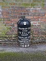
 Boundary marker, Barrack Lane - geograph.org.uk - 3938633.jpg 960 × 1,280; 398 KB
-
 Boundary Marker, Mansfield Road - geograph.org.uk - 3903436.jpg 960 × 1,280; 371 KB
-
 Boundary Marker, Mapperley (geograph 6977939).jpg 960 × 720; 330 KB
-
 Boundary Marker, Redcliffe Road - geograph.org.uk - 3903440.jpg 960 × 1,280; 345 KB
-
 Boundary Marker, Redcliffe Road top - geograph.org.uk - 3903443.jpg 960 × 1,280; 419 KB
-
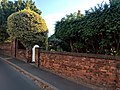 Boundary Wall At Ivy Cottage, Wollaton Village, Notts (1).jpg 4,032 × 3,024; 3.35 MB


.jpg)
.jpg)


.jpg)


.jpg)


.jpg)
.jpg)


.jpg)


.jpg)


.jpg)


.jpg)


.jpg)


.jpg)

.jpg)


.jpg)


.jpg)
.jpg)


.jpg)


.jpg)


.jpg)


.jpg)