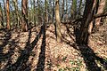
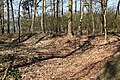
Category:Grabhügelfeld im Herrensand
Jump to navigation
Jump to search
| Object location | | View all coordinates using: OpenStreetMap |
|---|
Media in category "Grabhügelfeld im Herrensand"
The following 10 files are in this category, out of 10 total.
-
 Lindern - Kreisstraße 357 - Grabhügelfeld im Herrensand 01 ies.jpg 5,616 × 3,744; 31.2 MB
-
 Lindern - Kreisstraße 357 - Grabhügelfeld im Herrensand 02 ies.jpg 5,616 × 3,744; 25.51 MB
-
 Lindern - Kreisstraße 357 - Grabhügelfeld im Herrensand 03 ies.jpg 5,616 × 3,744; 29.94 MB
-
 Lindern - Kreisstraße 357 - Grabhügelfeld im Herrensand 04 ies.jpg 5,616 × 3,744; 36.33 MB
-
 Lindern - Kreisstraße 357 - Grabhügelfeld im Herrensand, Wall 01 ies.jpg 5,616 × 3,744; 34.92 MB
-
 Lindern - Kreisstraße 357 - Grabhügelfeld im Herrensand, Wall 02 ies.jpg 5,616 × 3,744; 33.74 MB
-
 Lindern - Kreisstraße 357 - Grabhügelfeld im Herrensand, Wall 03 ies.jpg 5,616 × 3,744; 32.15 MB
-
 Lindern - Kreisstraße 357 - Grabhügelfeld im Herrensand, Wall 04 ies.jpg 5,616 × 3,744; 36.97 MB
-
 Lindern - Kreisstraße 357 - Grabhügelfeld im Herrensand, Wall 05 ies.jpg 5,616 × 3,744; 31.39 MB
-
 Lindern - Kreisstraße 357 - Grabhügelfeld im Herrensand, Wall 06 ies.jpg 5,616 × 3,744; 34.36 MB


