Category:Grünten
Jump to navigation
Jump to search
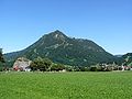
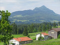
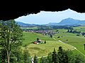
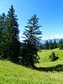
Deutsch: Der Grünten ist ein 1738 Meter hoher Berg in den Allgäuer Alpen, im deutschen Bundesland Bayern.
English: The Grünten (1738 m) is a mountain in Bavaria/ Germany.
mountain  | |||||
| Upload media | |||||
| Instance of | |||||
|---|---|---|---|---|---|
| Location | Bavaria, Germany | ||||
| Mountain range |
| ||||
| Topographic prominence |
| ||||
| Topographic isolation |
| ||||
| Elevation above sea level |
| ||||
 | |||||
Subcategories
This category has the following 12 subcategories, out of 12 total.
B
- Burgberger Hörnle (7 F)
E
G
- Gebirgsjägerdenkmal Grünten (16 F)
- Gigglstein (3 F)
- Grüntenhaus (9 F)
- Grüntenhütte (15 F)
- Grüntenlifte (8 F)
- Grüntenseilbahn (15 F)
- Grüntensteinbruch (77 F)
S
- Sender Grünten (16 F)
V
- Views from Grünten (29 F)
Media in category "Grünten"
The following 185 files are in this category, out of 185 total.
-
 2014-10-24 07-53-25 Germany Tirol Jungholz Höfen.jpg 4,288 × 2,848; 7.52 MB
-
 87463 Dietmannsried, Germany - panoramio (76).jpg 4,000 × 2,257; 893 KB
-
 Aerials Bavaria 20.09.2005 13-48-39.jpg 2,048 × 1,536; 2.35 MB
-
 AIMG 2805 Stein Kirchturm.jpg 3,110 × 2,333; 1.32 MB
-
 Allgaeuer Alpen Panorama vom Bergbauernmuseum.jpg 7,592 × 781; 2.95 MB
-
 Allgäuer Alpen auf der Grüntenalpe.jpg 6,000 × 4,000; 21.77 MB
-
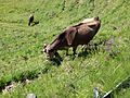
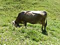
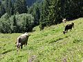
 Allgäuer Rind am Grünten (1).jpg 3,672 × 4,896; 5.24 MB
-
 Allgäuer Rind am Grünten (2).jpg 3,672 × 4,896; 5.45 MB
-
 Allgäuer Rind am Grünten (3).jpg 4,896 × 3,672; 5.44 MB
-
 Alpe - geo.hlipp.de - 15843.jpg 640 × 425; 67 KB
-
 Alpenvorland mit grünten.jpg 2,736 × 3,648; 2.56 MB
-
 Auf dem Grünten 2.jpg 2,560 × 1,920; 1.08 MB
-
 Auf dem Grünten.jpg 2,560 × 1,920; 1.13 MB
-
 Auf dem Weg zum Grünten 020405.jpg 2,183 × 1,565; 2.31 MB
-
 Aufstieg zum Grünten - panoramio - Clemens Pohl (1).jpg 2,032 × 1,524; 496 KB
-
 Aufstieg zum Grünten - panoramio - Clemens Pohl (2).jpg 1,200 × 900; 241 KB
-
 Aufstieg zum Grünten - panoramio - Clemens Pohl.jpg 2,032 × 1,524; 1.27 MB
-
 Aufstieg zum Grünten - panoramio.jpg 2,032 × 1,524; 892 KB
-
 Ausblick aus der Ferienwohnung www.fewo-neuhofer.de - panoramio.jpg 1,958 × 1,469; 1.62 MB
-
 Ausblick vom Skigebiet Fellhorn - panoramio.jpg 3,072 × 1,536; 2.15 MB
-

-
 Ballons über dem Grünten - panoramio.jpg 3,872 × 2,592; 2.96 MB
-
 Beim Grüntenlift - panoramio.jpg 2,048 × 1,536; 759 KB
-
 Berghofen Leonhard.jpg 800 × 529; 125 KB
-
 Bergpanorama Allgäuer Alpen - panoramio.jpg 2,032 × 1,524; 798 KB
-
 Besler.JPG 3,264 × 2,448; 2.83 MB
-
 BHS Getriebe Landschaft Sonthofen Luftbild baxxx 0008.jpg 709 × 491; 500 KB
-
 Biessenhofen - Kreen südl - Hart - MOD - St Martin, Grünten, Löwenzahn 300417 - 01.jpg 4,608 × 3,456; 871 KB
-
 Blaichach - Halden v SW, Grünten.jpg 2,048 × 1,536; 1.49 MB
-
 Blaichach - Illertal und Grünten , Sonthofen vom Ofterschwanger Horn.jpg 3,584 × 2,016; 1.28 MB
-
 Blick auf Oberstdorf02.jpg 2,304 × 1,728; 3.25 MB
-
 Blick auf Sender und Denkmal - panoramio.jpg 4,196 × 1,696; 983 KB
-
 Blick nach Süden - panoramio (4).jpg 2,816 × 2,120; 1.48 MB
-
 Blick vom Nebelhorn bei Oberstdorf.jpg 4,032 × 3,024; 3.02 MB
-
 Blick von der Söllereckbahn Richtung Sonthofen - panoramio.jpg 3,072 × 2,304; 4.19 MB
-
 Blick von Rauns auf den Grünten - panoramio.jpg 2,115 × 1,592; 285 KB
-
 Blick zum Grünten - panoramio.jpg 1,306 × 979; 594 KB
-
 Blick zum Grünten vom Mittag aus - panoramio.jpg 1,224 × 1,632; 185 KB
-
 Blick über Sulzberg zum Grünten - panoramio.jpg 2,816 × 2,120; 1.4 MB
-
 Breakfast In The Mountains (235293583).jpeg 2,048 × 1,361; 689 KB
-
 Burgberg - Oberortwang - Burgberg v SW, Grünten.JPG 4,000 × 2,248; 2.63 MB
-
 Burgberg 5.jpg 2,816 × 2,120; 1.32 MB
-
 Burgberg 6.jpg 2,816 × 2,120; 1.57 MB
-
 Burgberg mit Grünten - August 2008 - panoramio.jpg 1,600 × 1,200; 1.04 MB
-
 Burgberg und Grünten - panoramio.jpg 2,048 × 1,536; 982 KB
-
 Der Grünten von Immenstadt aus - panoramio.jpg 500 × 376; 51 KB
-
 Die Südseite vom Grünten mit Blick auf den Allgäuer Hochalpen.jpg 6,000 × 3,375; 12.73 MB
-
 Diepolz über dem Nebel - panoramio.jpg 2,816 × 2,120; 1.31 MB
-
 District-Oberallgäu Germany Grünten-01.jpg 5,594 × 3,729; 14.32 MB
-
 Emmereis GO-1.jpg 2,472 × 1,854; 1.67 MB
-
 Feuerstelle - panoramio.jpg 2,816 × 2,120; 1.48 MB
-
 Fichte - panoramio.jpg 2,816 × 2,120; 1.48 MB
-
 Fritz Schwaiger Rauhenzell und Grünten.jpg 641 × 828; 277 KB
-
 Gipfelkreuz Grünten.jpg 2,736 × 3,648; 4.62 MB
-
 Grosser Alpsee (2).JPG 4,032 × 3,024; 2.32 MB
-
 Gruenten from Riedberger Horn.JPG 3,264 × 2,448; 2.68 MB
-
 Gruenten vom rottachberg.jpg 1,600 × 1,200; 536 KB
-
 Gruenten von Gruentenhuette.png 1,280 × 958; 1.6 MB
-
 Gruenten-2008-12-19.jpg 1,600 × 1,200; 452 KB
-
 Gruenten-IMG 1172a.jpg 6,960 × 4,640; 9.29 MB
-
 Gruentensee de.jpg 850 × 721; 500 KB
-
 GruentenSW1105.jpg 1,024 × 768; 156 KB
-
 GruentenVonOyMittelbergH2a.jpg 4,570 × 3,075; 18.64 MB
-
 Grünten - panoramio (1).jpg 4,288 × 3,216; 7.24 MB
-
 Grünten - panoramio (2).jpg 2,816 × 2,120; 637 KB
-
 Grünten - panoramio (3).jpg 2,048 × 1,536; 1,002 KB
-
 Grünten - panoramio (4).jpg 2,816 × 2,120; 1.46 MB
-
 Grünten - panoramio (6).jpg 2,816 × 2,120; 1.45 MB
-
 Grünten - panoramio - Clemens Pohl.jpg 3,872 × 2,592; 457 KB
-
 Grünten - panoramio - Johannes Geiger.jpg 3,456 × 2,592; 1.5 MB
-
 Grünten - panoramio - Mayer Richard (2).jpg 2,816 × 2,120; 1.45 MB
-
 Grünten - panoramio - Mayer Richard.jpg 2,816 × 2,120; 1.38 MB
-
 Grünten - panoramio.jpg 2,816 × 2,120; 1.44 MB
-
 Grünten 020405.jpg 1,600 × 1,104; 721 KB
-
 Grünten 240708.jpg 2,600 × 1,950; 4.22 MB
-
 Grünten Blick v. Burghalde KE.jpg 4,794 × 3,222; 8.25 MB
-
 Grünten ganz.jpg 2,560 × 1,920; 1.11 MB
-
 Grünten GO-1.jpg 2,592 × 1,944; 1.14 MB
-
 Grünten GO-2.jpg 2,592 × 1,944; 1.14 MB
-
 Grünten GO-3.jpg 2,592 × 1,944; 1.43 MB
-
 Grünten GO-4.jpg 3,264 × 2,448; 2.07 MB
-
 Grünten Jägerdenkmal - panoramio.jpg 2,816 × 2,120; 685 KB
-
 Grünten letztes Sonnenlicht.jpg 3,301 × 4,951; 11.43 MB
-
 Grünten mit Viehweide.JPG 2,048 × 1,536; 1.79 MB
-
 Grünten von Burgberg aus gesehen - panoramio - Clemens Pohl.jpg 1,200 × 900; 359 KB
-
 Grünten von Burgberg aus gesehen - panoramio.jpg 2,032 × 1,524; 968 KB
-
 Grünten-Blick-1.jpg 2,177 × 1,633; 1.44 MB
-
 Grünten10.JPG 2,048 × 1,539; 2.89 MB
-
 Grünten11.JPG 2,048 × 1,536; 1.83 MB
-
 Grünten12.JPG 2,048 × 1,536; 1.71 MB
-
 Grünten16.09.2012.JPG 4,608 × 3,456; 2.33 MB
-
 Grünten34.JPG 2,048 × 1,536; 1.64 MB
-
 Grünten36.JPG 2,048 × 1,536; 2.17 MB
-
 Grünten39.JPG 2,048 × 1,536; 1.98 MB
-
 Grüntensteinbruch - panoramio (1).jpg 2,816 × 2,120; 1.78 MB
-
 Grüntensteinbruch - panoramio.jpg 1,280 × 960; 1,014 KB
-
 Haslach GO-1.jpg 2,448 × 1,836; 1.18 MB
-
 Heidelbeerkopf Gruenten.JPG 3,264 × 2,448; 3.04 MB
-
 Heini-Klopfer-Schanze Oberstdorf 04.jpg 4,624 × 2,601; 9.11 MB
-
 Holzphallus auf dem Grünten.jpg 1,601 × 1,000; 1.37 MB
-
 Hütte am Kammeregg - panoramio.jpg 2,816 × 2,120; 1.51 MB
-
 Illertal bei Thanners, 18.10.2014.jpg 2,592 × 1,944; 1.52 MB
-
 Immenstadt - Seeblick - Gr u Kl Alpsee, Grünten.jpg 2,272 × 1,704; 540 KB
-
 Immenstadt - Unterlohe, Grünten.JPG 1,920 × 1,080; 1,015 KB
-
 Immenstadt in der Nähe des Alpsees2 - panoramio.jpg 2,032 × 1,524; 521 KB
-
 Immenstadt unter dem Nebel - panoramio.jpg 2,816 × 2,120; 1.46 MB
-
 Jägerdenkmal auf dem Grünten.JPG 2,816 × 2,120; 1.43 MB
-
 Kammeregg Abstieg - panoramio.jpg 1,280 × 960; 494 KB
-
 Kanzelwand und Fellhorn 7.JPG 1,600 × 1,200; 605 KB
-
 Kempten - Tannen v N, Grünten 090521.jpg 4,504 × 2,485; 1.19 MB
-
 Kranzegger Bach GO-1.jpg 2,592 × 1,944; 1.36 MB
-
 Lahnerkopf Summit cross.JPG 3,264 × 2,448; 4.07 MB
-
 Liftstation - panoramio.jpg 2,816 × 2,120; 1.43 MB
-
 Liftstation Kammeregg - panoramio.jpg 2,816 × 2,120; 1.44 MB
-
 Ludwig Caspar Weiß Rettenberg mit Grünten 1844.jpg 868 × 529; 303 KB
-
 Mindelheimer Klettersteig1.JPG 3,888 × 2,592; 4.11 MB
-
 Mittag über dem Nebel - panoramio.jpg 2,816 × 2,120; 1.44 MB
-
 MK57871 Freibergsee.jpg 2,828 × 1,767; 3.39 MB
-
 Moosbach-Grünten.jpg 3,464 × 4,632; 6.7 MB
-
 Nebel im Illertal - panoramio.jpg 2,816 × 2,120; 1.48 MB
-
 Niedersonthofenersee - panoramio.jpg 2,816 × 2,120; 921 KB
-
 Oberstdorf, Germany - panoramio - Jan Gumpinger.jpg 2,304 × 1,728; 1.51 MB
-
 Parkplatz Kammeregg - panoramio.jpg 2,816 × 2,120; 1.45 MB
-
 Parkplatz mit Blick zum Grünten - panoramio.jpg 2,816 × 2,120; 1.42 MB
-
 Porta Alpinae - panoramio (1).jpg 2,816 × 2,120; 1.43 MB
-
 Porta Alpinae - panoramio.jpg 2,816 × 2,120; 1.42 MB
-
 Rangiswanger Horn.JPG 3,264 × 2,448; 2.33 MB
-
 Rettenbach a A östl - Grünten, SoUg 241212 - 04.JPG 2,560 × 1,440; 655 KB
-
 Rettenberg - panoramio (1).jpg 2,816 × 2,120; 1.49 MB
-
 Rettenberg, OA - An der Halde - Rettenberg v N, Grünten 01.jpg 2,197 × 1,421; 881 KB
-
 Reuterwanne-weg-oben.jpg 1,200 × 800; 600 KB
-
 Rotbuche am Nordhang - panoramio.jpg 2,816 × 2,120; 1.48 MB
-
 Rotbuche am Weg - panoramio.jpg 2,816 × 2,120; 1.5 MB
-
 Rotbuche Stamm - panoramio.jpg 2,816 × 2,120; 1.51 MB
-
 Rottachberg und Grünten - panoramio.jpg 2,048 × 1,536; 458 KB
-
 Rottachsee im Herbst.jpg 3,980 × 2,983; 6.9 MB
-
 Roßberg-Alpe - panoramio.jpg 2,756 × 1,649; 1.75 MB
-
 Rubinger oy02.jpg 2,145 × 1,497; 3.12 MB
-
 Rubinger oy03.jpg 2,154 × 1,506; 2.74 MB
-
 Rubingeroy03.jpg 2,163 × 1,518; 2.8 MB
-
 Ruine Schöneberg GO-7.jpg 2,592 × 1,944; 1.49 MB
-
 SchneelandschaftGrüntenAquarell.jpg 1,295 × 929; 981 KB
-
 Schöne Aussichten - panoramio.jpg 1,371 × 1,028; 1.22 MB
-
 Seifriedsberg und Burgberg - panoramio.jpg 2,816 × 2,120; 1.68 MB
-
 Sendeanlage Grünten.jpg 6,240 × 4,160; 8.8 MB
-
 Sicht auf Schönblick, Illertal und Grünten links.jpg 3,648 × 2,736; 1.12 MB
-
 Siechenkopf.jpg 1,200 × 814; 504 KB
-
 Sigiswanger Horn.JPG 3,264 × 2,448; 4.26 MB
-
 Silbriger Fichtenstamm - panoramio.jpg 2,816 × 2,120; 1.49 MB
-
 Sonthofen - Fluss-Renaturierung mit Grünten.JPG 4,000 × 3,000; 3.47 MB
-
 Sonthofen - Walten - Wegkreuz, Grünten v S.JPG 2,272 × 1,704; 912 KB
-
 Sonthofen Markthalle.jpg 2,560 × 1,920; 1.14 MB
-
 Sonthofen02.jpg 2,304 × 1,728; 2.74 MB
-
 Sportplatz bei Sonthofen - geo.hlipp.de - 20653.jpg 640 × 426; 62 KB
-
 Stiefenhofen winter gruenten.jpg 2,592 × 3,872; 903 KB
-
 Stillachtal 180806.jpg 1,600 × 1,193; 645 KB
-
 Stötten - Mösten westl - Settele Nr 4 v NO, Grünten 060116.JPG 2,992 × 2,992; 1.04 MB
-
 Sulzberg, OA - Steingaden Nr 12 Wiedemann v N (sw).jpg 4,000 × 2,248; 1.16 MB
-
 Südlich Grünten Allgäuer Alpen 2020-09-18.jpg 3,840 × 2,160; 1.55 MB
-
 Tor zu den Alpen - panoramio.jpg 2,816 × 2,120; 1.47 MB
-
 Tür auf - panoramio.jpg 2,816 × 2,120; 1.48 MB
-
 Untere Gottesackerwaende Southface Gruenten Wertacher Hoernle.JPG 3,264 × 2,448; 3.63 MB
-
 Vergleich ohne-mit Polfilter, Stiefenhofen mit Grünten - panoramio.jpg 3,000 × 2,422; 696 KB
-
 Viehgangeln am Grünten (1).jpg 4,896 × 3,672; 9 MB
-
 Viehgangeln am Grünten (2).jpg 4,896 × 3,672; 9.5 MB
-
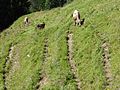 Viehgangeln am Grünten (3).jpg 4,896 × 3,672; 8.96 MB
-
 Viehgangeln am Grünten (4).jpg 4,896 × 3,672; 7.81 MB
-
 Viehgangeln am Grünten (5).jpg 4,896 × 3,672; 8.06 MB
-
 Viehgangeln am Grünten (6).jpg 4,896 × 3,672; 7.35 MB
-
 Viehgangeln am Grünten (7).jpg 3,672 × 4,896; 9.16 MB
-
 Viehgangeln am Grünten (8).jpg 4,896 × 3,672; 8.18 MB
-
 Vorderburg - panoramio (5).jpg 2,816 × 2,120; 1.46 MB
-
 Vorplatz der Hütte - panoramio.jpg 2,816 × 2,120; 1.5 MB
-
 Wagneritz vor dem Grünten - panoramio.jpg 2,816 × 2,120; 1.53 MB
-
 Wertach mit Grünten.JPG 1,734 × 1,301; 307 KB
-
 Wertach, OA - Ellegger Höhe - Oberellegg westl - Gereute, Grünten v NO, Talnebel 01.jpg 4,000 × 1,355; 1.21 MB
-
 WikiProjekt Landstreicher Obermaiselstein 03.jpg 3,871 × 2,737; 2.66 MB
-
 WikiProjekt Landstreicher Sturmannshöhle 23.jpg 4,000 × 3,000; 3.09 MB
-
 WikiProjekt Landstreicher Südhang Grünten 05.jpg 3,000 × 4,000; 3.89 MB
-
 WikiProjekt Landstreicher Südhang Grünten 06.jpg 4,000 × 3,000; 4.92 MB
-
 WikiProjekt Landstreicher Südhang Grünten 08.jpg 3,000 × 4,000; 3.79 MB
-
 WikiProjekt Landstreicher Südhang Grünten 10.jpg 4,000 × 3,000; 3.18 MB
-
 WikiProjekt Landstreicher Südhang Grünten 16.jpg 3,000 × 4,000; 4.1 MB
-
 WikiProjekt Landstreicher Südhang Grünten 19.jpg 4,000 × 3,000; 3.72 MB
-
 WikiProjekt Landstreicher Südhang Grünten 20.jpg 4,000 × 3,000; 3.82 MB

.jpg)


.jpg)
.jpg)
.jpg)


.jpg)
.jpg)


.jpg)


.jpeg)


.JPG)


.jpg)
.jpg)
.jpg)
.jpg)
.jpg)


.jpg)


.jpg)


.jpg)


.jpg)


.jpg)


.jpg)
.jpg)
.jpg)
.jpg)
.jpg)
.jpg)
.jpg)
.jpg)
.jpg)


Categories:
- Mountains of Landkreis Oberallgäu
- Mountains of Allgäu Alps in Bavaria
- 1730s mountains of Swabia (Bavaria)
- Geography of Burgberg im Allgäu
- Geography of Rettenberg
- Allgäuer Voralpen östlich der Iller
- Schutz des Grüntengebietes, des Großen Waldes, der Deutschen Alpenstraße und des Wertachtales
- Horns (landforms) in Bavaria
- Mountains of Germany by name