Category:Gréiwelsser Barrière
Jump to navigation
Jump to search
| Object location | | View all coordinates using: OpenStreetMap |
|---|
| Upload media | |||||
| Instance of |
| ||||
|---|---|---|---|---|---|
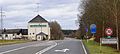
| Location | Bertrange, Canton of Luxembourg, Luxembourg | ||||
 | |||||
Media in category "Gréiwelsser Barrière"
The following 4 files are in this category, out of 4 total.
-
 Bertrange, Gréiwels Barrière (1).jpg 3,899 × 3,899; 3.37 MB
-
 Bertrange, Gréiwels Barrière (2).jpg 6,000 × 4,000; 6.11 MB
-
 Bertrange, Gréiwels Barrière (3).jpg 5,719 × 3,813; 4.98 MB
-
 GréiwelsBarrière01.jpg 4,288 × 1,914; 981 KB
.jpg)
.jpg)
.jpg)
