Category:Goudriaanse Molen
Jump to navigation
Jump to search
| Object location | | View all coordinates using: OpenStreetMap |
|---|
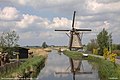
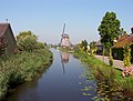
windmill in Goudriaan, Netherlands  | |||||
| Upload media | |||||
| Instance of |
| ||||
|---|---|---|---|---|---|
| Location | Goudriaan, Molenlanden, South Holland, Netherlands | ||||
| Street address |
| ||||
| Located on street |
| ||||
| Has use |
| ||||
| Heritage designation |
| ||||
| Source of energy | |||||
 | |||||
|
This is a category about rijksmonument number 17033
|
| Address |
|
Media in category "Goudriaanse Molen"
The following 17 files are in this category, out of 17 total.
-

-

-
 De Goudriaansemolen in Goudriaan.jpg 4,770 × 3,177; 2.67 MB
-
 Dutch windmills (4) (16752536542).jpg 3,338 × 4,154; 3.16 MB
-
 Exterieur OVERZICHT - Goudriaan - 20265791 - RCE.jpg 1,200 × 794; 149 KB
-
 Goudriaan en zijn Molen.jpg 4,770 × 3,177; 2.58 MB
-
 Goudriaan.jpg 4,770 × 3,177; 1.04 MB
-
 Goudriaanse molen 21-11-19 (49099491428).jpg 6,000 × 4,000; 4 MB
-
 Goudriaanse Molen.jpg 4,608 × 3,456; 6.39 MB
-
 Interieur van achtkante grondzeiler - AMR Molenfoto - 20538372 - RCE.jpg 1,200 × 900; 147 KB
-
 Interieur van achtkante grondzeiler - AMR Molenfoto - 20538373 - RCE.jpg 1,200 × 900; 151 KB
-
 Interieur van achtkante grondzeiler - AMR Molenfoto - 20538374 - RCE.jpg 1,200 × 900; 148 KB
-
 Interieur van achtkante grondzeiler - AMR Molenfoto - 20538375 - RCE.jpg 1,200 × 900; 185 KB
-
 Smoutjesvliet in Goudriaan.JPG 1,632 × 1,232; 728 KB
-

-
 Watermolen polder Goudriaan en noord-zijde - Goudriaan - 20083329 - RCE.jpg 1,200 × 1,178; 256 KB
-
 Watermolen van de polder Goudriaan - Goudriaan - 20083330 - RCE.jpg 1,200 × 1,186; 214 KB


_(16752536542).jpg)


.jpg)


