Category:Gottlieb Schumacher, Karte des Ostjordanlandes
Jump to navigation
Jump to search
map by Gottlieb Schumacher 1908-1921 .jpg) | |||||
| Upload media | |||||
| Instance of | |||||
|---|---|---|---|---|---|
| Depicts | Jordan and West Bank | ||||
| Genre | |||||
| Creator | |||||
| Place of publication | |||||
| Language of work or name | |||||
| Collection |
| ||||
| Publication date |
| ||||
| |||||
Media in category "Gottlieb Schumacher, Karte des Ostjordanlandes"
The following 13 files are in this category, out of 13 total.
-

-
 Gottlieb Schumacher, Karte des Ostjordanlandes 00-index (FL13720763 2367037).jpg 6,694 × 8,213; 79.48 MB
-
 Gottlieb Schumacher, Karte des Ostjordanlandes 01-hula-a--1--2 (FL13720766 2367037).jpg 9,835 × 10,790; 149.99 MB
-
 Gottlieb Schumacher, Karte des Ostjordanlandes 02-tiberias-a--3 (FL13720773 2367037).jpg 9,136 × 8,525; 106.77 MB
-
 Gottlieb Schumacher, Karte des Ostjordanlandes 03-irbid-a--4 (FL13720777 2367037).jpg 10,221 × 8,583; 122.4 MB
-
 Gottlieb Schumacher, Karte des Ostjordanlandes 04-north-to-damia-bridge-a--5 (FL13720782 2367037).jpg 10,428 × 11,310; 154.33 MB
-
 Gottlieb Schumacher, Karte des Ostjordanlandes 05-tafas-b--3-c--3 (FL13720786 2367037).jpg 12,330 × 8,542; 146.37 MB
-
 Gottlieb Schumacher, Karte des Ostjordanlandes 06-dera-b--4 (FL13720791 2367037).jpg 9,728 × 8,523; 106.87 MB
-
 Gottlieb Schumacher, Karte des Ostjordanlandes 07-jerash-b--5 (FL13720796 2367037).jpg 10,322 × 11,262; 146.28 MB
-
 Gottlieb Schumacher, Karte des Ostjordanlandes 08-bosra-c--4 (FL13720801 2367037).jpg 9,900 × 8,462; 110.34 MB
-
 Gottlieb Schumacher, Karte des Ostjordanlandes 08-bosra-c--4 (FL13720801 2367037).tif 9,900 × 8,462; 172.53 MB
-
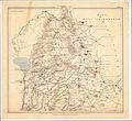
 Gottlieb Schumacher. Karte des Ostjordanlandes Blatt I. 1900.jpg 1,024 × 1,200; 249 KB
-
 Karte des Ostjordanlandes.jpg 22,772 × 20,864; 364.37 MB

.jpg)
.jpg)
.jpg)
.jpg)
.jpg)
.jpg)
.jpg)
.jpg)

