Category:Gorgie, Edinburgh
Jump to navigation
Jump to search
area of Edinburgh, Scotland  | |||||
| Upload media | |||||
| Instance of | |||||
|---|---|---|---|---|---|
| Location |
| ||||
 | |||||
Subcategories
This category has the following 6 subcategories, out of 6 total.
D
- Destiny Church, Gorgie (4 F)
G
- Gorgie City Farm (3 F)
N
- North British Distillery (2 F)
T
- Tynecastle High School (20 F)
Media in category "Gorgie, Edinburgh"
The following 11 files are in this category, out of 11 total.
-
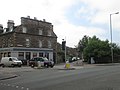 A road junction in Edinburgh - geograph.org.uk - 4085102.jpg 640 × 480; 52 KB
-
 Appin Street, Gorgie - geograph.org.uk - 3569097.jpg 4,516 × 3,330; 2.14 MB
-
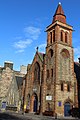
 Destiny Church - geograph.org.uk - 3057206.jpg 640 × 424; 99 KB
-
-
 Green tears (8578894926).jpg 4,161 × 2,774; 1.7 MB
-
 Housing development in Gorgie - geograph.org.uk - 731076.jpg 640 × 480; 72 KB
-
 Modern tenements - geograph.org.uk - 731070.jpg 640 × 480; 73 KB
-
 Muckle great chimney off Hermand Crescent (geograph 2598583).jpg 1,892 × 2,553; 862 KB
-
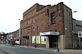
 New supermarket in Gorgie - geograph.org.uk - 731057.jpg 640 × 480; 58 KB
-
 Stewart Terrace, Gorgie - geograph.org.uk - 294029.jpg 640 × 480; 105 KB
-
 Two Railway Bridges and a Gatehouse - geograph.org.uk - 452642.jpg 640 × 480; 92 KB


.jpg)


.jpg)


