Category:Golumbey
Jump to navigation
Jump to search
| Object location | | View all coordinates using: OpenStreetMap |
|---|
Русский: ru:Некрасовка (Бахчисарайский район)
Українська: uk:Некрасовка (Бахчисарайський район)
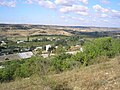
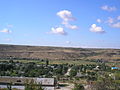
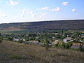
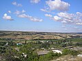
human settlement in Bakhchysarai Raion, Autonomous Republic of Crimea, Ukraine  | |||||
| Upload media | |||||
| Instance of | |||||
|---|---|---|---|---|---|
| Location |
| ||||
| Official language | |||||
| Population |
| ||||
| Elevation above sea level |
| ||||
 | |||||
Media in category "Golumbey"
The following 21 files are in this category, out of 21 total.
-
 Golumbey 1.JPG 2,816 × 2,112; 1.36 MB
-
 Golumbey 10.JPG 2,816 × 2,112; 1.22 MB
-
 Golumbey 11.JPG 2,816 × 2,112; 1.21 MB
-
 Golumbey 12.JPG 2,816 × 2,112; 1.17 MB
-
 Golumbey 13.JPG 2,816 × 2,112; 1.13 MB
-
 Golumbey 14.JPG 2,816 × 2,112; 1.27 MB
-
 Golumbey 16.JPG 2,816 × 2,112; 1.18 MB
-
 Golumbey 3.JPG 2,816 × 2,112; 1.1 MB
-
 Golumbey 4.JPG 2,816 × 2,112; 1.19 MB
-
 Golumbey 5.JPG 2,816 × 2,112; 1.13 MB
-
 Golumbey 6.JPG 2,816 × 2,112; 1.17 MB
-
 Golumbey 7.JPG 2,816 × 2,112; 1.08 MB
-
 Golumbey 8.JPG 2,816 × 2,112; 1.11 MB
-
 Golumbey 9.JPG 2,816 × 2,112; 1.41 MB
-
 Вид на долину - panoramio (10).jpg 2,560 × 1,920; 1.4 MB
-
 Вид на долину - panoramio (9).jpg 2,560 × 1,920; 1.44 MB
-
 Держидерево - panoramio (2).jpg 2,560 × 1,920; 1.42 MB
-
 Дорога - panoramio (863).jpg 2,560 × 1,920; 1.41 MB
-
 Свалка - panoramio (54).jpg 2,560 × 1,920; 1.48 MB
-
 Свалка - panoramio (59).jpg 2,560 × 1,920; 1.44 MB
-
 Свалка у дороги - panoramio.jpg 2,560 × 1,920; 1.5 MB


.jpg)
.jpg)
.jpg)
.jpg)
.jpg)
.jpg)
