Category:Golf courses in Surrey
Jump to navigation
Jump to search
Subcategories
This category has the following 5 subcategories, out of 5 total.
Media in category "Golf courses in Surrey"
The following 57 files are in this category, out of 57 total.
-
 14th tee at Worplesdon - geograph.org.uk - 1394744.jpg 640 × 427; 83 KB
-
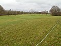
 A View of the Green - geograph.org.uk - 21175.jpg 640 × 480; 125 KB
-
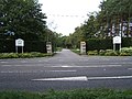 A243 Entrance to Leatherhead Golf Club - geograph.org.uk - 55105.jpg 640 × 480; 126 KB
-
 Banstead Downs Golf Course 1.JPG 4,608 × 2,592; 4.45 MB
-
 Banstead Downs Golf Course 2.JPG 4,608 × 2,592; 4.42 MB
-
 Banstead Downs Golf Course 3.JPG 4,608 × 2,592; 3.99 MB
-
 Bridge On the River Wey - geograph.org.uk - 518323.jpg 640 × 480; 125 KB
-
 By the Bunker - geograph.org.uk - 826775.jpg 480 × 640; 97 KB
-
 Chipstead Golf Course - geograph.org.uk - 1227120.jpg 640 × 360; 55 KB
-
 Chipstead Golf Course - geograph.org.uk - 1227136.jpg 640 × 480; 82 KB
-
 Chipstead Golf Course - geograph.org.uk - 1227142.jpg 640 × 480; 58 KB
-
 Clandon Regis - geograph.org.uk - 1085918.jpg 640 × 480; 128 KB
-
 Clandon Regis Golf Club - geograph.org.uk - 1085923.jpg 640 × 480; 126 KB
-
 Clandon Regis Golf Club - geograph.org.uk - 1085930.jpg 640 × 480; 122 KB
-
 Clandon Regis Golf Course - geograph.org.uk - 1085936.jpg 640 × 480; 119 KB
-
 Earlswood Golf Course - geograph.org.uk - 106909.jpg 640 × 480; 118 KB
-
-
 Golf Club Grounds at Broadwater Park, 2015.jpg 2,048 × 1,536; 2.75 MB
-
 Golf course (1983859299).jpg 3,296 × 2,472; 4.46 MB
-
 Golf course at Foxhills (geograph 2477643).jpg 2,464 × 1,485; 3.04 MB
-

-
 Golfing at Clandon Regis - geograph.org.uk - 598577.jpg 640 × 480; 122 KB
-
 Hindhead Golf Course - geograph.org.uk - 3842.jpg 640 × 480; 45 KB
-

-
 Oak Park golf course. - geograph.org.uk - 52862.jpg 640 × 480; 81 KB
-
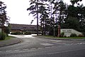 Pine Ridge Golf Club - geograph.org.uk - 59444.jpg 640 × 427; 106 KB
-
 Pyrford Golf Club - geograph.org.uk - 642807.jpg 640 × 480; 88 KB
-
 Reigate Hill Golf Club, Surrey - geograph.org.uk - 1446727.jpg 640 × 428; 70 KB
-
 Reigate Hill Golf Club, Surrey - geograph.org.uk - 1446741.jpg 640 × 428; 88 KB
-
 Reigate Hill Golf Club, Surrey - geograph.org.uk - 1446831.jpg 640 × 428; 68 KB
-
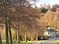
 Shillinglee Park - geograph.org.uk - 25579.jpg 640 × 396; 67 KB
-
 Sutton Green golf course - geograph.org.uk - 45824.jpg 640 × 427; 82 KB
-
 Tyrell's Wood Golf Course - geograph.org.uk - 65084.jpg 640 × 480; 108 KB
-
 Walton Heath Golf Course - geograph.org.uk - 1152757.jpg 640 × 426; 65 KB
-
 West Hill Golf Course - geograph.org.uk - 45832.jpg 640 × 427; 109 KB
-
 Woking Golf Club - geograph.org.uk - 22965.jpg 640 × 480; 131 KB
-
 Woldingham Golf Club - geograph.org.uk - 1142190.jpg 640 × 480; 100 KB
-
 Bunker on Golfcourse - geograph.org.uk - 21173.jpg 640 × 480; 97 KB
-
 Cobbett Hill - geograph.org.uk - 58274.jpg 640 × 427; 108 KB
-
 Entrance to Rusper Golf Club - geograph.org.uk - 34633.jpg 640 × 480; 87 KB
-

-
 Fore^ at Hoebridge - geograph.org.uk - 570173.jpg 640 × 480; 87 KB
-
 Golfing on Merrow Downs - geograph.org.uk - 600523.jpg 640 × 480; 110 KB
-
 Guildford Golf Course - geograph.org.uk - 600513.jpg 640 × 480; 90 KB
-
 Guildford Golf Course, Merrow Downs. - geograph.org.uk - 140758.jpg 640 × 435; 116 KB
-
 Hankley Common Golf Club - geograph.org.uk - 13215.jpg 640 × 388; 78 KB
-
 Hoebridge Golf Course - geograph.org.uk - 154071.jpg 640 × 480; 124 KB
-
 Hoebridge Golf Course - geograph.org.uk - 570547.jpg 640 × 480; 122 KB
-
 North Downs Golf Course - geograph.org.uk - 47436.jpg 640 × 480; 151 KB
-
 Pyrford Golf Club - geograph.org.uk - 518281.jpg 640 × 480; 111 KB
-

-
 Shey Copse Course - geograph.org.uk - 570555.jpg 640 × 480; 110 KB
-
 Sunningdale Ladies' Golf Club - geograph.org.uk - 166297.jpg 640 × 480; 338 KB
-
 Surbiton Golf Club - geograph.org.uk - 48799.jpg 640 × 480; 122 KB
-
 The Third Tee - geograph.org.uk - 20445.jpg 640 × 480; 109 KB
-
 Windlesham Golf Club - geograph.org.uk - 166277.jpg 640 × 480; 276 KB
-


.jpg)
.jpg)


