Category:Golf courses in Dumfries and Galloway
Jump to navigation
Jump to search
Golf Links and courses in Dumfries and Galloway : link
Subcategories
This category has the following 3 subcategories, out of 3 total.
Media in category "Golf courses in Dumfries and Galloway"
The following 31 files are in this category, out of 31 total.
-

-
 Colvend Golf Course - geograph.org.uk - 307493.jpg 640 × 480; 183 KB
-
 Dumfries and County Golf Club course - geograph.org.uk - 709327.jpg 640 × 480; 59 KB
-

-
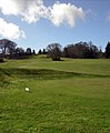
 Fairway at Cally Park (geograph 6207875).jpg 3,264 × 2,448; 4.35 MB
-

-
 Gale casualty, Annanside - geograph.org.uk - 392006.jpg 612 × 408; 344 KB
-

-
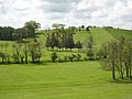
 Kenmure Castle and Kenmure Holms, Kells, Kirkcudbrightshire.jpg 2,592 × 1,944; 2.11 MB
-
-
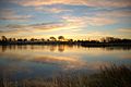
 Lochmaben golf course and Kirk Loch - geograph.org.uk - 115655.jpg 640 × 468; 63 KB
-
 Lockerbie Golf Course - geograph.org.uk - 221717.jpg 640 × 426; 77 KB
-
 New Galloway Golf Course - geograph.org.uk - 1219524.jpg 526 × 640; 79 KB
-
-
 Powfoot Golf Course - geograph.org.uk - 1065064.jpg 640 × 427; 193 KB
-

-
 Solway Links Golf Course - geograph.org.uk - 383467.jpg 636 × 459; 108 KB
-
 Southerness golf course - geograph.org.uk - 855235.jpg 640 × 480; 64 KB
-
 Southerness. - geograph.org.uk - 12814.jpg 640 × 480; 62 KB
-
 St Medan Golf Club - geograph.org.uk - 214716.jpg 640 × 480; 72 KB
-
 Stranraer Golf Club - geograph.org.uk - 316953.jpg 640 × 480; 61 KB
-
 The 16th hole at Cally Golf Course (geograph 5978500).jpg 2,592 × 1,944; 1.43 MB
-
 The clubhouse at Southerness Golf Course - geograph.org.uk - 383470.jpg 640 × 469; 100 KB
-
 The Pines Golf Centre, Dumfries - geograph.org.uk - 673560.jpg 640 × 480; 59 KB
-
 Wigtown and Bladnoch Golf Club - geograph.org.uk - 455161.jpg 640 × 480; 57 KB
-

-
-
 Langholm Golf Course - geograph.org.uk - 602543.jpg 640 × 480; 106 KB
-
 Langholm Golf Course - geograph.org.uk - 603801.jpg 624 × 463; 127 KB
-
 Stranraer Golf Club - geograph.org.uk - 164299.jpg 640 × 480; 61 KB
-
 Thornhill Golf Course - geograph.org.uk - 376751.jpg 640 × 480; 100 KB


.jpg)


.jpg)


