Category:Goldenhill Park, West Dunbartonshire
Jump to navigation
Jump to search

Subcategories
This category has the following 2 subcategories, out of 2 total.
G
Media in category "Goldenhill Park, West Dunbartonshire"
The following 12 files are in this category, out of 12 total.
-

-
 Duntocher and the Kilpatrick Hills - geograph.org.uk - 1236740.jpg 640 × 480; 160 KB
-
 Duntocher from Goldenhill - geograph.org.uk - 1236737.jpg 640 × 480; 123 KB
-
 Duntocher from Goldenhill Park - geograph.org.uk - 900991.jpg 640 × 480; 131 KB
-
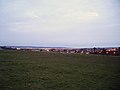
 Dusk view across Clydebank - geograph.org.uk - 771890.jpg 640 × 480; 67 KB
-
-
 Goldenhill Park - geograph.org.uk - 771898.jpg 640 × 480; 41 KB
-
 Pathway in Goldenhill Park - geograph.org.uk - 1236748.jpg 480 × 640; 108 KB
-
 Sign at site of Roman influence - geograph.org.uk - 900122.jpg 480 × 640; 183 KB
-
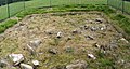
 Site of Roman Fort on Antonine Wall - geograph.org.uk - 1511453.jpg 640 × 167; 25 KB
-

-
 Woodland path by Duntocher Burn - geograph.org.uk - 900988.jpg 640 × 480; 183 KB


